
Robtown, Ohio facts for kids
Quick facts for kids
Robtown, Ohio
|
|
|---|---|
| Nickname(s):
Bobtown
|
|
| Country | United States |
| State | Ohio |
| County | Pickaway |
| Settled | 1822 |
| Government | |
| • Type | None |
| Elevation | 787 ft (240 m) |
| Time zone | UTC-5 (Eastern (EST)) |
| • Summer (DST) | UTC-4 (EDT) |
| ZIP code |
43103
|
| Area code(s) | 740–220 |
Robtown is an unincorporated community in Pickaway County, in the U.S. state of Ohio. The area is located approximately five miles west of South Bloomfield, Ohio and three miles northeast of Darbyville, Ohio, on the banks of Grave Run, a tributary of the Scioto River, and at the crossroads of Ohio State Route 316 and Turney Caldwell Road.
History
A post office called Robtown was established in 1864, and remained in operation until 1902. Besides the post office, Robtown had two country stores.
Images for kids
-
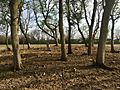
George Hott Farm Cemetery
-
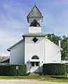
Scioto Chapel United Methodist Church


All content from Kiddle encyclopedia articles (including the article images and facts) can be freely used under Attribution-ShareAlike license, unless stated otherwise. Cite this article:
Robtown, Ohio Facts for Kids. Kiddle Encyclopedia.