
Rose City, Michigan facts for kids
Quick facts for kids
Rose City, Michigan
|
|
|---|---|
| City of Rose City | |
.jpg)
Looking north along M-33 toward Main Street
|
|

Location within Ogemaw County
|
|

Rose City, Michigan
Location in Michigan

Rose City, Michigan
Location in the United States
|
|
| Country | United States |
| State | Michigan |
| County | Ogemaw |
| Settled | 1875 |
| Incorporated | 1910 |
| Government | |
| • Type | Mayor–council |
| Area | |
| • Total | 1.09 sq mi (2.82 km2) |
| • Land | 1.08 sq mi (2.80 km2) |
| • Water | 0.01 sq mi (0.03 km2) |
| Elevation | 958 ft (292 m) |
| Population
(2010)
|
|
| • Total | 653 |
| • Estimate
(2019)
|
632 |
| • Density | 586.82/sq mi (226.62/km2) |
| Time zone | UTC-5 (Eastern (EST)) |
| • Summer (DST) | UTC-4 (EDT) |
| ZIP code(s) |
48654
|
| Area code(s) | 989 |
| FIPS code | 26-69680 |
| GNIS feature ID | 636193 |
Rose City is a city in Ogemaw County in the U.S. state of Michigan. The population was 653 at the 2010 census, which ranks it as the seventh-smallest city by population in the state.
History
Churchill was the original name of this lumbering town. Hiram Hodge was the first resident of the community. He built a hotel, but later left. The Rose family including Allan S. Rose, his father and two brothers, came from New York State in 1875. They build a general store with space for a post office.
A post office opened with the name Churchill on September 8, 1875. On July 23, 1892 the post office's name was changed to Rose City.
Rose City was incorporated as a city in 1905. In 1910, the city was hit with a major fire that destroyed the business section with in an hour.
Geography
According to the United States Census Bureau, the city has a total area of 1.09 square miles (2.82 km2), of which 1.08 square miles (2.80 km2) is land and 0.01 square miles (0.03 km2) is water.
Demographics
| Historical population | |||
|---|---|---|---|
| Census | Pop. | %± | |
| 1910 | 542 | — | |
| 1920 | 331 | −38.9% | |
| 1930 | 338 | 2.1% | |
| 1940 | 355 | 5.0% | |
| 1950 | 446 | 25.6% | |
| 1960 | 435 | −2.5% | |
| 1970 | 530 | 21.8% | |
| 1980 | 661 | 24.7% | |
| 1990 | 686 | 3.8% | |
| 2000 | 721 | 5.1% | |
| 2010 | 653 | −9.4% | |
| 2019 (est.) | 632 | −3.2% | |
| U.S. Decennial Census | |||
2010 census
At the 2010 census there were 653 people in 238 households, including 154 families, in the city. The population density was 604.6 inhabitants per square mile (233.4/km2). There were 288 housing units at an average density of 266.7 per square mile (103.0/km2). The racial makeup of the city was 96.9% White, 0.2% African American, 1.2% Native American, 0.3% Asian, 0.5% from other races, and 0.9% from two or more races. Hispanic or Latino of any race were 1.7%.
Of the 238 households 35.7% had children under the age of 18 living with them, 36.1% were married couples living together, 21.4% had a female householder with no husband present, 7.1% had a male householder with no wife present, and 35.3% were non-families. 30.7% of households were one person and 14.3% were one person aged 65 or older. The average household size was 2.36 and the average family size was 2.87.
The median age was 44.6 years. 23.3% of residents were under the age of 18; 7.4% were between the ages of 18 and 24; 19.6% were from 25 to 44; 25% were from 45 to 64; and 24.8% were 65 or older. The gender makeup of the city was 48.4% male and 51.6% female.
Images for kids
-
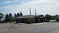
U.S. Post Office in Rose City -
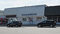
Rose City City Hall -
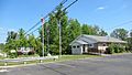
Ogemaw District Library -
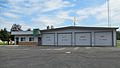
Rose City Police and Fire Department -
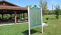
Rose City state historic marker -
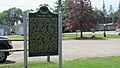
The Big Fire state historic marker


.jpg)


_historic_marker.jpg)
See also
 In Spanish: Rose City (Míchigan) para niños
