South Harrison Township, New Jersey facts for kids
Quick facts for kids
South Harrison Township, New Jersey
|
|
|---|---|
|
Township
|
|
| Township of South Harrison | |

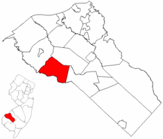
South Harrison Township highlighted in Gloucester County. Inset map: Gloucester County highlighted in the State of New Jersey.
|
|

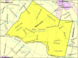
Census Bureau map of South Harrison Township, New Jersey
|
|
| Country | |
| State | |
| County | |
| Incorporated | March 2, 1883 |
| Government | |
| • Type | Township |
| • Body | Township Committee |
| Area | |
| • Total | 15.96 sq mi (41.32 km2) |
| • Land | 15.90 sq mi (41.17 km2) |
| • Water | 0.06 sq mi (0.15 km2) 0.38% |
| Area rank | 170th of 565 in state 11th of 24 in county |
| Elevation | 118 ft (36 m) |
| Population | |
| • Total | 3,162 |
| • Estimate
(2019)
|
3,123 |
| • Rank | 446th of 566 in state 19th of 24 in county |
| • Density | 201.7/sq mi (77.9/km2) |
| • Density rank | 505th of 566 in state 24th of 24 in county |
| Time zone | UTC−05:00 (Eastern (EST)) |
| • Summer (DST) | UTC−04:00 (Eastern (EDT)) |
| ZIP Code |
08039 - Harrisonville
|
| Area code(s) | 856 |
| FIPS code | 3401569030 |
| GNIS feature ID | 0882145 |
| Website | |
South Harrison Township is a township in Gloucester County, New Jersey, United States. As of the 2010 United States Census, the township's population was 3,162, reflecting an increase of 745 (+30.8%) from the 2,417 counted in the 2000 Census, which had in turn increased by 498 (+26.0%) from the 1,919 counted in the 1990 Census.
South Harrison was formed as a township by an act of the New Jersey Legislature on March 2, 1883, from portions of Harrison Township. Elk Township was formed from portions of South Harrison Township on April 17, 1891. It is a dry town, where alcohol cannot be sold, though alcohol is available at the winery in the township.
Geography
According to the United States Census Bureau, the township had a total area of 15.731 square miles (40.744 km2), including 15.677 square miles (40.604 km2) of land and 0.054 square miles (0.140 km2) of water (0.34%).
Unincorporated communities, localities and place names located partially or completely within the township include Cedar Grove, Harrisonville (served as ZIP code 08039), Jessups Mills and Lincoln.
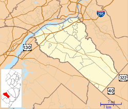
The township borders Woolwich Township, Harrison Township, Elk Township, and Salem County.
Demographics
| Historical population | |||
|---|---|---|---|
| Census | Pop. | %± | |
| 1890 | 971 | — | |
| 1900 | 706 | −27.3% | |
| 1910 | 694 | −1.7% | |
| 1920 | 583 | −16.0% | |
| 1930 | 680 | 16.6% | |
| 1940 | 686 | 0.9% | |
| 1950 | 868 | 26.5% | |
| 1960 | 974 | 12.2% | |
| 1970 | 1,226 | 25.9% | |
| 1980 | 1,486 | 21.2% | |
| 1990 | 1,919 | 29.1% | |
| 2000 | 2,417 | 26.0% | |
| 2010 | 3,162 | 30.8% | |
| 2019 (est.) | 3,123 | −1.2% | |
| Population sources: 1890-2000 1890-1920 1890 1890-1910 1910-1930 1930-1990 2000 2010 * = Lost territory in previous decade. |
|||
Census 2010
As of the census of 2010, there were 3,162 people, 1,020 households, and 862 families residing in the township. The population density was 201.7 per square mile (77.9/km2). There were 1,056 housing units at an average density of 67.4 per square mile (26.0/km2)*. The racial makeup of the township was 91.59% (2,896) White, 5.06% (160) Black or African American, 0.00% (0) Native American, 1.20% (38) Asian, 0.03% (1) Pacific Islander, 0.95% (30) from other races, and 1.17% (37) from two or more races. [[Hispanic (U.S. Census)|Hispanic or Latino of any race were 3.10% (98) of the population.
There were 1,020 households out of which 42.1% had children under the age of 18 living with them, 73.1% were married couples living together, 7.6% had a female householder with no husband present, and 15.5% were non-families. 11.5% of all households were made up of individuals, and 4.8% had someone living alone who was 65 years of age or older. The average household size was 3.10 and the average family size was 3.36.
In the township, the population was spread out with 28.7% under the age of 18, 6.3% from 18 to 24, 24.0% from 25 to 44, 30.6% from 45 to 64, and 10.4% who were 65 years of age or older. The median age was 40.4 years. For every 100 females there were 95.8 males. For every 100 females ages 18 and old there were 97.5 males.
The Census Bureau's 2006-2010 American Community Survey showed that (in 2010 inflation-adjusted dollars) median household income was $106,667 (with a margin of error of +/- $12,029) and the median family income was $113,875 (+/- $14,397). Males had a median income of $84,408 (+/- $4,334) versus $55,750 (+/- $10,554) for females. The per capita income for the borough was $34,515 (+/- $3,976). About 2.0% of families and 10.4% of the population were below the poverty line, including 3.8% of those under age 18 and 8.1% of those age 65 or over.
Census 2000
As of the 2000 United States Census there were 2,417 people, 800 households, and 663 families residing in the township. The population density was 153.0 people per square mile (59.1/km2). There were 829 housing units at an average density of 52.5 per square mile (20.3/km2). The racial makeup of the township was 93.09% White, 3.76% African American, 0.04% Native American, 0.29% Asian, 0.04% Pacific Islander, 2.19% from other races, and 0.58% from two or more races. Hispanic or Latino of any race were 3.43% of the population.
There were 800 households, out of which 41.1% had children under the age of 18 living with them, 71.9% were married couples living together, 7.8% had a female householder with no husband present, and 17.1% were non-families. 13.4% of all households were made up of individuals, and 5.0% had someone living alone who was 65 years of age or older. The average household size was 2.94 and the average family size was 3.25.
In the township the population was spread out, with 26.9% under the age of 18, 7.1% from 18 to 24, 28.9% from 25 to 44, 27.8% from 45 to 64, and 9.4% who were 65 years of age or older. The median age was 38 years. For every 100 females, there were 102.4 males. For every 100 females age 18 and over, there were 105.7 males.
The median income for a household in the township was $68,491, and the median income for a family was $76,390. Males had a median income of $55,313 versus $32,337 for females. The per capita income for the township was $25,968. About 4.1% of families and 8.0% of the population were below the poverty line, including 7.7% of those under age 18 and 8.0% of those age 65 or over.
Transportation
As of May 2010[update], the township had a total of 47.93 miles (77.14 km) of roadways, of which 22.43 miles (36.10 km) were maintained by the municipality, 21.96 miles (35.34 km) by Gloucester County and 3.54 miles (5.70 km) by the New Jersey Department of Transportation.
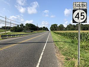
Route 45 (Woodstown-Mullica Hill Road) traverses the township southwest-to-northeast, from the border with Pilesgrove Township to Harrison Township. County Route 538 (Swedesboro Road) crosses along the northern portion of the township from Woolwich Township in the northwest to Elk Township to the southeast. County Route 581 (Commissioners Pike) crosses from Upper Pittsgrove Township in the south to Harrison Township in the north.
Education
The South Harrison Township School District serves public school students in pre-kindergarten through sixth grade at South Harrison Township Elementary School. As of the 2020–21 school year, the district, comprised of one school, had an enrollment of 315 students and 32.0 classroom teachers (on an FTE basis), for a student–teacher ratio of 9.8:1.
Public school students in seventh through twelfth grades are educated by the Kingsway Regional School District, which also serves students from East Greenwich Township, Swedesboro and Woolwich Township, with the addition of students from Logan Township who attend the district's high school as part of a sending/receiving relationship in which tuition is paid on a per-pupil basis by the Logan Township School District. South Harrison Township accounted for 13% of district enrollment. As of the 2020–21 school year, the district, comprised of two schools, had an enrollment of 2,868 students and 207.8 classroom teachers (on an FTE basis), for a student–teacher ratio of 13.8:1. Schools in the district (with 2020–21 enrollment data from the National Center for Education Statistics) are Kingsway Regional Middle School with 1,023 students in grades 7-8 and Kingsway Regional High School with 1,802 students in grades 9-12. Under a 2011 proposal, Kingsway would have merged with its constituent member's K-6 districts to become a full K-12 district, with various options for including Logan Township as part of the consolidated district.
Students from across the county are eligible to apply to attend Gloucester County Institute of Technology, a four-year high school in Deptford Township that provides technical and vocational education. As a public school, students do not pay tuition to attend the school.
See also
 In Spanish: Municipio de South Harrison (Nueva Jersey) para niños


