South Tipperary facts for kids
Quick facts for kids
South Tipperary
Tiobraid Árann Theas
Tipperary (South Riding)
|
||
|---|---|---|
|
Former County
1898–2014 |
||
|
||
| Motto(s): | ||
 |
||
| Country | Ireland | |
| Province | Munster | |
| Created | 12 August 1898 | |
| Abolished | 3 June 2014 | |
| County town | Clonmel | |
| Government | ||
| • Type | South Tipperary County Council | |
| Area | ||
| • Total | 2,257 km2 (871 sq mi) | |
| Population
(2011)
|
88,433 | |
| Car plates | TS (1987–2013) | |
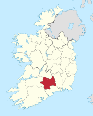
South Tipperary (Irish: Tiobraid Árann Theas) was a county in Ireland. It was part of the South-East Region and was also located in the province of Munster. It was named after the town of Tipperary and consisted of 52% of the land area of the traditional county of Tipperary. South Tipperary County Council was the local authority for the county. The population of the county was 88,433 according to the 2011 census. It was abolished on 3 June 2014, merged with North Tipperary under a new Tipperary County Council.
Geography and political subdivisions
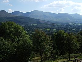
The county was part of the central plain of Ireland, but the diversified terrain contained several mountain ranges: the Knockmealdown, the Galtee. The county was landlocked. The county was drained by the River Suir. The centre was known as 'the Golden Vale', a rich pastoral stretch of land in the Suir basin which extends into counties Limerick and Cork.
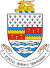
The county was established in 1898 with separate assize courts since 1838. The county town was Clonmel; other important urban centres included Carrick-on-Suir, Cashel, Cahir, and Tipperary. The county's motto was Vallis Aurea Siurensis (Latin: The Golden Vale of the Suir).
Baronies
There were six historic baronies in South Tipperary: Clanwilliam, Iffa and Offa East, Iffa and Offa West, Kilnamanagh Lower, Middle Third and Slievardagh.
Civil parishes and townlands
Civil parishes in Ireland were delineated after the Down Survey as an intermediate subdivision, with multiple townlands per parish and multiple parishes per barony. The civil parishes had some use in local taxation and were included on the nineteenth century maps of the Ordnance Survey of Ireland. For poor law purposes, District Electoral Divisions replaced civil parishes in the mid-nineteenth century. There were 123 civil parishes in the county.
Irish language
There were native speakers of Irish in South Tipperary until the middle of the 20th century. Recordings of their dialect, made before the last native speakers died, have been made available through a project of the Royal Irish Academy Library.


