Stirling Range facts for kids
Quick facts for kids Stirling Range(Koikyennuruff) |
|
|---|---|

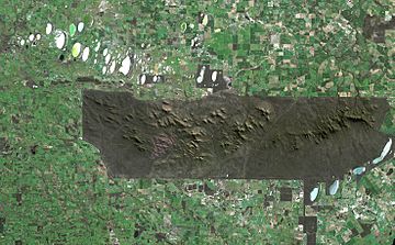
Satellite image of the park. The sharp boundaries on all sides of the park show where agriculture immediately gives way to protected land.
|
|
| Highest point | |
| Peak | Bluff Knoll |
| Elevation | 1,099 m (3,606 ft) |
| Geography | |
| Country | Australia |
| State | Western Australia |
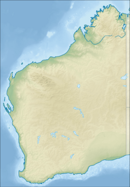
| Range coordinates | 34°24′S 118°09′E / 34.400°S 118.150°E |
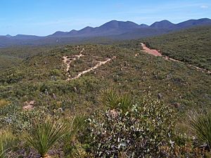
The Stirling Range or Koikyennuruff is a range of mountains and hills in the Great Southern region of Western Australia, 337 kilometres (209 mi) south-east of Perth. It is over 60 kilometres (37 mi) wide from west to east, stretching from the highway between Mount Barker and Cranbrook eastward past Gnowangerup. The Stirling Range is protected by the Stirling Range National Park, which was gazetted in 1913, and has an area of 1,159 km2 (447 sq mi).
History

The plains in the Stirling Range region were the hunting grounds for small groups of Indigenous Australians for thousands of years before European settlement. At least two tribes frequented the area: the Qaaniyan people in the west, and the Koreng people in the east. The Stirling Range played an important role in their culture, appearing in a number of Dreamtime stories.
The first recorded sighting of the Stirling Ranges by a European explorer was by Matthew Flinders on 5 January 1802. While sailing along the south coast of Australia, just east of King George Sound, he noted at a distance of eight leagues (44 km) inland a chain of rugged mountains, the easternmost of which he named Mount Rugged (now called Bluff Knoll).
An army garrison was established at King George Sound in 1826, and the following year the commanding officer, Major Edmund Lockyer, explored the land north of the Sound. On 11 February 1827, he observed in the distance mountains running east and west about 40 miles.
Alexander Collie explored to the north of the Sound in 1831. On 29 April, he described the Stirling Range and recorded names for the main peaks. The following year, Robert Dale led an expedition to the Range. On 24 January 1832, he made the first recorded ascent of a peak in the Stirling Range, scaling Toolbrunup. Late in 1835, Governor James Stirling and John Septimus Roe led an expedition from Albany to Perth. They first saw the Stirling Ranges on 3 November, and on travelling closer to them the following day, Roe gave them their name.
Early exploitation of the Stirling Ranges included cutting of sandalwood and kangaroo hunting. The Ranges were never formally taken up for grazing, probably because of the many poison bushes in the area. However, squatters ran sheep to the south of the Range in the 1850s, and in the 1860s a selection was taken up at the base of Mount Trio.
The area that is now the Stirling Range National Park was temporarily reserved in April 1908, and formally gazetted as Western Australia's third national park in June 1913.
Attractions and activities
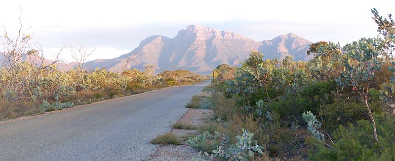
Notable features include Toolbrunup, Bluff Knoll (the tallest peak for a thousand kilometres or more in any direction and most popular tourist attraction), and a silhouette called The Sleeping Princess which is visible from the Porongurup Range. Popular recreational activities include bushwalking, abseiling and gliding. Camping is not permitted within the park boundaries.
Major peaks
- Bluff Knoll—34° 22' S 118° 15' E (1095m)
- Mount Hassell—34° 22' S 118° 04' E (847m)
- Mount Magog, Western Australia—34 °23' S 117° 56' E (856m)
- Mount Trio—34° 20' S 118° 06' E (856m)
- Talyuberlup Peak—34° 24' S 117° 57' E (783m)
- Toolbrunup Peak—34 °23' S 118° 02' E (1052m)
- Erickson, Rica (1951) Springtime in the Stirlings - The West Australian 17 November 1951 p. 11 - re climbing Mondurup at the west end of the Range.
See also
 In Spanish: Cordillera Stirling para niños


