
Tamrookum, Queensland facts for kids
Quick facts for kids TamrookumQueensland |
|||||||||||||||
|---|---|---|---|---|---|---|---|---|---|---|---|---|---|---|---|

Fields, 2016
|
|||||||||||||||

Tamrookum
Location in Queensland
|
|||||||||||||||
| Population | 91 (2016 census) | ||||||||||||||
| • Density | 4.76/km2 (12.3/sq mi) | ||||||||||||||
| Postcode(s) | 4285 | ||||||||||||||
| Area | 19.1 km2 (7.4 sq mi) | ||||||||||||||
| Time zone | AEST (UTC+10:00) | ||||||||||||||
| Location |
|
||||||||||||||
| LGA(s) | Scenic Rim Region | ||||||||||||||
| State electorate(s) | Scenic Rim | ||||||||||||||
| Federal Division(s) | Wright | ||||||||||||||
|
|||||||||||||||
Tamrookum is a rural locality in the Scenic Rim Region, Queensland, Australia. In the 2016 census, Tamrookum had a population of 91 people.
Geography
The Mount Lindesay Highway traverses Tamrookum from north to south and forms part of the north west boundary. The eastern boundary is marked by the Logan River. A series of small, vegetated hills in the west rises to elevations of up to 140 m. In the east adjacent to the river the predominate land use is agriculture.
History

The name Tamrookum is believed to be a corruption of the Aboriginal words dhan/buragun meaning place of boomerangs.
Heritage listings

Tamrookum has a number of heritage-listed sites, including:
- Tamrookum Church Road: All Saints Memorial Church, Tamrookum
Education
Tamrookum State School is a government primary (Prep-6) school for boys and girls at 9019 Mount Lindesay Highway (28°06′23″S 152°54′56″E / 28.1064°S 152.9155°E). In 2017, the school had an enrolment of 141 students with 15 teachers (8 full-time equivalent) and 12 non-teaching staff (7 full-time equivalent). There is no secondary school in Tamrookum; the nearest is Beaudesert State High School in Beaudesert.
Images for kids
-
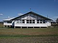
Tamrookum Memorial Hall, 2016

