
Te Awamutu facts for kids
Quick facts for kids
Te Awamutu
|
|
|---|---|
|
Town
|
|
| Nickname(s):
T.A., "The Rose Town of New Zealand"
|
|
| Country | New Zealand |
| Region | Waikato |
| Territorial authority | Waipa District |
| Population
(June 2023)
|
|
| • Total | 14,000 |
| Time zone | UTC+12 (NZST) |
| • Summer (DST) | UTC+13 (NZDT) |
| Website | City: teawamutu.co.nz Region: http://www.ew.govt.nz |
Te Awamutu is a town in the Waikato region in the North Island of New Zealand. It is the council seat of the Waipa District and serves as a service town for the farming communities which surround it. Te Awamutu is located some 30 kilometres (19 mi) south of Hamilton on State Highway 3, one of the two main routes south from Auckland and Hamilton.
Te Awamutu has a population of 14,000 (June 2023), making it the fifth-largest urban area in the Waikato behind Hamilton, Taupō, Cambridge and Tokoroa.
The town is often referred to as "The Rose Town of New Zealand" because of its elaborate rose gardens in the centre of the town. Many local businesses use "Rosetown" in their name, and the symbol of the rose is widely used on local signs and billboards. The local paper, Te Awamutu Courier, has a symbol of a rose in the masthead on its front page.
Contents
History

Tainui Maori first settled in the area in about 1450, according to noted Tainui historian Te Hurinui-Jones. Te Awamutu means "the river cut short", as it marked the end of the navigable section of the Mangapiko Stream.
Te Awamutu was the birthplace of the first Maori King, Pōtatau Te Wherowhero (died 1860).
The first European missionaries visited the area in 1834. The CMS missionaries established a flourishing trade school that focused on developing agricultural skills. The missionaries introduced European crops such as wheat, potatoes and peaches; they provided advice and some capital to help local Maori establish eight local flour mills in the wider area. They assisted in finding a suitable miller to operate the mills and to train Maori in this skill. During the 1850s the wider area prospered on the back of sending surplus farm produce to Auckland. For a brief period wheat was even sent overseas. By the late 1850s prices dropped as cheaper flour and other foodstuffs were imported from Australia. This caused huge resentment among local Maori who had grown use to the wealth provided by trade. Some of the more warlike Maori such as Rewi Maniapoto blamed the missionaries for having a negative influence on Maori tikanga (cultural practices). He attempted to kill the local missionary and burnt down the trade school and other mission buildings. Other Christian Maori warned other Europeans to leave the Waikato as their lives were in danger. Te Awamutu was a major site during the New Zealand land wars of the 19th century, serving as a garrison town for the colonial settlers from 1864. European settlement began at the conclusion of the Waikato Wars (1863–1865).
Te Awamutu today
The main thoroughfare is Alexandra Street, so named because it was once the main road to the town of Alexandra (since renamed to Pirongia to avoid confusion with the town of Alexandra in the South Island).
The town has a large dairy factory, and serves as an important centre in the local dairy industry.
The town is often referred to as "The Rose Town of New Zealand" because of its elaborate rose gardens in the centre of the town. Many local businesses use "Rosetown" in their name, and the symbol of the rose is widely used on local signs and billboards. The local paper, Te Awamutu Courier, has a symbol of a rose in the masthead on its front page.
Geography
Te Awamutu literally means in English "The River's End". The town is on gently undulating land close to the banks of a tributary of the Waipa River. The Waikato Plains lie to the north and east, and the promontory of Mount Pirongia, 20 kilometres to the west, is easily visible. Inside the township are two streams called the Mangapiko Stream and the Mangaohoi Stream. The Mangaohoi ends and becomes the Tributary of the Mangapiko near Memorial park.
The town is close to the extinct Kakepuku and Pirongia volcanoes (and other volcanoes of the Alexandra Volcanic Group). Maungatautari, another extinct volcanic cone, now the site of New Zealand's largest ecological restoration project, is also nearby.
Other towns surrounding Te Awamutu include Cambridge, 25 kilometres to the northeast, Otorohanga, 30 kilometres to the southwest, and Raglan 50 kilometres to the northwest. The small town of Kihikihi lies just to the south of Te Awamutu.
Demographics
| Historical population | ||
|---|---|---|
| Year | Pop. | ±% p.a. |
| 2006 | 10,146 | — |
| 2013 | 10,620 | +0.65% |
| 2018 | 12,198 | +2.81% |
Te Awamutu, comprising the statistical areas of Te Awamutu North, Te Awamutu West, Goodfellow Park, Te Awamutu Stadium, Te Awamutu Central, Pekerau, Fraser Street and Sherwin Park, had a population of 12,198 at the 2018 New Zealand census, an increase of 1,578 people (14.9%) since the 2013 census, and an increase of 2,052 people (20.2%) since the 2006 census. There were 4,656 households. There were 5,787 males and 6,414 females, giving a sex ratio of 0.9 males per female, with 2,421 people (19.8%) aged under 15 years, 2,208 (18.1%) aged 15 to 29, 4,944 (40.5%) aged 30 to 64, and 2,631 (21.6%) aged 65 or older.
Ethnicities were 81.8% European/Pākehā, 23.2% Māori, 2.7% Pacific peoples, 4.5% Asian, and 1.7% other ethnicities (totals add to more than 100% since people could identify with multiple ethnicities).
The proportion of people born overseas was 14.7%, compared with 27.1% nationally.
Although some people objected to giving their religion, 50.4% had no religion, 37.1% were Christian, 0.8% were Hindu, 0.2% were Muslim, 0.5% were Buddhist and 3.0% had other religions.
Of those at least 15 years old, 1,317 (13.5%) people had a bachelor or higher degree, and 2,442 (25.0%) people had no formal qualifications. The employment status of those at least 15 was that 4,587 (46.9%) people were employed full-time, 1,308 (13.4%) were part-time, and 393 (4.0%) were unemployed.
| Name | Population | Median age | Median income |
|---|---|---|---|
| Te Awamutu North | 1,101 | 39.1 years | $33,000 |
| Te Awamutu West | 1,320 | 37.5 years | $32,400 |
| Goodfellow Park | 1,788 | 37.8 years | $25,900 |
| Te Awamutu Stadium | 1,749 | 42 years | $34,700 |
| Te Awamutu Central | 402 | 48.1 years | $27,300 |
| Pekerau | 2,442 | 39.4 years | $29,100 |
| Fraser Street | 1,416 | 47.6 years | $30,400 |
| Sherwin Park | 1,980 | 40.9 years | $25,800 |
| New Zealand | 37.4 years | $31,800 |
For earlier censuses, Te Awamutu was divided into four area units, central, east, south and west, as in this table. Māori formed 19.7% of the population in central, 22.8% in east, 23.2% in south and 25.7% in west.
| Year | Population | Households | Median age | Median income | National median | |
| Te Awamutu total | 2001 | 9,180 | 3,531 | $18,500 | ||
| 2006 | 9,819 | 3,828 | $24,400 | |||
| 2013 | 10,308 | 4,125 | $28,500 | |||
| Central | 2001 | 2,892 | 1,179 | 40.5 | $16,900 | |
| 2006 | 3,153 | 1,281 | 42.1 | $21,800 | ||
| 2013 | 3,321 | 1,368 | 41.6 | $26,700 | ||
| East | 2001 | 2,301 | 849 | 34.9 | $17,200 | |
| 2006 | 2,511 | 975 | 38.9 | $23,500 | ||
| 2013 | 2,769 | 1,107 | 42.0 | $27,400 | ||
| South | 2001 | 2,862 | 1,098 | 38.7 | $16,800 | |
| 2006 | 2,928 | 1,131 | 39.8 | $21,300 | ||
| 2013 | 2,913 | 1,176 | 41.8 | $25,100 | ||
| West | 2001 | 1,125 | 405 | 33.6 | $18,100 | |
| 2006 | 1,227 | 441 | 35.4 | $25,400 | ||
| 2013 | 1,305 | 474 | 36.4 | $28,500 |
Culture
Te Awamutu Museum was established in 1935. The museum has a number of permanent exhibitions focusing on the history of Te Awamutu and the surrounding area. There is also an exhibition, 'Everyone is here' focusing on Tim and Neil Finn, brothers and Te Awamutu natives, of the bands Split Enz and later Crowded House; the town was mentioned in the latter's 1986 song "Mean To Me", and also in Split Enz's earlier song "Haul Away".
The museum contains one of the most famous early Māori artefacts, a large carved post known simply as Te Uenuku. This impressive carving has caused much controversy because its style is markedly different from any other early Māori work, yet it is clearly of a Māori design.
Facilities and attractions
The Te Awamutu Museum is one of the attractions of the town, and has many exhibitions relating to the history of the area. Te Awamutu itself is located on SH3, one of the major routes used when touring the North Island of New Zealand.
The town has three large supermarkets, electronics retailers, and a well equipped sports / leisure centre.
Education
Te Awamutu has two co-educational state primary schools: Te Awamutu Primary School, with a roll of 538 and Pekerau School with a roll of 205.
Many of these students then progress on to Te Awamutu Intermediate, with a roll of 529, and Te Awamutu College, with a roll of 1401.
There are also three other schools in the town:
- St Patrick's Catholic School is a co-educational Year 1-8 state integrated Catholic primary school, with a roll of 258.
- Waipa Christian School is a co-educational Year 1-8 state integrated Christian primary school, with a roll of 72.
- Te Wharekura o Nga Purapura o te Aroha is a co-educational Year 1-15 state school, with a roll of 92 as of April 2023
Notable residents
The town's best known residents are the Finn Brothers, Tim and Neil, whose musical careers have stretched from Split Enz through the internationally successful Crowded House to their current solo and collaborative works. The town is mentioned in Split Enz's song "Haul Away", and also in Crowded House's 1986 song "Mean to Me", the debut single from their self-titled debut album. Musician Spencer P. Jones (The Beasts of Bourbon, Paul Kelly and The Coloured Girls) was also born in Te Awamutu.
Images for kids
-
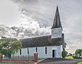
St John's church built 1853

