
Tehachapi, California facts for kids
Quick facts for kids
Tehachapi, California
|
|
|---|---|
| City of Tehachapi | |

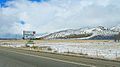
View of wind turbines with Tehachapi in the distance
|
|
| Nickname(s):
The Land of Four Seasons
|
|

Location of Tehachapi, California
|
|

Tehachapi, California
Location in California

Tehachapi, California
Location in the United States
|
|
| Country | |
| State | |
| County | Kern |
| Region | Tehachapi Mountains |
| Founded | 1876 |
| Incorporated | August 13, 1909 |
| Area | |
| • Total | 10.25 sq mi (26.54 km2) |
| • Land | 10.15 sq mi (26.29 km2) |
| • Water | 0.10 sq mi (0.25 km2) 0.97% |
| Elevation | 3,970 ft (1,210 m) |
| Population
(2010)
|
|
| • Total | 14,414 |
| • Estimate
(2019)
|
13,011 |
| • Density | 1,281.87/sq mi (494.92/km2) |
| Time zone | UTC−8 (Pacific) |
| • Summer (DST) | UTC−7 (PDT) |
| ZIP Code |
93561
|
| Area code | 661 |
| FIPS code | 06-78092 |
| GNIS feature IDs | 1652798, 2412041 |
| Reference #: | 643 |
Tehachapi ( Kawaiisu: Tihachipia, meaning "hard climb") is a city in Kern County, California, in the Tehachapi Mountains, at an elevation of 3,970 feet (1,210 m), between the San Joaquin Valley and the Mojave Desert.
Tehachapi is 35 miles (56 km) east-southeast of Bakersfield, and 20 miles (32 km) west of Mojave. According to the United States Census Bureau, the city has a total area of 10 square miles (26 km2) and a population of 14,414.
The Tehachapi area is known for the nearby Tehachapi Loop (a popular railfan site), Tehachapi Pass Wind Farm, the Tehachapi Depot Museum, the Tehachapi Museum, the Tomo-Kahni State Historic Park and Tomi-Kahni Resource Center (Native American), and excellent air conditions for gliding. Ten miles (16 km) to the west, at Keene, is the National Chavez Center, established to share the legacy of Cesar Chavez.
Contents
Features
The Tehachapi area is known for the nearby Tehachapi Loop (a popular railfan site), Tehachapi Pass Wind Farm, The Indian Point Ostrich Ranch, the Tomo-Kahni State Historic Park and Tomi-Kahni Resource Center (Native American), and excellent air conditions for gliding. Ten miles to the west at Keene, is the National Chavez Center, established to share the legacy of Cesar Chavez.
The California Correctional Institution maximum security prison, also known as Tehachapi State Prison, is in the area; as is proximity to Edwards Air Force Base (40 miles to the east).
History

The Kawaiisu people (also Nuwu ("people" in Kawaiisu), or Nuooah) are the Native American tribe whose homeland was the Tehachapi Valley, and seasonally the southern Sierra Nevada and Mojave Desert, for thousands of years.
One possibility for the origin of the name Tehachapi comes from the Kawaiisu language. It may be derived from the word for "hard climb" or tihachipia, according to the Tomi-Kahni Resource Center. The settlement has been formerly known and spelled as: Tehachapai; Tehachapa; Tehachepi; Tehachipi; and Summit Station.
Previously known as 'Old Town', Tehachapi was established in the 1860s. It is now registered as California Historical Landmark #643 for being the oldest settlement in the Tehachapi Valley.
Construction of the original Southern Pacific-SP railroad depot was the beginning of the downtown core. It is now on the National Register of Historic Places (NRHP)—and was the oldest building in downtown Tehachapi until it burned in June 2008. The building had been in the final stages of becoming a museum. It has since been rebuilt using the original plans with only minor modifications to meet modern building codes. The new depot was dedicated on June 5, 2010.
On July 21, 1952 Tehachapi was devastated by a magnitude 7.5 earthquake on the little-known White Wolf Fault.
Demographics
The population was 14,414 at the 2010 census, up from 10,957 at the 2000 census.
| Historical population | |||
|---|---|---|---|
| Census | Pop. | %± | |
| 1890 | 255 | — | |
| 1910 | 385 | — | |
| 1920 | 458 | 19.0% | |
| 1930 | 736 | 60.7% | |
| 1940 | 1,264 | 71.7% | |
| 1950 | 1,685 | 33.3% | |
| 1960 | 3,161 | 87.6% | |
| 1970 | 4,211 | 33.2% | |
| 1980 | 4,126 | −2.0% | |
| 1990 | 5,791 | 40.4% | |
| 2000 | 10,957 | 89.2% | |
| 2010 | 14,414 | 31.6% | |
| 2019 (est.) | 13,011 | −9.7% | |
| U.S. Decennial Census | |||
2010
The 2010 United States Census reported that Tehachapi had a population of 14,414. The population density was 1,445.7 people per square mile (558.2/km2).
The racial makeup of Tehachapi was 9,426 (65.4%) White, 1,297 (9.0%) African American, 206 (1.4%) Native American, 238 (1.7%) Asian, 21 (0.1%) Pacific Islander, 2,725 (18.9%) from other races, and 501 (3.5%) from two or more races. Hispanic or Latino of any race were 5,466 persons (37.9%).
The Census reported that 8,487 people (58.9% of the population) lived in households, 6 (0%) lived in non-institutionalized group quarters, and 5,921 (41.1%) were institutionalized.
There were 3,121 households, out of which 1,199 (38.4%) had children under the age of 18 living in them, 1,504 (48.2%) were opposite-sex married couples living together, 418 (13.4%) had a female householder with no husband present, 181 (5.8%) had a male householder with no wife present. There were 194 (6.2%) unmarried opposite-sex partnerships, and 18 (0.6%) same-sex married couples or partnerships. 879 households (28.2%) were made up of individuals, and 428 (13.7%) had someone living alone who was 65 years of age or older. The average household size was 2.72. There were 2,103 families (67.4% of all households); the average family size was 3.34.
The population was spread out, with 2,599 people (18.0%) under the age of 18, 1,542 people (10.7%) aged 18 to 24, 5,891 people (40.9%) aged 25 to 44, 3,115 people (21.6%) aged 45 to 64, and 1,267 people (8.8%) who were 65 years of age or older. The median age was 34.4 years. For every 100 females, there were 234.8 males. For every 100 females age 18 and over, there were 283.0 males.
There were 3,539 housing units at an average density of 354.9 per square mile (137.0/km2), of which 1,841 (59.0%) were owner-occupied, and 1,280 (41.0%) were occupied by renters. The homeowner vacancy rate was 3.2%; the rental vacancy rate was 12.2%. 4,913 people (34.1% of the population) lived in owner-occupied housing units and 3,574 people (24.8%) lived in rental housing units.
2000
As of the census of 2000, there were 10,957 people, 2,533 households, and 1,709 families residing in the city. The population density was 1,144.0 people per square mile (441.6/km2). There were 2,914 housing units at an average density of 304.2 per square mile (117.4/km2).
The racial makeup of the city was 57.17% White, 13.80% Black or African American, 1.35% Native American, 0.74% Asian, 0.16% Pacific Islander, 23.82% from other races, and 2.97% from two or more races. 32.70% of the population were Hispanic or Latino of any race.
There were 2,533 households, out of which 35.6% had children under the age of 18 living with them, 47.5% were married couples living together, 14.3% had a female householder with no husband present, and 32.5% were non-families. 28.8% of all households were made up of individuals, and 13.5% had someone living alone who was 65 years of age or older. The average household size was 2.59 and the average family size was 3.19.
In the city, the population was spread out, with 18.5% under the age of 18, 12.9% from 18 to 24, 42.7% from 25 to 44, 16.5% from 45 to 64, and 9.4% who were 65 years of age or older. The median age was 33 years. For every 100 females, there were 224.8 males. For every 100 females age 18 and over, there were 270.0 males.
The median income for a household in the city was $29,208, and the median income for a family was $40,030. Males had a median income of $50,446 versus $26,023 for females. The per capita income for the city was $18,220. 20.4% of the population and 17.4% of families were below the poverty line. Out of the total population, 24.5% of those under the age of 18 and 15.5% of those 65 and older were living below the poverty line.
Climate
| Climate data for Tehachapi, California (Elevation 3,970ft) | |||||||||||||
|---|---|---|---|---|---|---|---|---|---|---|---|---|---|
| Month | Jan | Feb | Mar | Apr | May | Jun | Jul | Aug | Sep | Oct | Nov | Dec | Year |
| Record high °F (°C) | 75 (24) |
78 (26) |
81 (27) |
89 (32) |
97 (36) |
104 (40) |
105 (41) |
104 (40) |
102 (39) |
96 (36) |
85 (29) |
81 (27) |
105 (41) |
| Average high °F (°C) | 51.3 (10.7) |
54.0 (12.2) |
56.0 (13.3) |
62.6 (17.0) |
70.6 (21.4) |
79.7 (26.5) |
87.1 (30.6) |
86.3 (30.2) |
80.4 (26.9) |
70.8 (21.6) |
59.6 (15.3) |
52.3 (11.3) |
67.6 (19.8) |
| Daily mean °F (°C) | 40.4 (4.7) |
42.8 (6.0) |
44.7 (7.1) |
50.0 (10.0) |
56.7 (13.7) |
65.6 (18.7) |
72.1 (22.3) |
70.6 (21.4) |
64.2 (17.9) |
55.7 (13.2) |
47 (8) |
41.3 (5.2) |
54.3 (12.4) |
| Average low °F (°C) | 29.6 (−1.3) |
31.6 (−0.2) |
33.5 (0.8) |
37.5 (3.1) |
43.8 (6.6) |
51.5 (10.8) |
57.2 (14.0) |
54.9 (12.7) |
48.1 (8.9) |
40.7 (4.8) |
34.4 (1.3) |
30.4 (−0.9) |
41.1 (5.1) |
| Record low °F (°C) | −4 (−20) |
4 (−16) |
9 (−13) |
17 (−8) |
26 (−3) |
29 (−2) |
36 (2) |
32 (0) |
22 (−6) |
17 (−8) |
6 (−14) |
−4 (−20) |
−4 (−20) |
| Average precipitation inches (mm) | 1.85 (47) |
1.82 (46) |
1.94 (49) |
0.92 (23) |
0.43 (11) |
0.11 (2.8) |
0.11 (2.8) |
0.25 (6.4) |
0.32 (8.1) |
0.48 (12) |
1.13 (29) |
1.70 (43) |
11.08 (281) |
| Average snowfall inches (cm) | 5.7 (14) |
3.0 (7.6) |
6.4 (16) |
2.0 (5.1) |
0.3 (0.76) |
0 (0) |
0 (0) |
0 (0) |
0 (0) |
0 (0) |
1.6 (4.1) |
4.3 (11) |
23.3 (59) |
| Source: The Western Regional Climate Center | |||||||||||||
Tehachapi is known for its four-season climate. The wet season is generally November through May, although thunderstorms are likely during the summer. Average temperatures range from 88 °F (30.6 °C)/58 °F (13.9 °C) in July to 52 °F (10.6 °C)/29 °F (−1.1 °C) in January. The area typically collects 15–20 inches of snow each winter. There are an average of 31.1 days with highs of 91 °F (32 °C) or higher and an average of 94.8 days with lows of 31 °F (0 °C) or lower annually.
The highest recorded temperature was 115 °F (46 °C) on July 27, 1934. The lowest recorded temperature was −4 °F (−20 °C) on January 14, 1932, and December 21, 1967. Annual precipitation averages 11.08 inches (281 mm) and there is measurable precipitation on average of 42 days annually. The wettest year was 1983 with 27.77 inches (705 mm) and the driest year was 1989 with 4.30 inches (109 mm). The most precipitation in one month was 11.59 inches (294 mm) in March 1983. The most precipitation in 24 hours was 3.40 inches (86 mm) on March 1, 1983. The snowiest year was 1967 when 62.0 inches (1,570 mm) fell. The most snow in one month was 44.0 inches (1,120 mm) in January 1933.
Earthquakes
Downtown Tehachapi is approximately 15 miles (24 km) from the White Wolf Fault, 6 miles (10 km) from the Garlock Fault and 30 miles (50 km) from the San Andreas Fault. The 1857 Fort Tejon earthquake on the San Andreas Fault had an estimated magnitude of 7.9 but there is no record of the local effects of this quake. The Garlock Fault last ruptured approximately 500 years ago.
- 1952 Kern County earthquake
Tehachapi is best known for the 7.3 1952 Kern County earthquake on the White Wolf Fault in 1952. At the time, the earthquake was the largest in Southern California in the twentieth century and the largest since the 1872 Lone Pine earthquake. It was felt as far away as Reno, Nevada. Twelve people died in the quake and severe damage was done to buildings and rail lines in the area.
Community and culture

Cycling
Tehachapi has a thriving and growing cycling community for both mountain biking and road cycling. The Tehachapi Gran Fondo, a mass cycling event in September, was named Best Century by Cycle CA Magazine two years in a row. The event offers several distance choices, the longest being around 100 miles and 7,000 ft of climbing through wind farms, vegetable farms, orchards and mountains.
Tehachapi Mountain Trails Association is a local group of riders and trail builders. The trails are often used for singletrack mountain biking. TMTA members are walkers, hikers, road bicyclists, mountain bikers, horseback riders, and outdoor enthusiasts interested in developing and preserving multi-use non motorized trails throughout the greater Tehachapi area. The group meets monthly and communicates via their Facebook page regularly.
Community Orchestra and Theater
Tehachapi boasts two local orchestras. The Tehachapi Community Orchestra Now called the Tehachapi Symphony Orchestra, was founded in 1997 by Joan Samara and Deborah Hand as an outgrowth of the Da Camera Players String Ensemble, and incorporated in 1998 by Gayel Pitchford. It performs 5 free-to-the public concerts each year, with familiar selections from the classical canon. This orchestra and its founders' vision were profiled in the Sept/Oct 2005 issue of Symphony magazine. (See also The Tehachapi News October 12, 1997)
The Tehachapi Pops Orchestra, founded in 2006 by Deborah Hand, plays an eclectic blend of popular and jazz music, as well as original compositions. T-Pops performs 5 to 6 concerts each year. All are free to the public except for the Halloween concert held at the Beekay Theater with the local theater group, the Tehachapi Community Theater.
As of 2010[update], a local theater group, the Tehachapi Community Theater, performs in the restored downtown BeeKay Theater.
Newspapers
The city has several local news publications, including the Tehachapi News (since 1899) and The Loop.
FM radio stations
Two FM radio stations broadcast from Tehachapi, however they originate in neighboring towns and feature no local Tehachapi programming:
- KKZQ (100.1 FM; Tehachapi, CA)
- KSRY (103.1 FM; Tehachapi, CA)
As of 2010[update], an effort is underway by the Tehachapi Media Foundation to initiate a local web-based radio station.
Film productions
Tehachapi has been host to productions by both Hollywood productions and independent filmmakers, as well as being frequently mentioned, particularly during the noir era.
Perhaps the first movie to be filmed in Tehachapi was The Lady of the Dugout (1918), which starred former outlaws Al and Frank Jennings playing themselves. The brother outlaws were well known to Americans of the time.
Referencing the local women's prison was a common manner in which Tehachapi received mentioned in noir film, including Double Indemnity in which Fred MacMurray's character tells of one woman who killed her husband: "All she collected was a three-to-ten stretch in Tehachapi."
In The Maltese Falcon, Sam Spade (played by Humphrey Bogart) tells a female criminal and love interest, "Well, if you get a good break, you'll be out of Tehachapi in twenty years and you can come back to me then." In the book, the reference was not to Tehachapi but to San Quentin.
Nocturne (1946) featured a housemaid mysteriously referred to as the "Tehachapi Debutante," and 1948's The Hunted has a heroine fresh out of Tehachapi after four years for jewelry theft.
In The Story of Molly X (1949), Molly X is the leader of a San Francisco gang sent to Tehachapi for her role in a burglary attempt instead of San Quentin for execution. Most of the film then takes place at the prison, as Molly goes from being trouble to a model prisoner.
In 1001 Rabbit Tales, Bugs Bunny tells the sultan's son that Hansel and Gretel's witch was sent to Tehachapi.
In Star Trek Generations (1994), actors Patrick Stewart and William Shatner appear in a scene filmed in the Tehachapi mountains.
The Christina Applegate vehicle originally titled Tehachapi sends her character to Tehachapi because her lover is in prison here. The movie was eventually released under the title Across the Moon (1995).
The fourth season of the teen-geared television series, Endurance produced by the Discovery Kids Network was filmed in Tehachapi and aired from 2005–2006.
In Mac and Me (1988), after the characters state they have to "drive to Woolworth's in Palmdale" the next shot shows them driving up a dirt road through a Tehachapi wind farm. Similarly, Terminal Velocity (1994) has a fight sequence filmed on top of a hill in one of the farms.
Herbie: Fully Loaded (2005) shot a sequence at a wind farm and on Oak Creek Road, which winds through several farms.
Other movies filmed in Tehachapi include Face to Face (2001), Fault (2002), Batman: Revenge, (2003), The Gentleman Don La Mancha (2004), I.F.O. (Identified Flying Object) (1985), Motor Mansions (2005) and The Legend of Mary Worth (2006), The Grapes of Wrath (film) (1940), featuring the scene at Keene Ranch, and The Hangover Part III (2013).
Economy

Tehachapi has historically been agrarian, with apples, peaches, grain, vegetables and hay grown year-round.
Wine grapes were grown in the area from the 19th century up until prohibition. A 2007 application to the Alcohol and Tobacco Tax and Trade Bureau (TTB) for the "Tehachapi/Cummings Valley AVA" was declined due to insufficient planted acreage. The Tehachapi Mountains American Viticultural Area was approved in 2020. It is approximately 58,000 acres (23,000 ha).
Roughly half of Tehachapi's water supply originates as groundwater that is replenished by local precipitation; the other half comes from the California Aqueduct.
The California Correctional Institution, a maximum security prison also known as Tehachapi State Prison, is in the area. Edwards Air Force Base lies 40 miles (64 km) to the east.
The Tehachapi area has been a center for renewable wind energy, containing 4,531 turbines that produce 3,200 megawatts of electricity as of 2019. In the same year, Amazon announced it would begin sourcing wind energy from Tehachapi as part of its goal to become carbon-neutral by 2040. The Tehachapi Energy Storage Project, commissioned in 2014, is located at Monolith Substation.
In 2019, a Walmart store opened in Tehachapi, which would provide up to 200 full and part-time jobs.
Transportation
The Tehachapi Park and Ride facility at 335 W Tehachapi Boulevard offers free parking and connections to Kern Transit and Amtrak Thruway buses. Kern Transit Route 100 goes from Lancaster to Bakersfield. The Amtrak Thruway bus provides connections to Oxnard and Santa Barbara.
Tehachapi Municipal Airport is located approximately one mile east of the Park and Ride facility.
Images for kids
-
Looking northwest along State Route 58 in Tehachapi after a light dusting of snow

See also
 In Spanish: Tehachapi para niños
