
Tonelagee facts for kids
Quick facts for kids Tonelagee |
|
|---|---|
| Tóin le Gaoith | |

Tonelagee from the Glendasan River
|
|
| Highest point | |
| Elevation | 817 m (2,680 ft) |
| Prominence | 202 m (663 ft) |
| Listing | 100 Highest Irish Mountains, Marilyn, Hewitt, Arderin, Simm, Vandeleur-Lynam |
| Naming | |
| English translation | backside to the wind |
| Language of name | Irish |
| Geography | |

Tonelagee
Location in island of Ireland
|
|
| Location | County Wicklow, Republic of Ireland |
| Parent range | Wicklow Mountains |
| OSI/OSNI grid | O0850301589 |
| Topo map | OSi Discovery 56 |
| Geology | |
| Mountain type | Adamellite with microcline phenocrysts |
| Climbing | |
| Easiest route | From a car park at the top of nearby Glenmacnas Waterfall (on the Sally Gap side) where there are routes to the summit on either side of the lake and stream. |
Tonelagee (Irish: Tóin le Gaoith, meaning backside to the wind) at 817 metres (2,680 ft), is the 25th–highest peak in Ireland on the Arderin scale, and the 33rd–highest peak on the Vandeleur-Lynam scale. Tonelagee is situated in the central sector of the Wicklow Mountains range, and sits on the main "central spine" of the range that runs from Kippure in the north, to Lugnaquillia in the south; and in particular, the continuous "central boggy ridge" that runs from the Sally Gap in the north, via Mullaghcleevaun, to Tonelagee. Tonelagee is the third highest peak in Wicklow after Lugnaquilla and Mullaghcleevaun.
To the north is the subsidiary summit of Stoney Top 714 metres (2,343 ft), and to the east is another subsidiary summit of Tonelagee NE Top 668 metres (2,192 ft); between these three summits is the deep "heart-shaped" corrie lake of Lough Ouler.
Contents
Naming
Irish academic Paul Tempan, notes Tonelagee is sometimes spelled Tonelegee and its Irish name of Tóin le Gaoith appears in several Irish placenames, such as Tandragee in Antrim, however, it was not clear what they had in common regarding the wind. In addition, Tempan found no particular evidence of any other Irish language names behind Stoney Top except to note that there was a cross-inscribed standing stone between Stoney Top and the summit of Tonelagee.
Geography
Tonelagee is the third highest peak in the Wicklow Mountains, and is situated in southern-end of the central section of the range. Tonelagee sits on the main "central spine" of the whole Wicklow Mountains range that runs from Kippure in the north, to Lugnaquillia in the south, and in particular, Tonelagee is the southern terminus of the continuous "central boggy ridge" that runs from the Sally Gap in the north, via Mullaghcleevaun, to Tonelagee.
Tonelagee's prominence of 202 metres (663 ft), qualifies it was a Marilyn, and also ranks it as the 15th-highest mountain in Ireland on the MountainViews Online Database, 100 Highest Irish Mountains, where the minimum prominence threshold is 100 metres. Tonelagee's main "boggy massif" includes the northern subsidiary summit of Stoney Top 714 metres (2,343 ft), which has a prominence of 19 metres (62 ft) that qualifies it as Vandeleur-Lynam; while its second major eastern subsidiary summit of Tonelagee NE Top 668 metres (2,192 ft), has a prominence of 23 metres (75 ft) also qualifying it as Vandeleur-Lynam.
Tonelagee's massif includes a long south-easterly spur with the summits of (in order of proximity): Tonlagee South-East Top 546 metres (1,791 ft), Brockagh Mountain North-West Top 548 metres (1,798 ft), Brockagh Mountain 557 metres (1,827 ft), and Brockagh Mountain SE Top 470 metres (1,540 ft).
One of Tonelagee's most distinctive features is its deep north-eastern corrie, which contains the "heart-shaped" natural lake of Lough Ouler at 596 metres (1,955 ft) (not as high as Wicklow's highest natural lake of Cleevaun Lough at 686 metres (2,251 ft), on Mullaghcleevaun).
Hill walking
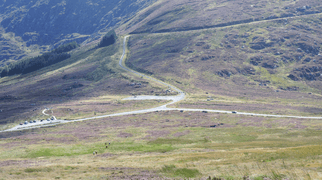
A common route to the summit of Tonelagee is from the east via an 8-kilometre 3-4 hour "loop walk" which starts from a large car-park just above Glenmacnass Waterfall just off the R115 road (also called the Old Military Road). The route crosses the Glenmacnass River to reach Tonelagee's north-east corrie and Lough Ouler, from where it then summits via the northern edge of the corrie rim to the summit of Tonelagee (passing the mica-shist "standing stone" along the way); the descent is via Tonelagee NE Top and then directly down to the shoulder to the Glenmacnass Waterfall car park.
A shorter even more direct route is from the Wicklow Gap on the R756 road to the west, climbing the 6-kilometre 2-3 hour route directly up the shoulder of Tonelagee and then retracing back to the car; this route is rarely offered in guidebooks as it leaves out Lough Ouler and Tonelagee's subsidiary summits.
Gallery
-
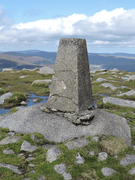
Summit pillar
-
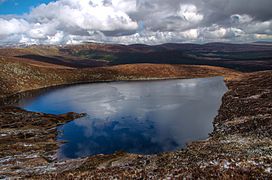
Heart-shaped Lough Ouler
-
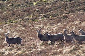
Deer on Tonelagee
-
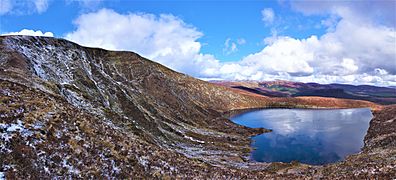
North-east corrie and Lough Ouler
-
Wicklow Gap on slopes of Tonelagee


