
Travnik facts for kids
Quick facts for kids
Travnik
Травник
|
||
|---|---|---|
|
Town and Municipality
|
||
.jpg) |
||
|
||

Location of Travnik within Bosnia and Herzegovina.
|
||
| Country | Bosnia and Herzegovina | |
| Canton | Central Bosnia | |
| Area | ||
| • Town and Municipality | 529 km2 (204 sq mi) | |
| Elevation | 514 m (1,686 ft) | |
| Population
(2013 census)
|
||
| • Town and Municipality | 16,534 | |
| • Density | 109/km2 (280/sq mi) | |
| • Urban | 57,543 | |
| Time zone | UTC+1 (CET) | |
| • Summer (DST) | UTC+2 (CEST) | |
| Postal code |
72270
|
|
| Area code(s) | (+387) 30 | |

Travnik (Травник ) is a town in central Bosnia and Herzegovina, 90 kilometres (56 miles) west of Sarajevo. It is the capital of the Central Bosnia Canton. It is in the Travnik Municipality. In 2013, the town of Travnik had 16,534 residents. The Travnik metropolitan area population was 57,543 people. In 1699 it became the residence of the viziers of the Ottoman province of Bosnia.
Travnik is close to the geographic center of Bosnia and Herzegovina at 44°14′N 17°40′E / 44.233°N 17.667°E. The river Lašva flows from west to east through the city. Travnik is in the Lašva valley. This valley connects the Bosna river valley to the Vrbas river valley.
Travnik is 514 metres (1,686 feet) above sea level. The Vilenica and Vlašić mountains are two of the geographical features found near Travnik. Vlašić mountain is at the very center of Bosnia and Herzegovina. Its highest peak is Paljenik with an elevation of 1,943 metres (6,375 ft).
Images for kids
-
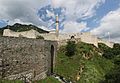
Travnik Fortress
-
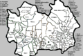
Villages within Travnik municipality
-
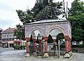
Vizier's grave (turbe) in Travnik.
-
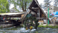
Old watermill by Plava voda
-

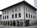
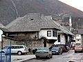
Birthplace of Ivo Andrić
-
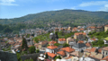
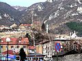
Travnik downtown from castle
-
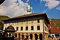
Suleimania Mosque
-
Suleimania Mosque
-
Suleimania Mosque
-
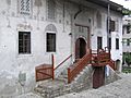
Suleimania Mosque
-
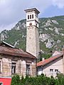
Sahat Kula, Clock Tower
-
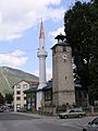
Another Clock Tower
-
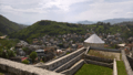
View from Travnik Castle
-
Birthplace (home) of Ivo Andrić
-
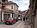
Poturmahala.
-
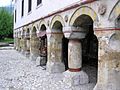
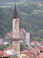
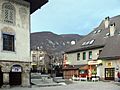
Old Town
-
-
Entry to Travnik from eastern side


.jpg)


See also
 In Spanish: Travnik para niños
