
Walnutport, Pennsylvania facts for kids
Quick facts for kids
Borough of Walnutport
|
|
|---|---|

Main Street in Walnutport
|
|

Location of Walnutport in Northampton County, Pennsylvania.
|
|

Borough of Walnutport
Location in Pennsylvania

Borough of Walnutport
Location in the United States
|
|
| Country | United States |
| State | Pennsylvania |
| County | Northampton |
| Borough | 1989 |
| Area | |
| • Total | 0.83 sq mi (2.15 km2) |
| • Land | 0.76 sq mi (1.96 km2) |
| • Water | 0.07 sq mi (0.19 km2) |
| Elevation | 814 ft (248 m) |
| Population
(2010)
|
|
| • Total | 2,070 |
| • Estimate
(2019)
|
2,087 |
| • Density | 2,764.24/sq mi (1,066.87/km2) |
| Time zone | UTC-5 (EST) |
| • Summer (DST) | UTC-4 (EDT) |
| ZIP Code |
18088
|
| Area code(s) | 610 and 484 (610 Exchange: 767) |
| FIPS code | 42-80800 |
Walnutport is a borough in Northampton County, Pennsylvania, United States. It was first incorporated in 1909. Walnutport is located in the Lehigh Valley metropolitan area along the Lehigh River.
The population of Walnutport was 2,070 at the 2010 census. The ZIP Code is 18088.
Contents
Geography
Walnutport is located at 40°45′6″N 75°35′44″W / 40.75167°N 75.59556°W (40.751554, -75.595574).
According to the United States Census Bureau, the borough has a total area of 0.8 square miles (2.1 km2), of which, 0.8 square miles (1.9 km2) of it is land and 0.1 square miles (0.2 km2) of it (7.41%) is water.
Walnutport is located 20 miles north of Bethlehem at the intersections of Pennsylvania Route 145 and Mountain View Drive, an extension of State Route 946. It's also located 4 miles south of Palmerton, 1 Mile east of Slatington, and 46 miles (74 km) south of Scranton, in the Wyoming Valley or the Scranton/Wilkes-Barre metropolitan area. Walnutport's elevation is at 814 feet above sea level.
Demographics
|
||||||||||||||||||||||||||||||||||||||||||||||||||||||||||||
At the 2000 census there were 2,043 people, 809 households, and 584 families residing in the borough. The population density was 2,727.6 people per square mile (1,051.7/km2). There were 865 housing units at an average density of 1,154.8 per square mile (445.3/km2). The racial makeup of the borough was 97.45% White, 0.39% African American, 0.34% Native American, 1.17% Asian, 0.39% from other races, and 0.24% from two or more races. Hispanic or Latino of any race were 1.52%.
There were 809 households, 28.9% had children under the age of 18 living with them, 58.1% were married couples living together, 9.9% had a female householder with no husband present, and 27.7% were non-families. 23.1% of households were made up of individuals, and 11.7% were one person aged 65 or older. The average household size was 2.46 and the average family size was 2.88.
In the borough the population was spread out, with 22.0% under the age of 18, 6.4% from 18 to 24, 29.6% from 25 to 44, 24.7% from 45 to 64, and 17.3% 65 or older. The median age was 40 years. For every 100 females there were 90.0 males. For every 100 females age 18 and over, there were 89.1 males.
The median household income was $41,743 and the median family income was $44,844. Males had a median income of $35,729 versus $21,546 for females. The per capita income for the borough was $18,095. About 8.8% of families and 8.5% of the population were below the poverty line, including 11.5% of those under age 18 and 12.7% of those age 65 or over.
Public education
The borough is served by the Northern Lehigh School District.
Gallery
-
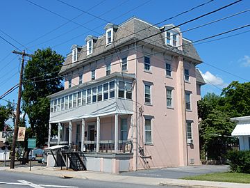
Presbyterian House
-
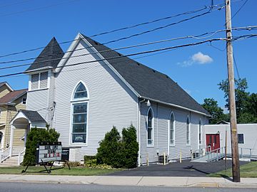
Christ Church UCC
-
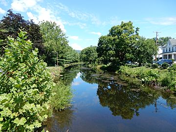
Lehigh Canal in Walnutport.


 |
Weiders Crossing | Danielsville | |
|
| Slatington | Cherryville | |||
| Laurys Station |
See also
 In Spanish: Walnutport para niños
