
West Melton, New Zealand facts for kids
Quick facts for kids
West Melton
|
|
|---|---|
|
Minor urban area
|
|

West Melton Tavern
|
|
| Country | New Zealand |
| Region | Canterbury |
| Territorial authority | Selwyn District |
| Ward | Selwyn Central |
| Electorates | Selwyn Te Tai Tonga |
| Area | |
| • Total | 5.32 km2 (2.05 sq mi) |
| Elevation | 88 m (289 ft) |
| Population
(June 2022)
|
|
| • Total | 2,640 |
| • Density | 496.2/km2 (1,285/sq mi) |
| Time zone | UTC+12 (New Zealand Standard Time) |
| • Summer (DST) | UTC+13 (New Zealand Daylight Time) |
| Local iwi | Ngāi Tahu |
West Melton is a town located west of Christchurch in the Canterbury region of New Zealand's South Island.
Demographics
West Melton is described by Statistics New Zealand as a small urban area, and covers 5.32 km2 (2.05 sq mi). It had an estimated population of 2,640 as of June 2022, with a population density of 496 people per km2.
| Historical population | ||
|---|---|---|
| Year | Pop. | ±% p.a. |
| 2006 | 327 | — |
| 2013 | 780 | +13.22% |
| 2018 | 2,085 | +21.73% |
West Melton had a population of 2,085 at the 2018 New Zealand census, an increase of 1,305 people (167.3%) since the 2013 census, and an increase of 1,758 people (537.6%) since the 2006 census. There were 675 households. There were 1,017 males and 1,068 females, giving a sex ratio of 0.95 males per female. The median age was 39.7 years (compared with 37.4 years nationally), with 549 people (26.3%) aged under 15 years, 207 (9.9%) aged 15 to 29, 1,116 (53.5%) aged 30 to 64, and 210 (10.1%) aged 65 or older.
Ethnicities were 94.0% European/Pākehā, 5.9% Māori, 0.9% Pacific peoples, 5.2% Asian, 0.6% MELAA and 1.7% other ethnicities (totals add to more than 100% since people could identify with multiple ethnicities).
The proportion of people born overseas was 19.0%, compared with 27.1% nationally.
Although some people objected to giving their religion, 51.9% had no religion, 40.1% were Christian, 0.1% were Hindu, 0.3% were Muslim, 1.0% were Buddhist and 1.3% had other religions.
Of those at least 15 years old, 444 (28.9%) people had a bachelor or higher degree, and 153 (10.0%) people had no formal qualifications. The median income was $55,400, compared with $31,800 nationally. The employment status of those at least 15 was that 918 (59.8%) people were employed full-time, 246 (16.0%) were part-time, and 27 (1.8%) were unemployed.
West Melton and the Selwyn District are two of the fastest growing areas in New Zealand with regards to population, and economic progression.
Halkett
Halkett is a rural statistical area north of West Melton and south of the Waimakariri River. It covers 86.01 km2 (33.21 sq mi). It had an estimated population of 1,800 as of June 2022, with a population density of 21 people per km2.
| Historical population for Halkett | ||
|---|---|---|
| Year | Pop. | ±% p.a. |
| 2006 | 1,287 | — |
| 2013 | 1,545 | +2.64% |
| 2018 | 1,656 | +1.40% |
Halkett had a population of 1,656 at the 2018 New Zealand census, an increase of 111 people (7.2%) since the 2013 census, and an increase of 369 people (28.7%) since the 2006 census. There were 585 households. There were 852 males and 804 females, giving a sex ratio of 1.06 males per female. The median age was 46.2 years (compared with 37.4 years nationally), with 291 people (17.6%) aged under 15 years, 246 (14.9%) aged 15 to 29, 858 (51.8%) aged 30 to 64, and 261 (15.8%) aged 65 or older.
Ethnicities were 94.9% European/Pākehā, 6.0% Māori, 2.5% Pacific peoples, 2.0% Asian, and 1.3% other ethnicities (totals add to more than 100% since people could identify with multiple ethnicities).
The proportion of people born overseas was 16.5%, compared with 27.1% nationally.
Although some people objected to giving their religion, 48.6% had no religion, 42.8% were Christian, 0.2% were Muslim, 0.2% were Buddhist and 0.9% had other religions.
Of those at least 15 years old, 339 (24.8%) people had a bachelor or higher degree, and 198 (14.5%) people had no formal qualifications. The median income was $38,800, compared with $31,800 nationally. The employment status of those at least 15 was that 702 (51.4%) people were employed full-time, 291 (21.3%) were part-time, and 15 (1.1%) were unemployed.
Newtons Road
Newtons Road is a rural statistical area south of West Melton, and north of Burnham Military Camp and Rolleston. It covers 153.14 km2 (59.13 sq mi). It had an estimated population of 3,820 as of June 2022, with a population density of 25 people per km2.
| Historical population for Newtons Road | ||
|---|---|---|
| Year | Pop. | ±% p.a. |
| 2006 | 2,604 | — |
| 2013 | 3,207 | +3.02% |
| 2018 | 3,342 | +0.83% |
Newtons Road had a population of 3,342 at the 2018 New Zealand census, an increase of 135 people (4.2%) since the 2013 census, and an increase of 738 people (28.3%) since the 2006 census. There were 1,113 households. There were 1,770 males and 1,572 females, giving a sex ratio of 1.13 males per female. The median age was 45.2 years (compared with 37.4 years nationally), with 597 people (17.9%) aged under 15 years, 528 (15.8%) aged 15 to 29, 1,785 (53.4%) aged 30 to 64, and 432 (12.9%) aged 65 or older.
Ethnicities were 92.2% European/Pākehā, 8.3% Māori, 0.9% Pacific peoples, 3.0% Asian, and 1.9% other ethnicities (totals add to more than 100% since people could identify with multiple ethnicities).
The proportion of people born overseas was 14.5%, compared with 27.1% nationally.
Although some people objected to giving their religion, 55.2% had no religion, 36.9% were Christian, 0.4% were Buddhist and 1.3% had other religions.
Of those at least 15 years old, 534 (19.5%) people had a bachelor or higher degree, and 465 (16.9%) people had no formal qualifications. The median income was $39,600, compared with $31,800 nationally. The employment status of those at least 15 was that 1,569 (57.2%) people were employed full-time, 507 (18.5%) were part-time, and 51 (1.9%) were unemployed.
Education
West Melton School is a full primary school catering for years 1 to 8. It had a roll of 422 as of April 2023. The school opened in 1871.
Transport
Bus
West Melton is serviced with the 86 bus route, a morning and evening express route that connects Darfield with the Central Christchurch.
Road
West Melton is accessed by State Highway 73 which pass through the centre of the town. West Melton is also closely linked to the newly built extension of the Christchurch Southern Motorway via Weedons Ross Road Interchange.
West Melton's first set of traffic lights is set to be installed in 2022-2023.
Images for kids
-
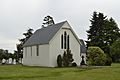
St Paul's Anglican church, 2013
-
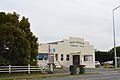
West Melton community centre


