
Garden State Parkway facts for kids
Quick facts for kids
|
||||
|---|---|---|---|---|
| Lua error in Module:Infobox_road/map at line 15: attempt to index field 'wikibase' (a nil value). | ||||
| Route information | ||||
| Maintained by New Jersey Turnpike Authority | ||||
| Length | 172.40 mi (277.45 km) | |||
| Existed | 1944–present | |||
| Major junctions | ||||
| South end | ||||
| North end | G.S. Pkwy. Connector to |
|||
| Highway system | ||||
| New Jersey State Highway Routes Interstate and US
|
||||

The Garden State Parkway (or Garden State Pkwy) is a toll highway (which means that people must pay to drive on it) that goes through New Jersey from the south end of the state at Cape May to the north end of the state at Montvale, New Jersey. It is 172.4 miles long, and in 2008, was reported to be the busiest toll highway in the United States.
Images for kids
-
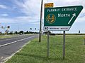
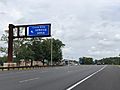
Typical entrance sign for the parkway
-
Garden State Parkway southbound, approaching the southern terminus at Route 109 in Lower Township
-
Garden State Parkway southbound in Cape May Court House
-
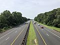
Garden State Parkway northbound in Egg Harbor Township
-
Garden State Parkway northbound in Bass River Township
-
Garden State Parkway southbound at CR 614 in Lacey Township
-
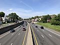
Garden State Parkway northbound in Wall Township
-
.
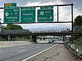
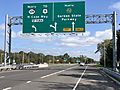
Garden State Parkway northbound at the interchange with Route 18 and Route 36 in Tinton Falls
-
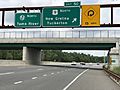
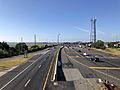
Garden State Parkway northbound approaching the Driscoll Bridge
-
Garden State Parkway southbound in Union Township
-
Garden State Parkway northbound in East Orange
-
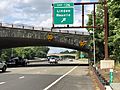
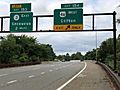
Garden State Parkway northbound in Clifton
-
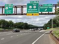
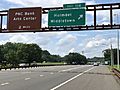
Garden State Parkway northbound in Paramus
-
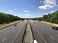
Stone overpasses on the Garden State Parkway in Union County
-
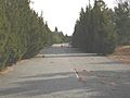
The old alignment at the Beesley's Point Bridge heading southbound with a white center line (instead of yellow)
-
Garden State Parkway southbound approaching exit 154
-
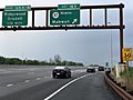
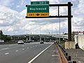
Garden State Parkway northbound at exit 114
-
The south end of the parkway at Route 109 in Lower Township, looking north
-
Garden State Parkway northbound approaching the Driscoll Bridge in 2002, before the southbound span was built
-
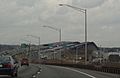
Flyover ramp from the GSP northbound to I-78 westbound, opened in 2009
-
Former traffic light at exit 9 (Shell Bay Avenue) before construction of overpass in 2014
-
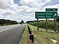
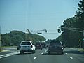
Southbound approaching exit 30 in Somers Point
-
Southbound at the Great Egg Toll Plaza
-
Toll plaza on the southbound entrance ramp at exit 165
-

Garden State Parkway tokens, which were discontinued after January 1, 2009
-
Historical picture of a Garden State Parkway toll plaza
-
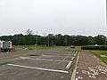
The John B. Townsend Shoemaker Holly picnic area
-
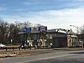
Northbound exit for the Forked River Service Area
-
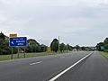
Assurance sign to the Ocean View Service Area
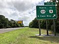
_at_the_exit_for_the_Garden_State_Parkway_NORTH_in_Middle_Township,_Cape_May_County,_New_Jersey.jpg)
_at_Exit_0_(New_Jersey_State_Route_109_NORTH_TO_U.S._Route_9,_North_Cape_May)_in_Lower_Township,_Cape_May_County,_New_Jersey.jpg)
_from_the_pedestrian_overpass_between_Exit_9_and_Exit_10_in_Middle_Township,_Cape_May_County,_New_Jersey.jpg)
_at_Exit_38B_(Atlantic_City_Expressway_WEST,_Camden)_in_Egg_Harbor_Township,_Atlantic_County,_New_Jersey.jpg)
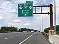
_at_Exit_50_(U.S._Route_9_NORTH,_New_Gretna,_Tuckerton)_in_Bass_River_Township,_Burlington_County,_New_Jersey.jpg)
_from_the_overpass_for_Ocean_County_Route_614_(Lacey_Road)_in_Lacey_Township,_Ocean_County,_New_Jersey.jpg)
_at_Exit_98_(New_Jersey_State_Route_138_EAST,_Interstate_195_WEST,_New_Jersey_State_Route_34,_Belmar,_Trenton)_in_Wall_Township,_Monmouth_County,_New_Jersey.jpg)
_at_Exit_127_(U.S._Route_9_NORTH,_New_Jersey_State_Route_440,_TO_Interstate_287,_Woodbridge,_Staten_Island)_in_Sayreville,_Middlesex_County,_New_Jersey.jpg)
_at_Exit_141_(Vauxhall_Road)_in_Union_Township,_Union_County,_New_Jersey.jpg)
_from_the_pedestrian_overpass_at_New_Street_in_East_Orange,_Essex_County,_New_Jersey.jpg)
_at_Exit_154_(U.S._Route_46_EAST,_Clifton)_in_Clifton,_Passaic_County,_New_Jersey.jpg)
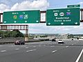
_at_Exit_163_(New_Jersey_State_Route_17_NORTH,_Mahwah)_in_Paramus,_Bergen_County,_New_Jersey.jpg)
_at_Exit_136_(Linden,_Roselle)_on_the_border_of_Clark_Township_and_Cranford_Township_in_Union_County,_New_Jersey.jpg)

_at_Exit_154_(U.S._Route_46_WEST,_Clifton)_in_Clifton,_Passaic_County,_New_Jersey.jpg)
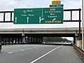
_at_Exit_114_(Holmdel,_Middletown)_in_Middletown_Township,_Monmouth_County,_New_Jersey.jpg)


_at_Exit_142C_(Maplewood)_in_Hillside_Township,_Union_County,_New_Jersey.jpg)

_at_Exit_30_(Somers_Point,_Ocean_City)_in_Somers_Point,_Atlantic_County,_New_Jersey.jpg)
_from_the_overpass_for_U.S._Route_9_(New_Road)_in_Somers_Point,_Atlantic_County,_New_Jersey.jpg)


_at_the_Forked_River_Service_Area_in_Lacey_Township,_Ocean_County,_New_Jersey.jpg)
_at_the_Ocean_View_Service_Area_in_Dennis_Township,_Cape_May_County,_New_Jersey.jpg)
See also
 In Spanish: Garden State Parkway para niños
