Garwood, New Jersey facts for kids
Quick facts for kids
Garwood, New Jersey
|
|
|---|---|
|
Borough
|
|
| Borough of Garwood | |
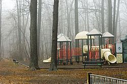
A local park in Garwood
|
|
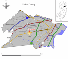
Map of Garwood in Union County. Inset: Location of Union County in the State of New Jersey.
|
|
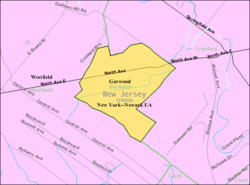
Census Bureau map of Garwood, New Jersey
|
|
| Country | |
| State | |
| County | |
| Incorporated | March 19, 1903 |
| Government | |
| • Type | Borough |
| • Body | Borough Council |
| Area | |
| • Total | 0.65 sq mi (1.68 km2) |
| • Land | 0.65 sq mi (1.68 km2) |
| • Water | 0.00 sq mi (0.00 km2) 0.00% |
| Area rank | 532nd of 565 in state 20th of 21 in county |
| Elevation | 82 ft (25 m) |
| Population | |
| • Total | 4,226 |
| • Estimate
(2019)
|
4,352 |
| • Rank | 404th of 566 in state 20th of 21 in county |
| • Density | 6,362.7/sq mi (2,456.7/km2) |
| • Density rank | 76th of 566 in state 8th of 21 in county |
| Time zone | UTC−05:00 (Eastern (EST)) |
| • Summer (DST) | UTC−04:00 (Eastern (EDT)) |
| ZIP Code |
07027
|
| Area code(s) | 908 |
| FIPS code | 3403925800 |
| GNIS feature ID | 0885229 |
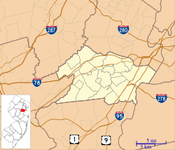
Garwood is a borough in Union County, New Jersey, United States. As of the 2010 United States Census, the borough's population was 4,226, reflecting an increase of 73 (+1.8%) from the 4,153 counted in the 2000 Census, which had in turn declined by 74 (-1.8%) from the 4,227 counted in the 1990 Census.
Contents
History
Garwood was incorporated as a borough on March 19, 1903, from portions of Cranford Township and Westfield Town.
Geography
According to the United States Census Bureau, the borough had a total area of 0.664 square miles (1.720 km2), all of which was land.
The borough is roughly bisected by the tracks of NJ Transit's Raritan Valley Line, originally built as part of the Jersey Central railroad. On the north side of the railroad, most of the streets are numbered, while on the south side of Garwood most of the streets are named after trees.
Garwood borders the Union County municipalities of Cranford and Westfield.
Demographics
| Historical population | |||
|---|---|---|---|
| Census | Pop. | %± | |
| 1910 | 1,118 | — | |
| 1920 | 2,084 | 86.4% | |
| 1930 | 3,344 | 60.5% | |
| 1940 | 3,622 | 8.3% | |
| 1950 | 4,622 | 27.6% | |
| 1960 | 5,426 | 17.4% | |
| 1970 | 5,260 | −3.1% | |
| 1980 | 4,752 | −9.7% | |
| 1990 | 4,227 | −11.0% | |
| 2000 | 4,153 | −1.8% | |
| 2010 | 4,226 | 1.8% | |
| 2019 (est.) | 4,352 | 3.0% | |
| Population sources: 1910-1920 1900-1910 1910-1930 1930-1990 2000 2010 |
|||
Census 2010
As of the census of 2010, there were 4,226 people, 1,778 households, and 1,118 families residing in the borough. The population density was 6,362.7 per square mile (2,456.7/km2). There were 1,870 housing units at an average density of 2,815.5 per square mile (1,087.1/km2)*. The racial makeup of the borough was 93.23% (3,940) White, 1.06% (45) Black or African American, 0.02% (1) Native American, 2.04% (86) Asian, 0.00% (0) Pacific Islander, 1.80% (76) from other races, and 1.85% (78) from two or more races. [[Hispanic (U.S. Census)|Hispanic or Latino of any race were 8.83% (373) of the population.
There were 1,778 households out of which 23.9% had children under the age of 18 living with them, 47.5% were married couples living together, 10.7% had a female householder with no husband present, and 37.1% were non-families. 29.9% of all households were made up of individuals, and 10.6% had someone living alone who was 65 years of age or older. The average household size was 2.38 and the average family size was 3.00.
In the borough, the population was spread out with 19.3% under the age of 18, 6.4% from 18 to 24, 30.4% from 25 to 44, 28.7% from 45 to 64, and 15.2% who were 65 years of age or older. The median age was 41.4 years. For every 100 females there were 93.9 males. For every 100 females ages 18 and old there were 92.3 males.
The Census Bureau's 2006-2010 American Community Survey showed that (in 2010 inflation-adjusted dollars) median household income was $72,254 (with a margin of error of +/- $9,274) and the median family income was $86,959 (+/- $8,603). Males had a median income of $58,258 (+/- $3,197) versus $43,455 (+/- $3,625) for females. The per capita income for the borough was $35,753 (+/- $2,821). About 0.9% of families and 1.8% of the population were below the poverty line, including none of those under age 18 and none of those age 65 or over.
Census 2000
As of the 2000 United States Census there were 4,153 people, 1,731 households, and 1,125 families residing in the borough. The population density was 6,292.9 people per square mile (2,429.5/km2). There were 1,782 housing units at an average density of 2,700.2 per square mile (1,042.5/km2). The racial makeup of the borough was 95.91% White, 0.36% African American, 1.32% Asian, 1.54% from other races, and 0.87% from two or more races. Hispanic or Latino of any race were 4.98% of the population.
There were 1,731 households, out of which 26.2% had children under the age of 18 living with them, 49.0% were married couples living together, 12.1% had a female householder with no husband present, and 35.0% were non-families. 28.7% of all households were made up of individuals, and 11.5% had someone living alone who was 65 years of age or older. The average household size was 2.40 and the average family size was 2.96.
In the borough the population was spread out, with 20.0% under the age of 18, 6.3% from 18 to 24, 35.6% from 25 to 44, 20.9% from 45 to 64, and 17.2% who were 65 years of age or older. The median age was 38 years. For every 100 females, there were 93.3 males. For every 100 females age 18 and over, there were 89.6 males.
The median income for a household in the borough was $52,571, and the median income for a family was $64,053. Males had a median income of $50,951 versus $36,538 for females. The per capita income for the borough was $26,944. About 3.5% of families and 5.1% of the population were below the poverty line, including 6.3% of those under age 18 and 6.4% of those age 65 or over.
Transportation
Roads and highways
As of May 2010[update], the borough had a total of 13.88 miles (22.34 km) of roadways, of which 11.90 miles (19.15 km) were maintained by the municipality, 1.02 miles (1.64 km) by Union County and 0.96 miles (1.54 km) by the New Jersey Department of Transportation.
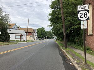
New Jersey Route 28 is the main highway through Garwood, connecting east to Cranford and west to Westfield. New Jersey Route 59, which borders Cranford to the east, has been described as the shortest four-lane paved highway in the United States. It was built in the late 1920s, numbered Route 22 at the time and was originally planned to run from Fairfield Township to Rahway, but was never completed. Its total length is 792 feet (241 m).
Public transportation
The Garwood station offers limited NJ Transit rail service on the Raritan Valley Line. The station has limited service, does not have platforms and is not ADA compliant.
NJ Transit also provides bus service along two different lines, the 113 route to the Port Authority Bus Terminal in Midtown Manhattan and the 59 bus to Newark.
Newark Liberty International Airport is approximately 15 minutes away. Linden Airport, a general aviation facility is in nearby Linden, New Jersey.
Education
The Garwood Public Schools serves students in pre-kindergarten through eighth grade at Lincoln School. As of the 2018–19 school year, the district, comprised of one school, had an enrollment of 386 students and 30.4 classroom teachers (on an FTE basis), for a student–teacher ratio of 12.7:1.
Public school students in ninth through twelfth grades attend Arthur L. Johnson High School in neighboring Clark as part of a sending/receiving relationship with the Clark Public School District. As of the 2018–19 school year, the high school had an enrollment of 717 students and 66.0 classroom teachers (on an FTE basis), for a student–teacher ratio of 10.9:1.
Students from Garwood, and all of Union County, are eligible to attend one of the Union County Vocational Technical Schools.
Notable people
People who were born in, residents of, or otherwise closely associated with Garwood include:
- David Durante (born 1980), national men's gymnastics champion.
- Loree Jon Hasson (born 1965), professional pool player.
- Barry Lubin (born 1952), creator of the clown character "Grandma" of the Big Apple Circus.
- John J. McCarthy (1927-2001), politician who served in the New Jersey General Assembly and as Mayor of Garwood.
- Tom Perrotta (born 1961), author.
See also
 In Spanish: Garwood (Nueva Jersey) para niños


