
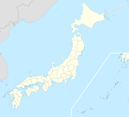
Image: Japan location map with side map of the Ryukyu Islands

Description: Location map of Japan Equirectangular projection. Geographic limits to locate objects in the main map with the main islands: N: 45°51'37" N (45.86°N) S: 30°01'13" N (30.02°N) W: 128°14'24" E (128.24°E) E: 149°16'13" E (149.27°E) Geographic limits to locate objects in the side map with the Ryukyu Islands: N: 39°32'25" N (39.54°N) S: 23°42'36" N (23.71°N) W: 110°25'49" E (110.43°E) E: 131°26'25" E (131.44°E)
Title: Japan location map with side map of the Ryukyu Islands
Credit: Own work
Author: Maximilian Dörrbecker (Chumwa)
Permission: I, the copyright holder of this work, hereby publish it under the following licenses: Permission is granted to copy, distribute and/or modify this document under the terms of the GNU Free Documentation License, Version 1.2 or any later version published by the Free Software Foundation; with no Invariant Sections, no Front-Cover Texts, and no Back-Cover Texts. A copy of the license is included in the section entitled GNU Free Documentation License.http://www.gnu.org/copyleft/fdl.htmlGFDLGNU Free Documentation Licensetruetrue This file is licensed under the Creative Commons Attribution-Share Alike 3.0 Unported license. You are free: to share – to copy, distribute and transmit the work to remix – to adapt the work Under the following conditions: attribution – You must attribute the work in the manner specified by the author or licensor (but not in any way that suggests that they endorse you or your use of the work). share alike – If you alter, transform, or build upon this work, you may distribute the resulting work only under the same or similar license to this one. http://creativecommons.org/licenses/by-sa/3.0 CC BY-SA 3.0 Creative Commons Attribution-Share Alike 3.0 truetrue You may select the license of your choice.
Usage Terms: Creative Commons Attribution-Share Alike 3.0
License: CC BY-SA 3.0
License Link: http://creativecommons.org/licenses/by-sa/3.0
Attribution Required?: Yes
Image usage
More than 100 pages link to this image. The following list shows the first 100 page links to this image only. A full list is available.
- Abiko, Chiba
- Aizuwakamatsu
- Aizuwakamatsu, Fukushima
- Asakuchi
- Asakuchi, Okayama
- Bandō, Ibaraki
- Bunkyō
- Chiba, Chiba
- Chiba (city)
- Chubu Centrair International Airport
- Date, Fukushima
- Fujiidera
- Fujikawa, Yamanashi
- Fujisawa, Kanagawa
- Fukui (city)
- Fukushima, Fukushima
- Fukushima (city)
- Fushimi-ku, Kyoto
- Futaba, Fukushima
- Hachiōji
- Hakone
- Hamamatsu
- Higashihiroshima
- Higashine
- Himeji, Hyōgo
- Himeji Castle
- Hirakata
- Hiratsuka
- Hirono, Fukushima
- Hirosaki
- Hitachi, Ibaraki
- Ichinoseki, Iwate
- Iitate, Fukushima
- Isesaki
- Itabashi
- Iwakuni
- Iwata, Shizuoka
- Kameyama, Mie
- Kaminoyama
- Kaminoyama, Yamagata
- Karuizawa, Nagano
- Kashima, Ibaraki
- Kashiwa
- Katsuyama, Fukui
- Kawasaki, Kanagawa
- Kawauchi, Fukushima
- Kesennuma
- Kisarazu Air Field
- Kitakami, Iwate
- Kitano Tenman-gū
- Kitano Tenmangū
- Kodaira, Tokyo
- Komatsu, Ishikawa
- Kudamatsu
- Kumagaya
- Kurashiki
- Kyoto
- Machida, Tokyo
- Makinohara
- Makinohara, Shizuoka
- Matsue
- Matsusaka
- Matsuyama
- Minamisanriku
- Mito, Ibaraki
- Morioka
- Muroran
- Nagakute
- Nagano (city)
- Naganuma, Hokkaido
- Nara (city)
- Niigata (city)
- Nishinoomote, Kagoshima
- Obama, Fukui
- Okugome
- Sabae, Fukui
- Sado, Niigata
- Saga (city)
- Sagamihara, Kanagawa
- Sakado, Saitama
- Sasamuta-jinja
- Sendai, Miyagi
- Sensō-ji
- Shimada, Shizuoka
- Shimizu, Shizuoka
- Shingō, Aomori
- Shinjuku
- Shizuoka (city)
- Shōdoshima
- Sodegaura
- Suzuka, Mie
- Takahagi, Ibaraki
- Takaoka, Toyama
- Takasaki
- Tamura, Fukushima
- Tatebayashi, Gunma
- Tomioka, Fukushima
- Wakayama, Wakayama
- Yokkaichi, Mie
- Yonezawa, Yamagata
