
Image: Suffolk UK location map

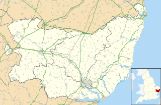
Description: Map of Suffolk, UK with the following information shown: Administrative borders Coastline, lakes and rivers Roads and railways Urban areas Equirectangular map projection on WGS 84 datum, with N/S stretched 160% Geographic limits: West: 0.30E East: 1.90E North: 52.57N South: 51.92N
Title: Suffolk UK location map
Credit: Ordnance Survey OpenData. Administrative borders and coastline data from Boundary-Line product. All other geographic data from Meridian 2 product. Inset derived from England location map.svg by Spischot.
Author: Nilfanion, created using Ordnance Survey data
Permission: This file is licensed under the Creative Commons Attribution-Share Alike 3.0 Unported license. Attribution: Contains Ordnance Survey data © Crown copyright and database right You are free: to share – to copy, distribute and transmit the work to remix – to adapt the work Under the following conditions: attribution – You must attribute the work in the manner specified by the author or licensor (but not in any way that suggests that they endorse you or your use of the work). share alike – If you alter, transform, or build upon this work, you may distribute the resulting work only under the same or similar license to this one. http://creativecommons.org/licenses/by-sa/3.0 CC BY-SA 3.0 Creative Commons Attribution-Share Alike 3.0 truetrue
Usage Terms: Creative Commons Attribution-Share Alike 3.0
License: CC BY-SA 3.0
License Link: http://creativecommons.org/licenses/by-sa/3.0
Attribution Required?: Yes
Image usage
More than 100 pages link to this image. The following list shows the first 100 page links to this image only. A full list is available.
- Aldeburgh
- Alderton
- Aldham
- Bawdsey
- Beccles
- Blaxhall
- Bramfield
- Brandeston
- Bredfield
- Brettenham
- Brightwell, Suffolk
- Bromeswell
- Bruisyard
- Bungay
- Bures, England
- Burgh
- Burstall
- Bury St Edmunds
- Castling's Heath
- Cavendish, Suffolk
- Charsfield
- Chediston
- Chillesford
- Clare, Suffolk
- Coddenham
- Copdock
- Cornard Tye
- Cransford
- Cratfield
- Culpho
- Dallinghoo
- Darsham
- Debenham
- Dennington
- Dunwich
- Earl Soham
- Easton, Suffolk
- Edwardstone
- Elmswell
- Eye, Suffolk
- Eyke
- Felixstowe
- Framlingham
- Framlingham Castle
- Friston
- Gosling Green
- Great Bealings
- Great Finborough
- Great Glemham
- Groton, Suffolk
- Hadleigh, Suffolk
- Hadleigh Heath
- Halesworth
- Hartest
- Haverhill, Suffolk
- Horner's Green
- Hoxne
- Ixworth
- Kedington
- Kersey
- Kersey Tye
- Kersey Upland
- Lakenheath
- Leiston
- Little Cornard
- Lowestoft
- Mill Green
- Needham Market
- Newmarket, Suffolk
- Orford, Suffolk
- Parliament Heath
- Pettistree
- Polstead
- Polstead Heath
- Poslingford
- Preston St Mary
- Priory Green
- Rattlesden
- Raydon
- Rendlesham
- Round Maple
- Saxmundham
- Shelland
- Shelley, Suffolk
- Sherbourne Street
- Shimpling
- Shotley
- Somerton, Suffolk
- Southwold
- Sproughton
- Stanstead, Suffolk
- Stanton
- Stoke-by-Clare
- Stoke-by-Nayland
- Stowmarket
- Stowupland
- Stradbroke
- Sudbury, Suffolk
- Swilland
- Tye Went
