Mississippi County, Missouri facts for kids
Quick facts for kids
Mississippi County
|
|
|---|---|

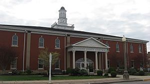
Mississippi County Courthouse in Charleston
|
|

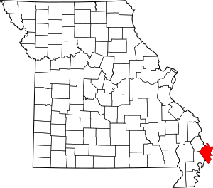
Location within the U.S. state of Missouri
|
|
 Missouri's location within the U.S. |
|
| Country | |
| State | |
| Founded | February 14, 1845 |
| Named for | Mississippi River |
| Seat | Charleston |
| Largest city | Charleston |
| Area | |
| • Total | 429 sq mi (1,110 km2) |
| • Land | 412 sq mi (1,070 km2) |
| • Water | 17 sq mi (40 km2) 4.0% |
| Population
(2020)
|
|
| • Total | 12,577 |
| • Estimate
(2018)
|
13,336 |
| • Density | 29.32/sq mi (11.319/km2) |
| Time zone | UTC−6 (Central) |
| • Summer (DST) | UTC−5 (CDT) |
| Congressional district | 8th |
Mississippi County is a county located in the Bootheel of the U.S. state of Missouri, with its eastern border formed by the Mississippi River. As of the 2020 census, the population was 12,577. The largest city and county seat is Charleston. The county was officially organized on February 14, 1845, and was named after the Mississippi River.
Contents
History
Mississippi County is located in what was formerly known as "Tywappity Bottom," a vast floodplain area bordered by the Scott County Hills on the north, St. James Bayou on the south, the Mississippi River on the east and Little River on the west.
In 1540, the Spanish explorer Hernando De Soto penetrated to the Arkansas River and perhaps well into southeastern Missouri, which was populated by various Native American tribes. Under the pressure of a constantly advancing white settlement, the Native Americans gradually retreated westward to survive. The area of southeastern Missouri was noted for its level swampy lowlands, subject to the seasonal flooding of the Mississippi River, which had resulted in extremely fertile soils.
By 1820 European Americans from the United States, many migrating from southern states, had settled most of the present counties of southeastern Missouri. The settlers were mostly farmers who came from Illinois and states of the Upper South: Kentucky, Tennessee, and Virginia. They wanted the fertile and cheap lands found in the area of present-day Charleston, Missouri.
European Americans reached Charleston in 1830. In 1837, Thankful Randol sold Joseph Moore 22½ acres of land; Moore laid out a plan for the city of Charleston. Its original boundary was 12 blocks - four north and south and three east and west. The Original Plat was filed on May 20, 1837. An act to incorporate the City of Charleston, Missouri, in the County of Mississippi, was enacted by the General Assembly of the State of Missouri on March 25, 1872.
The virgin forests attracted timber barons at the turn of the 20th century. Following the clearing of the timber, residents with state assistance built levees were built and formed drainage districts to redevelop the land. As hundreds of miles of levees and dikes were constructed within the Little River Drainage District, thousands of acres of land were drained and reclaimed for agriculture use. The reclaimed land, highly fertile due to centuries of floods from the Mississippi River, was cultivated for cotton, corn, and wheat. Since the late 20th century, soybeans and rice have been important commodity crops.
Geography

According to the U.S. Census Bureau, the county has a total area of 429 square miles (1,110 km2), of which 412 square miles (1,070 km2) is land and 17 square miles (44 km2) (4.0%) is water.
Adjacent counties
- Alexander County, Illinois (north)
- Ballard County, Kentucky (northeast across the Mississippi River)
- Carlisle County, Kentucky (east across the river)
- Hickman County, Kentucky (southeast across the river)
- Fulton County, Kentucky (south across the river)
- New Madrid County (southwest)
- Scott County (northwest)
Mississippi County has borders across the river with four Kentucky counties, but there is no direct highway connection among them due to the barrier of the river. None of the four Kentucky counties that border Missouri has any direct highway connection with Missouri, making Kentucky and Missouri the only two U.S. states to border each other, even across a major river, without a direct highway connection between them. This reflects the relatively low populations among these counties, which are largely rural in character. In early 2016, it was declared as the poorest county in Missouri
Major highways
 Interstate 57
 U.S. Route 60
 U.S. Route 62
 Route 77
 Route 80
 Route 105
Demographics
The rural county was at its peak of population in 1940. With changes in agriculture and mechanization requiring fewer workers, the number of jobs have declined, as has county population.
| Historical population | |||
|---|---|---|---|
| Census | Pop. | %± | |
| 1850 | 3,123 | — | |
| 1860 | 4,859 | 55.6% | |
| 1870 | 4,982 | 2.5% | |
| 1880 | 9,270 | 86.1% | |
| 1890 | 10,134 | 9.3% | |
| 1900 | 11,837 | 16.8% | |
| 1910 | 14,557 | 23.0% | |
| 1920 | 12,860 | −11.7% | |
| 1930 | 15,762 | 22.6% | |
| 1940 | 23,149 | 46.9% | |
| 1950 | 22,551 | −2.6% | |
| 1960 | 20,695 | −8.2% | |
| 1970 | 16,647 | −19.6% | |
| 1980 | 15,726 | −5.5% | |
| 1990 | 14,442 | −8.2% | |
| 2000 | 13,427 | −7.0% | |
| 2010 | 14,358 | 6.9% | |
| 2020 | 12,577 | −12.4% | |
| U.S. Decennial Census 1790-1960 1900-1990 1990-2000 2010-2015 |
|||
As of the census of 2000, there were 13,427 people, 5,383 households, and 3,671 families residing in the county. The population density was 32 people per square mile (13/km2). There were 5,840 housing units at an average density of 14 per square mile (5/km2). The racial makeup of the county was 77.93% White, 20.53% Black or African American, 0.25% Native American, 0.11% Asian, 0.01% Pacific Islander, 0.29% from other races, and 0.89% from two or more races. Approximately 0.96% of the population were Hispanic or Latino of any race.
There were 5,383 households, out of which 31.20% had children under the age of 18 living with them, 47.70% were married couples living together, 17.30% had a female householder with no husband present, and 31.80% were non-families. 28.50% of all households were made up of individuals, and 14.40% had someone living alone who was 65 years of age or older. The average household size was 2.44 and the average family size was 2.98.
In the county, the population was spread out, with 26.30% under the age of 18, 8.80% from 18 to 24, 25.40% from 25 to 44, 23.60% from 45 to 64, and 15.90% who were 65 years of age or older. The median age was 37 years. For every 100 females there were 87.60 males. For every 100 females age 18 and over, there were 82.70 males.
The median income for a household in the county was $28,837, and the median income for a family was $35,554. Males had a median income of $26,110 versus $17,204 for females. The per capita income for the county was $16,847. About 19.00% of families and 23.70% of the population were below the poverty line, including 31.70% of those under age 18 and 21.70% of those age 65 or over.
Religion
According to the Association of Religion Data Archives County Membership Report (2000), Mississippi County is a part of the Bible Belt with evangelical Protestantism being the majority religion. The most predominant denominations among residents in Mississippi County who adhere to a religion are Southern Baptists (53.88%), Methodists (13.70%), and Christian Churches and Churches of Christ (7.55%).
Communities
Education
Of adults 25 years of age and older in Mississippi County, 61.1% possesses a high school diploma or higher while 9.6% holds a bachelor's degree or higher as their highest educational attainment.
Public schools
- Charleston R-I School District - Charleston
- Warren E. Hearnes Elementary School (PK-05)
- Charleston Middle School (06-08)
- Charleston High School (09-12)
- East Prairie R-II School District - East Prairie
- East Prairie Elementary School (PK-04)
- East Prairie Middle School (05-08)
- East Prairie High School (09-12)
- Scott County R-IV School District - Benton
- Kelly Elementary School (K-05)
- Kelly Middle School (06-08)
- Thomas W. Kelly High School (09-12)
Private schools
- St. Henry's School - Charleston - (01-08) - Roman Catholic
Public libraries
- Mississippi County Library District
See also
 In Spanish: Condado de Misisipi (Misuri) para niños

