
Tropical Depression One (2009) facts for kids
| Tropical depression (SSHWS/NWS) | |

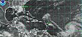
Tropical Depression One on May 28
|
|
| Formed | May 28, 2009 |
|---|---|
| Dissipated | May 29, 2009 |
| Highest winds | 1-minute sustained: 35 mph (55 km/h) Gusts: 45 mph (75 km/h) |
| Lowest pressure | 1006 mbar (hPa); 29.71 inHg |
| Fatalities | None |
| Damage | Minimal |
| Areas affected | Coastal North Carolina |
| Part of the 2009 Atlantic hurricane season | |
Tropical Depression One was the first tropical cyclone of the 2009 Atlantic hurricane season. It was also the third tropical cyclone since 2007 to form before June 1. The storm formed on May 28, and moved across the Atlantic Ocean. Later that day, the storm started to weaken and fall apart. On May 29, the storm died and became a remnant low.
Before the storm became a depression, some parts of the storm brought light rainfall to the eastern tip of North Carolina. However there were no damages or deaths reported. Also the National Hurricane Center (NHC) did not give out any tropical storm watches or warnings for the storm.
Storm history

During mid-May, a disorganized low pressure area formed in the Atlantic Ocean about 290 miles (465 kilometers) south-southwest of Wilmington, North Carolina. The low pressure moved north and started to become more organized. On May 27, the storm was 120 miles (195 km) south of Cape Hatteras, North Carolina when the National Hurricane Center (NHC) decided to start monitoring the storm. A high pressure area that was located southeast of the storm pushed it into a northeast direction. Then on 8 pm EDT (0000 UTC on May 28), the NHC stopped monitoring the storm, as the low was not expected to strengthen anymore.
On May 28, the NHC started to monitor the storm again and on 11:00 am EDT (1500 UTC), they declared the storm to be a tropical cyclone and named it Tropical Depression One. At that time, the storm's location was about 310 mi (500 km) south of Providence, Rhode Island. After it was named as a depression, the storm showed deep convection and the center of circulation was at the northwestern part of the storm. The reason why the depression restrengthened was because of lower wind shear and warmer ocean waters from the Gulf Stream. Later that day, the depression started to weaken when it moved into an area with higher wind shear and colder ocean waters. Around 7:30 pm EDT (2330 UTC), a QuikSCAT satellite flew over the depression and found tropical storm-force winds. But the NHC thought the depression didn't strengthen and that winds were affected by rain. After the satellite passed over the depression, the center of circulation moved closer to the northwest edge of the storm and convection started to decrease.

On May 29, the depression almost became a tropical storm, when the storm's strength was measured at T2.5, or 40 mph (65 km/h) using the Dvorak technique. But some of the measurements were also low as T1.5, which was the reason why the NHC didn't call it a tropical storm. After a quick burst of convection during the night, thunderstorm clouds inside the depression started to disappear by 3:00 am EDT (0700 UTC). By then, the tropical depression was no longer expected to strength anymore and was forecasted to weaken. A few hours later, the center of circulation was ripped apart by strong wind shear while a nearby trough also started to absorb the rest of the storm. With no convection around the center of the storm, it became a remnant low during the afternoon. At 5:00 pm EDT (2100 UTC), the NHC gave out its last advisory on Tropical Depression One. The remains of the storm were later taken in by a warm front around 2 am EDT (0600 UTC).
Impact and records
On May 27 the cyclone brought some light rainfall to parts of coastal North Carolina before it was called Tropical Depression One. Hatteras, North Carolina saw 0.1 in (2.5 mm) of rainfall and wind speeds up to 15 mph (24 km/h) with gusts to 23 mph (37 km/h). The lowest atmospheric pressure recorded from the storm was 1009 mbar (hPa; 29.81 inHg).
When the storm became Tropical Depression One on May 28, it was the third time since 1851 that an Atlantic tropical cyclone formed before June 1, the official start of an Atlantic hurricane season. The depression followed Subtropical Storm Andrea of May 2007 and Tropical Storm Arthur of May 2008. The first time this event happened was in 1932, 1933, and 1934; the second time it happened was in 1951, 1952, and 1953. The National Hurricane Center also reported that Tropical Depression One was also the farthest north a May tropical cyclone has ever formed.
Related pages
|
Tropical cyclones of the 2009 Atlantic hurricane season |
|||||||||||||||||||||||||||
|
|
||||||||||||||||||||||||||
|
|
|||||||||||||||||||||||||||
Images for kids
-
Satellite image of Tropical Storms Ana (center), Bill (right) and Claudette (left) on August 16

See also
 In Spanish: Depresión tropical Uno (2009) para niños
