Greenwich Township, Gloucester County, New Jersey facts for kids
Quick facts for kids
Greenwich Township, New Jersey
|
|
|---|---|
|
Township
|
|
| Township of Greenwich | |
|
|
| Motto(s):
"Home of the Historic Nothnagle Log Cabin!"
|
|
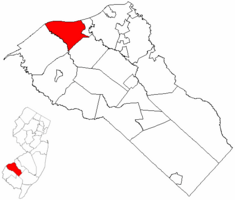
Greenwich Township highlighted in Gloucester County. Inset map: Gloucester County highlighted in the State of New Jersey.
|
|
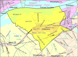
Census Bureau map of Greenwich Township, Gloucester County, New Jersey
|
|
| Country | |
| State | |
| County | |
| Formed | March 1, 1695 |
| Incorporated | February 21, 1798 |
| Named for | Greenwich, England |
| Government | |
| • Type | Faulkner Act (mayor–council) |
| • Body | Township Council |
| Area | |
| • Total | 12.03 sq mi (31.16 km2) |
| • Land | 8.96 sq mi (23.21 km2) |
| • Water | 3.07 sq mi (7.95 km2) 25.50% |
| Area rank | 193rd of 565 in state 13th of 24 in county |
| Elevation | 3 ft (0.9 m) |
| Population | |
| • Total | 4,899 |
| • Estimate
(2019)
|
4,795 |
| • Rank | 381st of 566 in state 16th of 24 in county |
| • Density | 546.2/sq mi (210.9/km2) |
| • Density rank | 438th of 566 in state 19th of 24 in county |
| Time zone | UTC−05:00 (Eastern (EST)) |
| • Summer (DST) | UTC−04:00 (Eastern (EDT)) |
| ZIP Code |
08027 - Gibbstown
|
| Area code(s) | 856 exchanges: 224, 423 |
| FIPS code | 3401528185 |
| GNIS feature ID | 0882142 |
| Website | |
Greenwich Township is a township in Gloucester County, New Jersey, United States. As of the 2010 United States Census, the township's population was 4,899, reflecting an increase of 20 (+0.4%) from the 4,879 counted in the 2000 Census, which had in turn declined by 223 (-4.4%) from the 5,102 counted in the 1990 Census.
Greenwich Township was first formed on March 1, 1695, and was formally incorporated as one of New Jersey's initial group of 104 townships by an act of the New Jersey Legislature on February 21, 1798. Over the centuries, portions of the township were taken to form Woolwich Township (March 7, 1767), Franklin Township (January 27, 1820), Spicer Township (March 13, 1844; now Harrison Township), Mantua Township (February 23, 1853), East Greenwich Township (February 10, 1881) and Paulsboro (March 2, 1904). The township was named for Greenwich, England.
Contents
Geography
According to the United States Census Bureau, the township had a total area of 12.032 square miles (31.164 km2), including 8.969 square miles (23.231 km2) of land and 3.063 square miles (7.934 km2) of water (25.46%).
Gibbstown (with a 2010 Census population of 3,739) is an unincorporated community and census-designated place (CDP) located within Greenwich Township.
Other unincorporated communities, localities and place names located partially or completely within the township include Clements, Green, Monds Island and Thompsons Point.
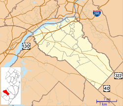
The township borders Paulsboro, East Greenwich Township, and Logan Township. Greenwich Township also borders the Delaware River.
Demographics
| Historical population | |||
|---|---|---|---|
| Census | Pop. | %± | |
| 1800 | 2,526 | — | |
| 1810 | 2,859 | 13.2% | |
| 1820 | 2,699 | −5.6% | |
| 1830 | 2,657 | −1.6% | |
| 1840 | 2,958 | 11.3% | |
| 1850 | 3,067 | 3.7% | |
| 1860 | 2,199 | −28.3% | |
| 1870 | 2,342 | 6.5% | |
| 1880 | 2,598 | 10.9% | |
| 1890 | 1,900 | −26.9% | |
| 1900 | 2,252 | 18.5% | |
| 1910 | 874 | −61.2% | |
| 1920 | 1,751 | 100.3% | |
| 1930 | 2,361 | 34.8% | |
| 1940 | 2,563 | 8.6% | |
| 1950 | 3,152 | 23.0% | |
| 1960 | 4,065 | 29.0% | |
| 1970 | 5,676 | 39.6% | |
| 1980 | 5,404 | −4.8% | |
| 1990 | 5,102 | −5.6% | |
| 2000 | 4,879 | −4.4% | |
| 2010 | 4,899 | 0.4% | |
| 2019 (est.) | 4,795 | −2.1% | |
| Population sources: 1800-2000 1800-1920 1840 1850-1870 1850 1870 1880-1890 1890-1910 1910-1930 1930-1990 2000 2010 * = Lost territory in previous decade. |
|||
Census 2010
As of the census of 2010, there were 4,899 people, 1,946 households, and 1,352 families residing in the township. The population density was 546.2 per square mile (210.9/km2). There were 2,048 housing units at an average density of 228.3 per square mile (88.1/km2)*. The racial makeup of the township was 93.22% (4,567) White, 4.00% (196) Black or African American, 0.06% (3) Native American, 0.76% (37) Asian, 0.00% (0) Pacific Islander, 0.41% (20) from other races, and 1.55% (76) from two or more races. [[Hispanic (U.S. Census)|Hispanic or Latino of any race were 2.35% (115) of the population.
There were 1,946 households out of which 25.8% had children under the age of 18 living with them, 53.3% were married couples living together, 11.6% had a female householder with no husband present, and 30.5% were non-families. 24.9% of all households were made up of individuals, and 13.3% had someone living alone who was 65 years of age or older. The average household size was 2.51 and the average family size was 3.01.
In the township, the population was spread out with 20.9% under the age of 18, 6.6% from 18 to 24, 24.8% from 25 to 44, 29.7% from 45 to 64, and 18.0% who were 65 years of age or older. The median age was 43.5 years. For every 100 females there were 95.7 males. For every 100 females ages 18 and old there were 92.2 males.
The Census Bureau's 2006-2010 American Community Survey showed that (in 2010 inflation-adjusted dollars) median household income was $63,817 (with a margin of error of +/- $7,652) and the median family income was $81,250 (+/- $14,406). Males had a median income of $47,927 (+/- $6,567) versus $41,750 (+/- $4,066) for females. The per capita income for the borough was $30,685 (+/- $3,226). About 8.1% of families and 8.9% of the population were below the poverty line, including 16.7% of those under age 18 and 5.9% of those age 65 or over.
Census 2000
As of the 2000 United States Census there were 4,879 people, 1,866 households, and 1,393 families residing in the township. The population density was 523.7 people per square mile (202.1/km2). There were 1,944 housing units at an average density of 208.7 per square mile (80.5/km2). The racial makeup of the township was 94.55% White, 3.32% African American, 0.10% Native American, 0.68% Asian, 0.02% Pacific Islander, 0.27% from other races, and 1.07% from two or more races. Hispanic or Latino of any race were 1.54% of the population.
There were 1,866 households, out of which 31.3% had children under the age of 18 living with them, 58.9% were married couples living together, 10.9% had a female householder with no husband present, and 25.3% were non-families. 22.1% of all households were made up of individuals, and 12.2% had someone living alone who was 65 years of age or older. The average household size was 2.61 and the average family size was 3.05.
In the township the population was spread out, with 22.8% under the age of 18, 7.4% from 18 to 24, 27.9% from 25 to 44, 23.9% from 45 to 64, and 18.1% who were 65 years of age or older. The median age was 40 years. For every 100 females, there were 95.4 males. For every 100 females age 18 and over, there were 92.0 males.
The median income for a household in the township was $53,651, and the median income for a family was $60,565. Males had a median income of $41,875 versus $31,627 for females. The per capita income for the township was $24,791. About 1.3% of families and 3.6% of the population were below the poverty line, including 3.9% of those under age 18 and 5.3% of those age 65 or over.
Transportation
Roads and highways
As of May 2010[update], the township had a total of 38.06 miles (61.25 km) of roadways, of which 23.72 miles (38.17 km) were maintained by the municipality, 8.96 miles (14.42 km) by Gloucester County and 5.38 miles (8.66 km) by the New Jersey Department of Transportation.
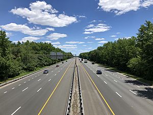
Only one state, U.S. and interstate passes through the township. State Route 44 passes through the center of the township while U.S. Route 130 and Interstate 295 (multiplexed together) pass near the southern center of town, with three interchanges: Exits 15, 16 and 17 (on the border with neighboring East Greenwich Township).
Public transportation
NJ Transit bus service is available between the township and Philadelphia on the 402 route.
The Port of Paulsboro includes marine transfer operations at PBF Energy's Paulsboro Refinery in Gibbstown and at Thompson Point, and is served by SMS Rail Lines for the rail spur to the refinery and the freight rail Penns Grove Secondary.
Points of interest
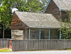
Nothnagle Log House is believed to be one of the oldest standing wooden structures built by European settlers in the Eastern United States. It is believed that it was built by early Finnish-Swedish settlers at some time after 1638 and before 1700, but its precise age has not been determined with scientific methods. A plaque at the house indicates that the structure was built between 1638–1643, while the National Register of Historic Places web site states: "Period of Significance: 1650-1699".
The one-room cabin is constructed of square-hewn logs with a low-beamed ceiling with a large corner fireplace in a rear corner.
Education
The Greenwich Township School District serves public school students in kindergarten through eighth grade. As of the 2018–19 school year, the district, comprised of two schools, had an enrollment of 408 students and 46.0 classroom teachers (on an FTE basis), for a student–teacher ratio of 8.9:1. Schools in the district (with 2018–19 enrollment data from the National Center for Education Statistics) are Broad Street Elementary School with 273 students in grades K-4 and Nehaunsey Middle School with 132 students in grades 5–8.
Public school students in ninth through twelfth grades attend Paulsboro High School in Paulsboro as part of a sending/receiving relationship with the Paulsboro Public Schools. As of the 2018–19 school year, the high school had an enrollment of 322 students and 31.1 classroom teachers (on an FTE basis), for a student–teacher ratio of 10.4:1.
Students from across the county are eligible to apply to attend Gloucester County Institute of Technology, a four-year high school in Deptford Township that provides technical and vocational education. As a public school, students do not pay tuition to attend the school.
Guardian Angels Regional School is a K-8 school that operates under the auspices of the Roman Catholic Diocese of Camden. Its PreK-3 campus is in Gibbstown while its 4-8 campus is in Paulsboro.
Notable people
People who were born in, residents of, or otherwise closely associated with Greenwich Township include:
- Stanley Druckenmiller (born 1953), hedge fund manager.
- Lewis Earle (born 1933), member of the Florida House of Representatives from 1968 to 1974.
- Sylvia Earle (born 1935), marine biologist.
- Alex Silvestro (born 1988), former football tight end / defensive end who played in the NFL for the Baltimore Ravens and New England Patriots.
See also
 In Spanish: Municipio de Greenwich (condado de Gloucester, Nueva Jersey) para niños


