
Lenawee County, Michigan facts for kids
Quick facts for kids
Lenawee County
|
|
|---|---|
.jpg)
|
|

Location within the U.S. state of Michigan
|
|
 Michigan's location within the U.S. |
|
| Country | |
| State | |
| Founded | 1822 (created) September 10, 1826 (organized) |
| Seat | Adrian |
| Largest city | Adrian |
| Area | |
| • Total | 761 sq mi (1,970 km2) |
| • Land | 750 sq mi (1,900 km2) |
| • Water | 12 sq mi (30 km2) 1.6%% |
| Population
(2020)
|
|
| • Total | 99,423 |
| • Density | 130/sq mi (51/km2) |
| Time zone | UTC−5 (Eastern) |
| • Summer (DST) | UTC−4 (EDT) |
| Congressional district | 7th |
Lenawee County ( len-UH-way) is a county located in the U.S. state of Michigan. As of the 2020 United States Census, the population was 99,423. The county seat is Adrian. The county was created in 1822, from territory partitioned from Monroe County. Its governing structure was organized in 1826.
Lenawee County comprises the Adrian, MI Micropolitan Statistical Area and is included in the Detroit-Warren-Ann Arbor, MI Combined Statistical Area. It is served by the Toledo Media market.
Lenawee County is home to the Potawatomi, Ottawa, Chippewa, Iroquois, Miami, Sauk, Fox, Mascoutens and Huron tribes.
Contents
History

The county was created in 1826. It was split off from Monroe County, Michigan. This Henry Schoolcraft neologism is thought to be derived from a Native American word meaning "man"—from the Delaware "leno or lenno" or the Shawnee "lenawai."
Geography
According to the U.S. Census Bureau, the county has a total area of 761 square miles (1,970 km2), of which 750 square miles (1,900 km2) is land and 12 square miles (31 km2) (1.6%) is water. Lenawee County is considered to be part of Southeastern Michigan.
Adjacent counties
- Washtenaw County (northeast)
- Jackson County (northwest)
- Monroe County (east)
- Hillsdale County (west)
- Lucas County, Ohio (southeast)
- Fulton County, Ohio (southwest)
Major highways
 I-73 (future)
 US 12
US 12 US 127
 US 223
 M-34
M-34 M-50
M-50 M-52
M-52- M-124
- M-156
Within Lenawee County's townships, north-south roads are referred to as "highways", while east-west roads are referred to as "roads".
Demographics
| Historical population | |||
|---|---|---|---|
| Census | Pop. | %± | |
| 1830 | 1,491 | — | |
| 1840 | 17,889 | 1,099.8% | |
| 1850 | 26,372 | 47.4% | |
| 1860 | 38,112 | 44.5% | |
| 1870 | 45,595 | 19.6% | |
| 1880 | 48,343 | 6.0% | |
| 1890 | 48,448 | 0.2% | |
| 1900 | 48,406 | −0.1% | |
| 1910 | 47,907 | −1.0% | |
| 1920 | 47,767 | −0.3% | |
| 1930 | 49,849 | 4.4% | |
| 1940 | 53,110 | 6.5% | |
| 1950 | 64,629 | 21.7% | |
| 1960 | 77,789 | 20.4% | |
| 1970 | 81,609 | 4.9% | |
| 1980 | 89,948 | 10.2% | |
| 1990 | 91,476 | 1.7% | |
| 2000 | 98,890 | 8.1% | |
| 2010 | 99,892 | 1.0% | |
| 2020 | 99,423 | −0.5% | |
| US Decennial Census 1790-1960 1900-1990 1990-2000 2010-2018 |
|||
As of the 2000 United States Census, there were 98,890 people, 35,930 households, and 26,049 families in the county. The population density was 132 people per square mile (51/km2). There were 39,769 housing units at an average density of 53 per square mile (20/km2). The racial makeup of the county was 92.51% White, 2.12% Black or African American, 0.41% Native American, 0.46% Asian, 0.01% Pacific Islander, 3.01% from other races, and 1.49% from two or more races. 6.96% of the population were Hispanic or Latino of any race. Residents identified as being 30.4% of German, 11.6% English, 10.2% American and 9.9% Irish ancestry. Some 94.7% spoke English and 4.2% Spanish as their first language.
There were 35,930 households, out of which 34.20% had children under the age of 18 living with them, 58.70% were married couples living together, 10.00% had a female householder with no husband present, and 27.50% were non-families. 22.90% of all households were made up of individuals, and 9.70% had someone living alone who was 65 years of age or older. The average household size was 2.61 and the average family size was 3.07.
The county population contained 25.90% under the age of 18, 9.10% from 18 to 24, 28.60% from 25 to 44, 23.70% from 45 to 64, and 12.70% who were 65 years of age or older. The median age was 36 years. For every 100 females there were 100.10 males. For every 100 females age 18 and over, there were 98.00 males.
The median income for a household in the county was $45,739, and the median income for a family was $53,661. Males had a median income of $38,458 versus $25,510 for females. The per capita income for the county was $20,186. About 4.40% of families and 6.70% of the population were below the poverty line, including 7.10% of those under age 18 and 9.20% of those age 65 or over.
Communities
Cities
Villages
- Addison
- Blissfield
- Britton
- Cement City (partially)
- Clayton
- Clinton
- Deerfield
- Onsted
Census-designated places
Unincorporated communities
Townships
- Adrian Charter Township
- Blissfield Township
- Cambridge Township
- Clinton Township
- Deerfield Township
- Dover Township
- Fairfield Township
- Franklin Township
- Hudson Township
- Macon Township
- Madison Charter Township
- Medina Township
- Ogden Township
- Palmyra Township
- Raisin Charter Township
- Ridgeway Township
- Riga Township
- Rollin Township
- Rome Township
- Seneca Township
- Tecumseh Township
- Woodstock Township
Images for kids
-
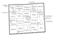
U.S. Census data map showing local municipal boundaries within Lenawee County. Shaded areas represent incorporated cities.

See also
 In Spanish: Condado de Lenawee para niños
