
List of Recorded Texas Historic Landmarks (Hunt-Martin) facts for kids
The following is a partial list of Recorded Texas Historic Landmarks (RTHLs) arranged by county as designated by the Texas Historical Commission and local county historical commissions in Texas. This page includes RTHLs in the following counties: Hunt, Hutchinson, Irion, Jack, Jackson, Jasper, Jeff Davis, Jefferson, Jim Hogg, Jim Wells, Johnson, Jones, Karnes, Kaufman, Kendall, Kenedy, Kent, Kerr, Kimble, King, Kinney, Kleberg, Knox, La Salle, Lamar, Lamb, Lampasas, Lavaca, Lee, Leon, Liberty, Limestone, Lipscomb, Live Oak, Llano, Loving, Lubbock, Lynn, Madison, Marion, and Martin.
| Anderson-Callahan • Cameron-Duval • Eastland-Gray • Grayson-Hudspeth • Hunt-Martin • Mason-Rusk • Sabine-Travis • Trinity-Zavala |
Contents
- Hunt County
- Hutchinson County
- Irion County
- Jack County
- Jackson County
- Jasper County
- Jeff Davis County
- Jefferson County
- Jim Hogg County
- Jim Wells County
- Johnson County
- Jones County
- Karnes County
- Kaufman County
- Kendall County
- Kenedy County
- Kent County
- Kerr County
- Kimble County
- King County
- Kinney County
- Kleberg County
- Knox County
- La Salle County
- Lamar County
- Lamb County
- Lampasas County
- Lavaca County
- Lee County
- Leon County
- Liberty County
- Limestone County
- Lipscomb County
- Live Oak County
- Llano County
- Loving County
- Lubbock County
- Lynn County
- Madison County
- Marion County
- Martin County
- See also
KEY
Landmarks with multiple historic designations are colored according to their highest designation within the following hierarchy.
| ⁕ Listed individually on the National Register of Historic Places (NRHP) as a National Historic Landmark |
| ⁂ Listed on the NRHP as a contributing property of a National Historic Landmark District |
| § Listed individually as or as part of a State Historic Site |
Hunt County
| Registered Texas Historic Landmark | Image | Marker number | Physical address | Nearest city | Year designated | Description |
|---|---|---|---|---|---|---|
| Bourland-Stevens-Samuell House | 7773 | 1916 Stonewall St.
33°8′37″N 96°6′27″W / 33.14361°N 96.10750°W |
Greenville | 1969 | ||
| Central Christian Church (Disciples of Christ) |
.jpg) |
7776 | 2611 Wesley St.
33°8′19″N 96°6′30″W / 33.13861°N 96.10833°W |
Greenville | 1989 | |
| Commerce Post Office | .jpg) |
7782 | 1210 Park St.
33°15′1″N 95°53′53″W / 33.25028°N 95.89806°W |
Commerce | 1991 | Commerce Public Library |
| Douglass School | .jpg) |
17939 | 1301 Morse St.
33°8′3″N 96°5′45″W / 33.13417°N 96.09583°W |
Greenville | 2014 | |
| Gen. Hal C. Horton Home | .jpg) |
7804 | 3925 Moulton St.
33°7′44″N 96°5′53″W / 33.12889°N 96.09806°W |
Greenville | 1969 | |
| Germany House | .jpg) |
12090 | 3403 Lee St.
33°8′23″N 96°6′53″W / 33.13972°N 96.11472°W |
Greenville | 1999 | |
| Hunt County Courthouse, 1929 |
 |
7823 | 2507 Lee St.
33°8′22″N 96°6′23″W / 33.13944°N 96.10639°W |
Greenville | 1994 | |
| Kavanaugh Methodist Church | .jpg) |
7809 | 2516 Park St.
33°7′53″N 96°6′26″W / 33.13139°N 96.10722°W |
Greenville | 1994 | |
| Lone Oak Methodist Church | 14123 | 218 Main St.
32°59′48″N 95°56′32″W / 32.99667°N 95.94222°W |
Lone Oak | 1988 | ||
| President's House |
.jpg) |
12091 | NW corner Stonewall St. at Campbell St.
33°14′33″N 95°54′18″W / 33.24250°N 95.90500°W |
Commerce | 1997 | Stonewall St., between Bryan and Bois D'Arc, Texas A&M University |
| W. R. J. Camp House |
 |
7774 | 2620 Church St.
33°8′34″N 96°6′27″W / 33.14278°N 96.10750°W |
Greenville | 1987 |
Hutchinson County
| Registered Texas Historic Landmark | Image | Marker number | Physical address | Nearest city | Year designated | Description |
|---|---|---|---|---|---|---|
| Ace Borger Home | 77 | 829 N. Hedgecoke St.
35°40′31″N 101°23′33″W / 35.67528°N 101.39250°W |
Borger | 1976 | 829 N. Hedgecoke, Borger | |
| East Ward Elementary School | 16744 | 200 E. 9th St.
35°40′33″N 101°23′18″W / 35.67583°N 101.38833°W |
Borger | 2011 | Northeast corner of Ninth and Harvey Streets | |
| Girl Scout Little House | 15271 | 119 N. McGee St.
35°39′59″N 101°23′41″W / 35.66639°N 101.39472°W |
Borger | 2008 | 119 N. McGee | |
| Holt School | 2515 | NW corner FM 281 at CR 22
36°1′24″N 101°13′51″W / 36.02333°N 101.23083°W |
Stinnett | 1989 | 16 mi. NE of stinnett on SH 207, then 5.9 mi. E on FM 281 | |
| Hutchinson County Courthouse |
2602 | 500 Main St.
35°49′39″N 101°26′32″W / 35.82750°N 101.44222°W |
Stinnett | 1995 | S.H. 207, Courthouse Square, Stinnett | |
| Isaac McCormick Cottage, "Birthplace of Hutchinson County" | 2 | N side 100 blk E. 5th St.
35°49′42″N 101°26′32″W / 35.82833°N 101.44222°W |
Stinnett | 1967 | North side of Courthouse Square, SH 207 - Stinnett | |
| Plemons Bridge | 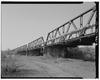 |
15709 | Plemons Rd. over Canadian River
35°44′51″N 101°20′49″W / 35.74750°N 101.34694°W |
Borger | 2009 |
Irion County
| Registered Texas Historic Landmark | Image | Marker number | Physical address | Nearest city | Year designated | Description |
|---|---|---|---|---|---|---|
| Barnhart Cowboy Church |  |
258 | SE corner 5th St. and Draper St.
31°7′44″N 101°10′27″W / 31.12889°N 101.17417°W |
Barnhart | 1981 | corner of 5th St. and Draper |
| Mertzon Central School | 3169 | 302 N. 3rd St.
31°15′36″N 100°49′24″W / 31.26000°N 100.82333°W |
Mertzon | 1962 | corner of Juanita and Third; marker is inside the school library |
Jack County
| Registered Texas Historic Landmark | Image | Marker number | Physical address | Nearest city | Year designated | Description |
|---|---|---|---|---|---|---|
| First Methodist Church, Jermyn, Texas | .jpg) |
1778 | First St. at S. Wise St.
33°15′36″N 98°23′31″W / 33.26000°N 98.39194°W |
Jermyn | 1968 | Corner of S. Wise and 1st streets |
| First National Bank |  |
1600 | 101 N. Main St.
33°13′7″N 98°9′33″W / 33.21861°N 98.15917°W |
Jacksboro | 1969 | US 281 at US 380, west side of courthouse square |
| Former Gulf, Texas & Western Railroad Depot |  |
1947 | 302 S. Main St.
33°12′55″N 98°9′33″W / 33.21528°N 98.15917°W |
Jacksboro | 1968 | |
| Fort Richardson Cavalry Post Hospital, 1867⁕ |
 |
2010 | W side of parade ground at Ft. Richardson
33°12′27″N 98°9′52″W / 33.20750°N 98.16444°W |
Jacksboro | 1965 | Fort Richardson State Historical Park |
| Fort Richardson Hotel |  |
2011 | 101 S. Main St.
33°13′5″N 98°9′33″W / 33.21806°N 98.15917°W |
Jacksboro | 1967 | US 281 and US 380, southwest corner of courthouse square |
| Jacksboro's First Railroad Depot | .jpg) |
2700 | S end of Depot St. at Ft. Richardson park boundary
33°12′29″N 98°9′40″W / 33.20806°N 98.16111°W |
Jacksboro | 1974 | at end of Depot Street, at east gate of Fort Richardson State Historical Park |
| Officers' Quarters⁕ |
.jpg) |
3674 | S side of parade ground at Ft. Richardson
33°12′23″N 98°9′44″W / 33.20639°N 98.16222°W |
Jacksboro | 1964 | Fort Richardson State Historical Park |
| Old Hess Building | .jpg) |
3743 | 102 N. Church St.
33°13′6″N 98°9′26″W / 33.21833°N 98.15722°W |
Jacksboro | 1967 | southeast corner of the square |
Jackson County
| Registered Texas Historic Landmark | Image | Marker number | Physical address | Nearest city | Year designated | Description |
|---|---|---|---|---|---|---|
| Branch and Bonnot House | 488 | CR 440 E of SH 172
28°53′22″N 96°27′54″W / 28.88944°N 96.46500°W |
Edna | 1965 | from Edna, take SH 111 East about 9 miles, then go south on FM 172 about 3.75 mile go E on gravel road CR 440 (first house on W side of street) | |
| Dr. Bronaugh-Hasdorff Home | 1263 | 203 E. Brackenridge St.
28°58′36″N 96°38′33″W / 28.97667°N 96.64250°W |
Edna | 1967 | 203 E Breckenridge St., Edna | |
| Dutart-McDowell Home | 1307 | 403 N. Wells St.
28°58′49″N 96°38′55″W / 28.98028°N 96.64861°W |
Edna | 1967 | Texana Museum, 403 Wells St., Edna | |
| George F. Horton Home | 2151 | 404 Hanover St.
28°58′27″N 96°38′42″W / 28.97417°N 96.64500°W |
Edna | 1966 | 404 Hanover St., Edna | |
| Killough Home | 2940 | 403 N. Wells St.
28°58′49″N 96°38′55″W / 28.98028°N 96.64861°W |
Edna | 1966 | 403 Wells St., Texana Museum, Edna | |
| La Bauve-Young-Payne Home |  |
2992 | 112 E. Brackenridge St.
28°58′36″N 96°38′36″W / 28.97667°N 96.64333°W |
Edna | 1967 | 112 E. Brackenridge St., Edna |
| Meriwether-Simons-Farquhar House | 3345 | 801 S. Allen St.
28°58′10″N 96°38′31″W / 28.96944°N 96.64194°W |
Edna | 1968 | 801 S. Allen ST., Edna | |
| Old J. C. Traylor Place | 2670 | 403 N. Wells St.
28°58′49″N 96°38′55″W / 28.98028°N 96.64861°W |
Edna | 1964 | Texana Museum, 403 Wells St. | |
| Old Morales Store | 3770 | 10191 SH 111
29°6′28″N 96°44′45″W / 29.10778°N 96.74583°W |
Morales | 1967 | Hwy. 111, 1 mile S of Morales | |
| Texana Presbyterian Church |
 |
5238 | Brackenridge Pkwy., Brackenridge Recreation Complex at Lake Texana
28°56′36″N 96°32′20″W / 28.94333°N 96.53889°W |
Edna | 1981 | FM 1822/510, S. Apollo Dr., Edna (near SE city limits) |
| Ward-Coates Home | 5717 | 6 mi. S on SH 172
28°45′5″N 96°27′11″W / 28.75139°N 96.45306°W |
La Ward | 1965 | From La Ward, take US 172 S. about 6 miles, then go E over cattle guard about .3 miles - house is visible from road. |
Jasper County
| Registered Texas Historic Landmark | Image | Marker number | Physical address | Nearest city | Year designated | Description |
|---|---|---|---|---|---|---|
| Andrew F. Smyth Home |
.jpg) |
10464 | 0.9 mi. N of FM 2799 on CR 101
30°56′7″N 94°8′39″W / 30.93528°N 94.14417°W |
Jasper | 1965 | 8 mi. W Jasper SH63 to FM 1747 to Bevilport Rd. Turn at first road. .9 mi to "Smyth's Landing" |
| Beaty-Orton House |
.jpg) |
10433 | 206 S. Main St.
30°55′8″N 93°59′58″W / 30.91889°N 93.99944°W |
Jasper | 1976 | |
| Belle-Jim Hotel |  |
11941 | 160 N. Austin St.
30°55′18″N 93°59′57″W / 30.92167°N 93.99917°W |
Jasper | 1999 | |
| Bridges House |
10436 | 1 mi. N of FM 2254 on CR 434
30°48′17″N 93°54′51″W / 30.80472°N 93.91417°W |
Roganville | 1966 | take FM 2254 W to Rockhill Rd. N about 1 mi. | |
| Hardy Pace Home | 10461 | 1965 | ||||
| R. C. Doom House |
10441 | 7602 FM 2799
30°55′25″N 94°7′27″W / 30.92361°N 94.12417°W |
Jasper | 1965 | on FM 2799 about 9 mi. W of Jasper near junction of FM 2799 and FM 1747 | |
| Waggoner-Scarborough Home | 10466 | 731 N. Main St.
30°55′39″N 94°0′4″W / 30.92750°N 94.00111°W |
Jasper | 1986 |
Jeff Davis County
| Registered Texas Historic Landmark | Image | Marker number | Physical address | Nearest city | Year designated | Description |
|---|---|---|---|---|---|---|
| First Rural School West of Pecos River |  |
10477 | SH 118 11 mi. SE of Fort Davis
30°31′12″N 103°46′8″W / 30.52000°N 103.76889°W |
Fort Davis | 1967 | take SH 118 SE approx. 11 miles to ROW |
| Fort Davis United Methodist Church | 17051 | 200 S. Front St.
30°35′16″N 103°53′45″W / 30.58778°N 103.89583°W |
Fort Davis | 1962 | Front Street & Woodward Ave. | |
| Grierson-Sproul House |
 |
18381 | 901 Court Ave.
30°35′26″N 103°54′17″W / 30.59056°N 103.90472°W |
Fort Davis | 2016 | |
| Jeff Davis County Courthouse |
 |
12368 | 100 Court Ave.
30°35′18″N 103°53′42″W / 30.58833°N 103.89500°W |
Fort Davis | 2000 | at the intersection of SH 17 and SH 118 in Fort Davis |
| Jeff Davis County Jail |  |
16485 | 100 Woodward Ave.
30°35′17″N 103°53′42″W / 30.58806°N 103.89500°W |
Fort Davis | 2010 | Fort Davis, 100 West Woodward Avenue |
| Smith-Carlton Adobe House | 17533 | 940 S. Front St.
30°34′37″N 103°53′47″W / 30.57694°N 103.89639°W |
Fort Davis | 2013 | ||
| Trueheart, Henry M. and Annie V., House |
 |
10488 | 804 Court Ave.
30°35′20″N 103°54′8″W / 30.58889°N 103.90222°W |
Fort Davis | 1964 | 4 blocks S of Courthouse Square; corner of 7th and Court St. |
| Union Mercantile |  |
10489 | 100 Memorial Sq.
30°35′20″N 103°53′37″W / 30.58889°N 103.89361°W |
Fort Davis | 1965 | N of the Courthouse Square |
Jefferson County
| Registered Texas Historic Landmark | Image | Marker number | Physical address | Nearest city | Year designated | Description |
|---|---|---|---|---|---|---|
| Boudreaux House | 14513 | 10714 E. Clubb Rd.
29°56′11″N 94°14′56″W / 29.93639°N 94.24889°W |
Fannett | 1966 | .5 mi. E of SH 124 on Broussard Cemetery Rd., S of Fannett | |
| Caroline Gilbert Hinchee House |
 |
10534 | 1814 Park St.
30°4′12″N 94°5′38″W / 30.07000°N 94.09389°W |
Beaumont | 1982 | |
| Central Fire Station |  |
10498 | 400 Walnut St.
30°5′10″N 94°5′55″W / 30.08611°N 94.09861°W |
Beaumont | 1983 | |
| Clubhouse of the Federated Women's Clubs of Port Arthur |
 |
10515 | 1924 Lakeshore Dr.
29°52′54″N 93°55′22″W / 29.88167°N 93.92278°W |
Port Arthur | 1982 | |
| David Crockett Middle School (RAZED) | 10505 | 1400 Royal St.
30°4′9″N 94°6′5″W / 30.06917°N 94.10139°W |
Beaumont | 1984 | Building razed 1996. | |
| Dugat-Hamshire House | 10510 | 11916 Dugat Rd.
29°54′51″N 94°15′17″W / 29.91417°N 94.25472°W |
Fannett | 1974 | off SH 124, 12 mi. SW of Beaumont in Fannett | |
| Ellwood-Craig House |
 |
10512 | 1953 Lakeshore Dr.
29°52′59″N 93°55′22″W / 29.88306°N 93.92278°W |
Port Arthur | 1973 | |
| First National Bank Building |
 |
10521 | 495 Orleans St.
30°4′59″N 94°5′57″W / 30.08306°N 94.09917°W |
Beaumont | 1989 | |
| French Trading Post |
 |
10527 | 2995 French Rd.
30°6′36″N 94°8′35″W / 30.11000°N 94.14306°W |
Beaumont | 1970 | |
| Fuller, Ruby Ruth, Building | 15944 | 300 Stilwell Blvd.Blvd.
29°52′45″N 93°55′35″W / 29.87917°N 93.92639°W |
Port Arthur | 2009 | ||
| Gates Memorial Library |
 |
10530 | 317 Stilwell Blvd.
29°52′42″N 93°55′38″W / 29.87833°N 93.92722°W |
Port Arthur | 1981 | |
| Hamshire House | 10533 | E. Hamshire Rd. E of Gallier Rd.
29°51′33″N 94°17′16″W / 29.85917°N 94.28778°W |
Hamshire | 1966 | ||
| Hebert Home | 14837 | Beaumont | 1965 | |||
| Holmes Duke House |
 |
10511 | 694 Forrest St.
30°5′15″N 94°6′18″W / 30.08750°N 94.10500°W |
Beaumont | 1986 | |
| Jefferson Theatre |
 |
10537 | 345 Fannin St.
30°4′54″N 94°5′52″W / 30.08167°N 94.09778°W |
Beaumont | 1978 | |
| McFaddin-Ward House |
 |
10542 | 1906 McFaddin Ave.
30°5′14″N 94°6′56″W / 30.08722°N 94.11556°W |
Beaumont | 1976 | |
| Mildred Buildings |
 |
11946 | 1415, 1425-95 Calder Ave.
30°5′8″N 94°6′36″W / 30.08556°N 94.11000°W |
Beaumont | 1999 | |
| Morris-Booz-White House | 10545 | 2545 Lakeshore Dr.Blvd.
29°53′14″N 93°55′5″W / 29.88722°N 93.91806°W |
Port Arthur | 1988 | ||
| Pivoto-Robinson House | 10552 | FM 1009 E of Bonner Rd.
30°1′21″N 94°25′48″W / 30.02250°N 94.43000°W |
Nome | 1981 | off US 1009, .7 mi. south of US 90 in Nome | |
| Saint Anthony's Cathedral |  |
10560 | 700 Jefferson St.
30°4′40″N 94°6′3″W / 30.07778°N 94.10083°W |
Beaumont | 1980 | |
| Sanders House |
 |
10561 | 479 Pine St.
30°5′10″N 94°5′53″W / 30.08611°N 94.09806°W |
Beaumont | 1982 | |
| South County Office Building |  |
10565 | 525 Lakeshore Dr.
29°52′14″N 93°55′58″W / 29.87056°N 93.93278°W |
Port Arthur | 1989 | |
| Texas' First Rice Mill |  |
10576 | 1800 Pecos St.
30°4′53″N 94°6′48″W / 30.08139°N 94.11333°W |
Beaumont | 1968 | |
| Tyrrell Public Library |
 |
10578 | 695 Pearl St.
30°4′56″N 94°5′48″W / 30.08222°N 94.09667°W |
Beaumont | 1976 | |
| Vuylstekke House | 10579 | 1831 Lakeshore Dr.
29°52′54″N 93°55′28″W / 29.88167°N 93.92444°W |
Port Arthur | 1996 | ||
| Woodworth House (Rose Hill) |
 |
10582 | 100 Woodworth Blvd.
29°53′24″N 93°54′54″W / 29.89000°N 93.91500°W |
Port Arthur | 1978 | |
| Woodworth House (Rose Hill) |
10583 | 100 Woodworth Blvd.
29°53′24″N 93°54′54″W / 29.89000°N 93.91500°W |
Port Arthur | 1978 |
Jim Hogg County
| Registered Texas Historic Landmark | Image | Marker number | Physical address | Nearest city | Year designated | Description |
|---|---|---|---|---|---|---|
| Hotel Viggo |  |
2576 | 205 N. Smith Ave.
27°18′29″N 98°40′43″W / 27.30806°N 98.67861°W |
Hebbronville | 1983 | 205 N. Smith Street (SH 16), Hebbronville |
| New York Store | 16538 | 308 E. Galbraith St.
27°18′24″N 98°40′32″W / 27.30667°N 98.67556°W |
Hebbronville | 2010 | on 306 E. Galbraith St. off Texas Hwy 359 and east of Hwy 16; downtown Hebbronville facing south in the middle of the street | |
| Old Garza Home | 6054 | 602 E. Santa Clara St.
27°18′30″N 98°40′20″W / 27.30833°N 98.67222°W |
Hebbronville | 1962 | 602 E. Santa Clara Street, Hebbronville | |
| Randado Catholic Church | 4183 | County road 0.5 mi. N of SH 16 just E of FM 649
27°4′51″N 98°52′44″W / 27.08083°N 98.87889°W |
Hebbronville | 1962 | from Hebbronville, take SH 16 about 22 miles south to town of Randada - go north about .5 mile on county road to church, Randado |
Jim Wells County
| Registered Texas Historic Landmark | Image | Marker number | Physical address | Nearest city | Year designated | Description |
|---|---|---|---|---|---|---|
| McGill Brothers Building |  |
3294 | 66 S. Wright St.
27°44′58″N 98°4′27″W / 27.74944°N 98.07417°W |
Alice | 1994 | 66 South Wright Street, Alice |
Johnson County
| Registered Texas Historic Landmark | Image | Marker number | Physical address | Nearest city | Year designated | Description |
|---|---|---|---|---|---|---|
| Carnegie Library Building |
 |
731 | 201 N. Caddo St.
32°20′54″N 97°23′11″W / 32.34833°N 97.38639°W |
Cleburne | 1981 | 201 North Caddo Street, Cleburne |
| Church of the Holy Comforter | .jpg) |
860 | 209 E. Wardville St.
32°20′56″N 97°23′6″W / 32.34889°N 97.38500°W |
Cleburne | 1970 | 209 East Wardville, Cleburne |
| Emory Home | .jpg) |
1481 | 300 College St.
32°15′57″N 97°10′29″W / 32.26583°N 97.17472°W |
Grandview | 1986 | 700 East College, Grandview |
| First Methodist Church | .jpg) |
1741 | 301 S. Spears St.
32°24′18″N 97°12′44″W / 32.40500°N 97.21222°W |
Alvarado | 1965 | 301 South Spear Street, Alvarado |
| Godley School |  |
16441 | 309 N. Pearson St.
32°27′13″N 97°31′52″W / 32.45361°N 97.53111°W |
Godley | 2010 | 309 N. Pearson |
| Henry Briden Cabin | .jpg) |
2443 | 301 S. SH 174
32°14′6″N 97°22′46″W / 32.23500°N 97.37944°W |
Rio Vista | 1975 | First State Bank grounds, Highway 174, Rio Vista |
| John L. and Annie Upshaw Cleveland House | .jpg) |
12864 | 808 S. Anglin St.
32°20′28″N 97°23′0″W / 32.34111°N 97.38333°W |
Cleburne | 2002 | 808 S. Anglin St |
| Johnson County Courthouse |
.jpg) |
2831 | 2 Main St.
32°20′50″N 97°23′10″W / 32.34722°N 97.38611°W |
Cleburne | 1999 | Courthouse Square, Highway 174–171, Cleburne |
| Johnson County Feeders Supply | .jpg) |
18013 | 302 S. Caddo St.
32°20′43″N 97°23′8″W / 32.34528°N 97.38556°W |
Cleburne | 2014 | southwest corner of S. Caddo and Harrell streets |
| Joiner-Long House |
 |
12890 | 604 Prairie Ave.
32°20′23″N 97°23′29″W / 32.33972°N 97.39139°W |
Cleburne | 2002 | 604 Prairie Avenue |
| Little Old House | .jpg) |
3099 | 409 N. Buffalo St.
32°20′56″N 97°23′25″W / 32.34889°N 97.39028°W |
Cleburne | 1965 | 409 North Buffalo Street, Cleburne |
| Lowell Smith Home |
 |
3077 | 1500 FM 916
32°14′20″N 97°21′27″W / 32.23889°N 97.35750°W |
Rio Vista | 1965 | from Rio Vista, take FM 916 west 1 mile;
private property |
| Meredith Hart House |
3344 | 0.5 mi. E on FM 916
32°14′21″N 97°21′29″W / 32.23917°N 97.35806°W |
Rio Vista | 1965 | Private
from Rio Vista, take FM 916 .5 mile east |
|
| Mizpah Gate | .jpg) |
15977 | 100 W. Hillcrest St.
32°23′47″N 97°19′36″W / 32.39639°N 97.32667°W |
Keene | 2009 | in front of 100 W. Hillcrest |
| Renfro-Clark House | .jpg) |
4244 | 128 N. Clark St.
32°32′40″N 97°19′3″W / 32.54444°N 97.31750°W |
Burleson | 1970 | 128 North Clark Street, Burleson |
| Riggs Pennington Home | 3983 | E side SH 171 on S edge of town
32°19′23″N 97°22′36″W / 32.32306°N 97.37667°W |
Cleburne | 1965 | Highway 171, Hillsboro Highway, at Cleburne City Limits (east side of street) | |
| Yellow Jacket Stadium | .jpg) |
16542 | 1201 W. Henderson St.
32°20′30″N 97°24′4″W / 32.34167°N 97.40111°W |
Cleburne | 2010 | South side of West Henderson Street - approximately 2 miles from the Johnson County Courthouse |
Jones County
| Registered Texas Historic Landmark | Image | Marker number | Physical address | Nearest city | Year designated | Description |
|---|---|---|---|---|---|---|
| Anson Opera House |  |
173 | 1120 11th St.
32°45′26″N 99°53′50″W / 32.75722°N 99.89722°W |
Anson | 1963 | 1120, 11th St., Anson |
| Avoca Methodist Church | 252 | Howard St. at CR 604
32°51′58″N 99°42′56″W / 32.86611°N 99.71556°W |
Avoca | 1981 | Howard Street | |
| First Baptist Church |
 |
15310 | 214 N. Swenson St.
32°56′50″N 99°48′8″W / 32.94722°N 99.80222°W |
Stamford | 1989 | |
| First Presbyterian Church Building | 1826 | 1300 Ave. K
32°45′26″N 99°53′50″W / 32.75722°N 99.89722°W |
Anson | 1990 | ||
| First United Methodist Church of Anson |  |
1880 | 832 Commercial Ave.
32°45′33″N 99°53′50″W / 32.75917°N 99.89722°W |
Anson | 1982 | |
| Jones County Courthouse |
 |
12415 | 1100 12th St.
32°45′23″N 99°53′47″W / 32.75639°N 99.89639°W |
Anson | 2000 | 11th St. and Commercial (US 277/83), Anson |
| St. John's Methodist Church |
 |
5046 | 200 S. Ferguson St.
32°56′38″N 99°47′59″W / 32.94389°N 99.79972°W |
Stamford | 1964 | Corner of Hamilton and Ferguson streets |
| Swenson Ranch Commissary | 11984 | 201 S. Swenson St.
32°56′37″N 99°48′16″W / 32.94361°N 99.80444°W |
Stamford | 1999 |
Karnes County
| Registered Texas Historic Landmark | Image | Marker number | Physical address | Nearest city | Year designated | Description |
|---|---|---|---|---|---|---|
| First Presbyterian Church | 1815 | 405 E. Mayfield St.
28°53′17″N 97°53′51″W / 28.88806°N 97.89750°W |
Karnes City | 1970 | 405 E. Mayfield, Karnes City | |
| First Store in Panna Maria |
2016-3.jpg) |
1874 | 13870 FM 81
28°57′27″N 97°53′56″W / 28.95750°N 97.89889°W |
Panna Maria | 1966 | FM 81, Panna Maria |
| Immaculate Conception Church |
2016-4.jpg) |
2619 | SW corner FM 81 at CR 382
28°57′26″N 97°53′53″W / 28.95722°N 97.89806°W |
Panna Maria | 1966 | FM 81, Panna Maria |
| John Gawlik House |
17888 | NE corner CR 381 at CR 242
28°57′30″N 97°54′1″W / 28.95833°N 97.90028°W |
Panna Maria | 2014 | Northeast Corner of CR 381 and CR 242 in Panna Maria. | |
| Old Helena Courthouse | .jpg) |
3742 | FM 81 at W. CR 302
28°57′1″N 97°49′14″W / 28.95028°N 97.82056°W |
Helena | 1962 | Old Courthouse Square, FM 81, Helena |
| Ox-Cart Road (Section of Chihuahua Road) | 3892 | FM 81 at W. CR 302
28°57′3″N 97°49′14″W / 28.95083°N 97.82056°W |
Helena | 1967 | Old courthouse Square, FM 81, Helena | |
| Pilarczyk Store |
2016-2.jpg) |
4016 | 13879 FM 81
28°57′28″N 97°53′55″W / 28.95778°N 97.89861°W |
Panna Maria | 1968 | FM 81, Panna Maria |
| Saint Joseph's School |
2016-2.jpg) |
4459 | CR 382 SE of FM 81
28°57′26″N 97°53′50″W / 28.95722°N 97.89722°W |
Panna Maria | 1990 | FM 81, Panna Maria |
| Saint Joseph's School |
2016-3.jpg) |
14815 | CR 382 SE of FM 81
28°57′26″N 97°53′50″W / 28.95722°N 97.89722°W |
Panna Maria | 1966 | |
| Saint Matthew's Episcopal Church | 4472 | 309 S. Fifth St.
28°48′56″N 97°51′4″W / 28.81556°N 97.85111°W |
Kenedy | 1986 | 309 S. 5th Street, Kenedy |
Kaufman County
| Registered Texas Historic Landmark | Image | Marker number | Physical address | Nearest city | Year designated | Description |
|---|---|---|---|---|---|---|
| Carnegie Library Building |
 |
9425 | 207 N. Frances St.
32°44′17″N 96°16′42″W / 32.73806°N 96.27833°W |
Terrell | 1983 | |
| Cartwright House |
 |
9424 | 505 Griffith Ave.
32°44′44″N 96°17′4″W / 32.74556°N 96.28444°W |
Terrell | 1968 | |
| Church of Our Merciful Saviour | .jpg) |
8500 | 500 S. Jackson St.
32°35′11″N 96°18′37″W / 32.58639°N 96.31028°W |
Kaufman | 1967 | 500 block of S. Jackson St., Kaufman |
| Church of the Good Shepherd |  |
8499 | 200 W. College St.
32°44′23″N 96°16′41″W / 32.73972°N 96.27806°W |
Terrell | 1967 | 200 W. College (corner of College and Frances Sts.), Terrell |
| Covenant United Presbyterian Church | .jpg) |
8504 | 400 E. Mulberry St.
32°35′20″N 96°18′23″W / 32.58889°N 96.30639°W |
Kaufman | 1971 | 400 E. Mulberry St., Kaufman |
| Dick P. Moore House | .jpg) |
8536 | 306 S. Bois d'Arc St.
32°44′51″N 96°28′23″W / 32.74750°N 96.47306°W |
Forney | 1985 | 306 S. Bois d'Arc St., Forney |
| Dr. L. E. Griffith Home |  |
8524 | 805 First St.
32°44′36″N 96°16′58″W / 32.74333°N 96.28278°W |
Terrell | 1962 | 805 First St., Terrell |
| Duncan and Emma McKellar House | .jpg) |
16928 | 306 S. Center St.
32°44′43″N 96°28′18″W / 32.74528°N 96.47167°W |
Forney | 2011 | Forney, 306 S. Center St. |
| Forney High School Building |  |
8518 | 600 S. Bois d'Arc St.
32°44′39″N 96°28′36″W / 32.74417°N 96.47667°W |
Forney | 1994 | 600 S. Bois d'Arc St., Forney |
| Greenslade Drug Store |  |
8523 | 111 W. Mulberry St.
32°35′20″N 96°18′35″W / 32.58889°N 96.30972°W |
Kaufman | 1968 | 111 W. Mulberry St. on public square, Kaufman |
| Griffith House |  |
18851 | 801 First St.
32°44′33″N 96°17′1″W / 32.74250°N 96.28361°W |
Terrell | 2017 | At the corner of First and Johnson Streets, North, 30 Degrees West of the center of the intersection of those streets in Terrell. |
| Huff-Park House | .jpg) |
8527 | 201 Wykagyl St.
32°35′25″N 96°18′49″W / 32.59028°N 96.31361°W |
Kaufman | 1971 | 201 N. Wykagyl, Kaufman |
| John H. Corley Home |  |
8501 | 720 Griffith Ave.
32°44′57″N 96°17′15″W / 32.74917°N 96.28750°W |
Terrell | 1968 | 720 Griffith Ave., Terrell |
| McKellar House | 8534 | 303 S. Center St.
32°44′40″N 96°28′17″W / 32.74444°N 96.47139°W |
Forney | 1989 | 303 S. Center St., Forney | |
| R. L. Warren House |
 |
8560 | 705 Griffith Ave.
32°44′51″N 96°17′12″W / 32.74750°N 96.28667°W |
Terrell | 1973 | 705 Griffith Avenue, Terrell |
| Robert A. Terrell Home |  |
8554 | Bowser Cir., Southwestern Christian College
32°44′6″N 96°17′5″W / 32.73500°N 96.28472°W |
Terrell | 1962 | on campus of Southwestern Christian College on Bowser St., enter off US 80/Moore Ave., Terrell |
| Terrell Elementary School |  |
8555 | 700 N. Catherine St.
32°44′39″N 96°16′32″W / 32.74417°N 96.27556°W |
Terrell | 1997 | 700 N. Catherine St., Terrell |
| Texas & Pacific Railroad Freight Depot |  |
8559 | 200 S. Virginia St.
32°44′7″N 96°16′32″W / 32.73528°N 96.27556°W |
Terrell | 1996 | 200 S. Virginia St., Terrell |
| Victorian Residence, 1883 (Cartwright House) |
 |
15332 | 505 Griffith Ave.
32°44′44″N 96°17′4″W / 32.74556°N 96.28444°W |
Terrell | 1968 | |
| W. E. Henderson Home | 8525 | 26239 FM 429
32°47′26″N 96°11′24″W / 32.79056°N 96.19000°W |
Terrell | 1970 | from the intersection of US 80 and FM 429 on the eastern edge of Terrell, take FM 429 NE about 5 1/2 miles to home on W side of road | |
| Walter P. and Meck Allen House |  |
13855 | 611 Griffith Ave.
32°44′50″N 96°17′11″W / 32.74722°N 96.28639°W |
Terrell | 2004 | |
| William and Blanche Brooks House |
 |
11986 | 500 S. Center St.
32°44′34″N 96°28′24″W / 32.74278°N 96.47333°W |
Forney | 1997 |
Kendall County
| Registered Texas Historic Landmark | Image | Marker number | Physical address | Nearest city | Year designated | Description |
|---|---|---|---|---|---|---|
| 1860 Temporary Headquarters of Gen. Robert E. Lee | 2016-1.jpg) |
23 | N side E. Evergreen St. E of S. Main St.
29°47′18″N 98°43′43″W / 29.78833°N 98.72861°W |
Boerne | 1963 | Main and Evergreen Street, Boerne |
| 1907 Comfort State Bank Building |
2016-2.jpg) |
29 | NW corner High St. and Seventh St.
29°58′2″N 98°54′29″W / 29.96722°N 98.90806°W |
Comfort | 1988 | Corner 7th and High Streets, Comfort |
| Arno Schwethelm Building |
.jpg) |
208 | 701 High St.
29°58′0″N 98°54′29″W / 29.96667°N 98.90806°W |
Comfort | 1981 | 7th and High Streets, Comfort |
| August Ebers House | 236 | W of Old Hwy. 9 S of Gillespie County line
30°8′10″N 98°49′6″W / 30.13611°N 98.81833°W |
Fredericksburg | 1983 | from Comfort take Old State Road 9 fourteen miles to house in Bankersmith | |
| August Faltin Building |
2016-3.jpg) |
237 | NW corner Main St. and Seventh St.
29°57′57″N 98°54′32″W / 29.96583°N 98.90889°W |
Comfort | 1982 | Main and Seventh, Comfort |
| Beseler House | 383 | 518 N. Main St.
29°47′53″N 98°44′3″W / 29.79806°N 98.73417°W |
Boerne | 1985 | ||
| Comfort Community Church |
998 | 318 High St.
29°58′13″N 98°54′48″W / 29.97028°N 98.91333°W |
Comfort | 1986 | High Street, between 2nd and 3rd, Comfort | |
| Comfort Post Office |
 |
1000 | 715 High St.
29°58′0″N 98°54′27″W / 29.96667°N 98.90750°W |
Comfort | 1986 | |
| Comfort School |
17739 | 232 High St.
29°58′15″N 98°54′53″W / 29.97083°N 98.91472°W |
Comfort | 2013 | NW corner of 3rd and High Streets | |
| Fabra Smokehouse | 2016-3.jpg) |
1546 | 202 S. Main St.
29°47′33″N 98°43′55″W / 29.79250°N 98.73194°W |
Boerne | 1980 | smokehouse on S side of 194 Main Street building - Boerne |
| Faltin Homestead |
.jpg) |
1564 | 430 Seventh St.
29°57′58″N 98°54′32″W / 29.96611°N 98.90889°W |
Comfort | 1962 | Main and Seventh Street, Comfort |
| Hanisch House | 2361 | Fourth St. N of Cypress Creek | Comfort | 1965 | SH 27 and Cypress Creek, Comfort | |
| Henry J. Graham Building | .jpg) |
2449 | 402 E. Blanco Rd.
29°47′47″N 98°43′49″W / 29.79639°N 98.73028°W |
Boerne | 1986 | on W side of city hall |
| Hygieostatic Bat Roost |
 |
2608 | 400 ft. S of FM 473 1.5 mi. E of town
29°58′13″N 98°53′5″W / 29.97028°N 98.88472°W |
Comfort | 1981 | from Comfort take FM 473 about 1.5 miles E - bat roost is about 400 feet S of the highway |
| Idlewilde Lodge | 2615 | 115 FM 473
29°58′3″N 98°52′59″W / 29.96750°N 98.88306°W |
Comfort | 1983 | from Comfort, take FM 473 about 1.5 miles E - turn S onto road to lodge, about .5 mile to site | |
| Ingenhuett-Faust Hotel |
 |
2646 | 717 High St.
29°58′0″N 98°54′26″W / 29.96667°N 98.90722°W |
Comfort | 1985 | |
| Ingenhuett-Karger Saloon |
.jpg) |
15937 | 725 High St.
29°57′59″N 98°54′25″W / 29.96639°N 98.90694°W |
Comfort | 2009 | |
| James House | 2726 | 114 Oak Park Dr.
29°47′2″N 98°43′42″W / 29.78389°N 98.72833°W |
Boerne | 1982 | ||
| Joseph Dienger Building |
 |
2857 | 106 West Blanco
29°47′40″N 98°43′55″W / 29.79444°N 98.73194°W |
Boerne | 1981 | |
| Julius A. and Anna Phillip House | 2888 | 116 N. Plant Ave.
29°47′54″N 98°43′32″W / 29.79833°N 98.72556°W |
Boerne | 1993 | ||
| Karger Building |
 |
15936 | 723 High St.
29°57′59″N 98°54′26″W / 29.96639°N 98.90722°W |
Comfort | 2009 | 725 High Street |
| Kendalia Community Church |  |
2919 | 108 Arthur St.
29°58′9″N 98°31′36″W / 29.96917°N 98.52667°W |
Kendalia | 1979 | Jones and Arthurs Streets, Kendalia - two blocks N of SH 473 |
| Kendall County Courthouse |
 |
2921 | 204 E. San Antonio Ave.
29°47′40″N 98°43′50″W / 29.79444°N 98.73056°W |
Boerne | 1970 | San Antonio and Watts Streets, east of Main Street, Boerne |
| Kuhlmann-King House |  |
2977 | 402 E. Blanco Rd.
29°47′44″N 98°43′48″W / 29.79556°N 98.73000°W |
Boerne | 1982 | on W side of city hall |
| Lex Sanitarium | 14702 | 300 yds. S of Johns Rd. 1 mi. W of town | Boerne | 1991 | ||
| Ludwig Hein Home |
.jpg) |
3145 | 622 High St.
29°58′3″N 98°54′30″W / 29.96750°N 98.90833°W |
Comfort | 1987 | |
| Otto Brinkmann House |
 |
3882 | 602 High St.
29°58′4″N 98°54′32″W / 29.96778°N 98.90889°W |
Comfort | 1976 | |
| Paul Ingenhuett Home |
2016-2.jpg) |
3956 | 417 Eighth St.
29°57′57″N 98°54′25″W / 29.96583°N 98.90694°W |
Comfort | 1979 | |
| Rice Home | 15626 | Near Cypress Creek | Comfort | 1965 | ||
| Saint Peter's Catholic Church | 4484 | 800 S. Main St.
29°47′11″N 98°43′47″W / 29.78639°N 98.72972°W |
Boerne | 1987 | 800 Block South Main Street, Boerne | |
| Stieler Ranch House | 5120 | 6 mi. N on US 87
30°3′56″N 98°55′0″W / 30.06556°N 98.91667°W |
Comfort | 1970 | at site, U.S. 87, 6 mile N of Comfort, Texas | |
| Stotts Home (Robert E. Lee House) | 2016-3.jpg) |
14280 | N side E. Evergreen St. E of S. Main St.
29°47′18″N 98°43′43″W / 29.78833°N 98.72861°W |
Boerne | 1963 | |
| The Gass Schmiede |
2015-2.jpg) |
5343 | SW corner High St. and Eighth St.
29°57′59″N 98°54′24″W / 29.96639°N 98.90667°W |
Comfort | 1986 | 8th and High Streets, Comfort |
| Theis House | 5460 | Newton Alley behind 242 S. Main St.
29°47′31″N 98°43′52″W / 29.79194°N 98.73111°W |
Boerne | 1984 | on Newton Alley behind 242 Main Street, Boerne | |
| Vogt-Clegg Log House | 5660 | 221 S. Plant Ave.
29°47′40″N 98°43′29″W / 29.79444°N 98.72472°W |
Boerne | 1993 | **On Private Property** | |
| Waring Schoolhouse |  |
5719 | 108 Ave. E
29°57′10″N 98°48′17″W / 29.95278°N 98.80472°W |
Waring | 1986 | 108 Avenue, Waring - from Comfort take IH-10 2 miles S, then FM 1621 5 miles E to Waring |
| Welfare School | 12370 | 217 Waring-Welfare Rd.
29°57′7″N 98°48′19″W / 29.95194°N 98.80528°W |
Welfare | 2000 | ||
| Weyrich Building | 16468 | 714 S. Main St.
29°47′12″N 98°43′45″W / 29.78667°N 98.72917°W |
Boerne | 2010 | 714 South Main Street | |
| Ye Kendall Inn |
 |
5925 | 128 W. Blanco
29°47′38″N 98°44′0″W / 29.79389°N 98.73333°W |
Boerne | 1962 |
Kenedy County
| Registered Texas Historic Landmark | Image | Marker number | Physical address | Nearest city | Year designated | Description |
|---|---|---|---|---|---|---|
| The Armstrong Ranch House | 5287 | E of US 77 S 20 mi.
26°56′11″N 97°45′53″W / 26.93639°N 97.76472°W |
Sarita | 1982 | from Sarita, take US 77 south about 20 miles - private - no access |
Kent County
| Registered Texas Historic Landmark | Image | Marker number | Physical address | Nearest city | Year designated | Description |
|---|---|---|---|---|---|---|
| First National Bank Building |
 |
11993 | 102 Donaho St.
33°14′52″N 100°34′28″W / 33.24778°N 100.57444°W |
Jayton | 1997 | |
| Old Kent County Jail |  |
3756 | Jct. SH 208 at CR 200
33°10′4″N 100°45′11″W / 33.16778°N 100.75306°W |
Clairemont | 1965 | junction of US 380 and SH 208, Clairemont |
Kerr County
| Registered Texas Historic Landmark | Image | Marker number | Physical address | Nearest city | Year designated | Description |
|---|---|---|---|---|---|---|
| A. C. Schreiner, Jr. Home | 51 | 405 Water St.
30°2′57″N 99°8′41″W / 30.04917°N 99.14472°W |
Kerrville | 1981 | 405 Water Street, Kerrville | |
| Cade House | 11992 | 375 Cade Loop Rd.
30°4′7″N 99°16′11″W / 30.06861°N 99.26972°W |
Ingram | 1999 | Cade Loop Road, 1.3 mi. S of SH 39 | |
| Camp Verde Barracks |
680 | Camp Verde Rd. 0.5 mi. W of SH 173
29°53′27″N 99°7′19″W / 29.89083°N 99.12194°W |
Camp Verde | 1962 | From Kerrville, take SH 173 to Camp Verde. Turn W onto Farm Road N of Verde Creek near junction with 480. Continue .5 mile to site. On private property. | |
| Camp Verde General Store and Post Office | 2016-2.jpg) |
681 | 285 E. Verde Creek Rd.
29°53′39″N 99°6′17″W / 29.89417°N 99.10472°W |
Camp Verde | 1971 | From Kerrville, take SH 173 S approximately 13 miles to Camp Verde. Store is located near intersection with FM 480. |
| Captain Charles Schreiner |
.jpg) |
710 | 216 Earl Garrett St.
30°2′46″N 99°8′23″W / 30.04611°N 99.13972°W |
Kerrville | 1970 | 216 Earl Garrett Street, Kerrville |
| Captain Charles Schreiner Home |
 |
711 | 216 Earl Garrett St.
30°2′46″N 99°8′23″W / 30.04611°N 99.13972°W |
Kerrville | 1962 | 216 Earl Garrett Street, Kerrville |
| First Presbyterian Church of Kerrville |  |
1840 | 800 Jefferson St.
30°2′51″N 99°8′17″W / 30.04750°N 99.13806°W |
Kerrville | 1995 | 800 Jefferson |
| First Presbyterian Church of Kerrville (sanctuary) | 14483 | 800 Jefferson St.
30°2′51″N 99°8′17″W / 30.04750°N 99.13806°W |
Kerrville | 1987 | ||
| First School House | 1863 | 1736 Y.O. Ranch Rd.
30°12′26″N 99°40′7″W / 30.20722°N 99.66861°W |
Mountain Home | 1967 | from Mountain Home take SH 41 approximately 15.2 miles to Y.O. Ranch - marker located at visitor's complex | |
| Guthrie Building |
 |
14000 | 241 Earl Garrett St.
30°2′47″N 99°8′22″W / 30.04639°N 99.13944°W |
Kerrville | 2007 | 241 Earl Garrett Street |
| Kennedy-Petersen House | 18623 | 840 Earl Garrett St.
30°3′7″N 99°8′2″W / 30.05194°N 99.13389°W |
Kerrville | 2017 | ||
| Masonic Building |
 |
14261 | 211 Earl Garrett St.
30°2′44″N 99°8′23″W / 30.04556°N 99.13972°W |
Kerrville | 2008 | 211 Earl Garrett St. |
| Remount Station | 4240 | 1736 Y.O. Ranch Rd.
30°12′26″N 99°40′7″W / 30.20722°N 99.66861°W |
Mountain Home | 1967 | from Mountain Home, take SH 41 approximately 15.2 miles to the Y.O. Ranch - marker located at visitor's complex | |
| San Antonio & Aransas Pass Passenger Train Depot | 18622 | 615 Schreiner St.
30°2′59″N 99°8′20″W / 30.04972°N 99.13889°W |
Kerrville | 2017 | ||
| Scott and Josephine Carr Schreiner | 17951 | 425 Water St.
30°2′55″N 99°8′39″W / 30.04861°N 99.14417°W |
Kerrville | 2014 | ||
| The Comparette Home | 5312 | 1001 Jefferson St.
30°2′40″N 99°8′6″W / 30.04444°N 99.13500°W |
Kerrville | 1979 | 1001 Jefferson Street, Kerrville | |
| The Cypress Creek School | .jpg) |
5318 | Stoneleigh Rd. 0.5 mi. from FM 1341
30°1′1″N 98°58′39″W / 30.01694°N 98.97750°W |
Kerrville | 1982 | from Kerrville, take FM 1341 about 10 miles to Cypress Creek - turn S onto Stonleigh Road, about .5 miles to school |
| Woolls Building |
 |
12604 | 318 San Antonio St.
29°56′40″N 99°2′13″W / 29.94444°N 99.03694°W |
Center Point | 2001 |
Kimble County
| Registered Texas Historic Landmark | Image | Marker number | Physical address | Nearest city | Year designated | Description |
|---|---|---|---|---|---|---|
| Brambletye |
 |
265 | RM 2291 2.7 mi. N of I-10
30°33′51″N 99°51′21″W / 30.56417°N 99.85583°W |
Junction | 1983 | from Junction, take IH-10W about 4 miles, then north 2.7 miles on FM 2291 |
| Campsite of Marques De Rubi, 1767 | 1188 | RM 1674 0.9 mi. E of RM 2291
30°31′16″N 99°49′23″W / 30.52111°N 99.82306°W |
Junction | 1967 | about 4 miles NW of Junction on HWY 1674 | |
| First Church in Community Copperas Methodist Church | 1528 | I-10 N. frontage road E. of jct. RM 1674 at Exit 442
30°30′0″N 99°58′48″W / 30.50000°N 99.98000°W |
Junction | 1968 | from Junction go west on IH-10 11.5 miles - take exit FM 1674, go east 1.1 miles to marker and church | |
| Hogget Home | 2321 | 0.5 mi. along previous US 377 roadway from jct. US 377 and Park Road 73
30°26′42″N 99°49′22″W / 30.44500°N 99.82278°W |
Junction | 1965 | from Junction, take US 377 about 5 miles to turnoff to state park (Hwy. 73) - take right on dead end road, go .5 mi. to home (private property) | |
| Kimble County Courthouse |  |
11708 | 501 Main St.
30°29′20″N 99°45′57″W / 30.48889°N 99.76583°W |
Junction | 2000 | |
| Kimble County Jail |  |
2892 | 415 Pecan St.
30°29′24″N 99°45′54″W / 30.49000°N 99.76500°W |
Junction | 1964 | N. 5th and Pecan St. |
| Marvin E. and Retta Ann Blackburn House | 13206 | 1720 College St.
30°29′19″N 99°46′46″W / 30.48861°N 99.77944°W |
Junction | 2004 | 1720 College Street | |
| Masonic Hall |  |
3164 | 613 Main St.
30°29′21″N 99°46′1″W / 30.48917°N 99.76694°W |
Junction | 1966 | |
| Near Route of Old Military Road | 3545 | I-10 S. frontage road at FM 2169 jct. at Exit 465
30°25′4″N 99°40′19″W / 30.41778°N 99.67194°W |
Junction | 1975 | from Junction, take IH-10E about 8 miles to Exit #465 (Segovia) - marker is on access road in front of truck stop | |
| Old Cloud Home | 3638 | FM 2169 5 mi. E. of Junction
30°30′5″N 99°42′1″W / 30.50139°N 99.70028°W |
Junction | 1964 | on FM 2169 5 miles east of Junction | |
| Old Log Cabin | 3641 | 101 N. Fourth St.
30°29′19″N 99°45′52″W / 30.48861°N 99.76444°W |
Junction | 1965 | corner of 4th and College St. (museum) | |
| Old Noxville School | 3618 | CR 4731 near Knoxville Cemetery
30°22′18″N 99°23′29″W / 30.37167°N 99.39139°W |
Junction | 1968 | 29 miles E of Junction Via FM 479 on CR just E of little Devil's River; school is about 1/2 down CR. | |
| Old Rock Store, 1879 |  |
4323 | 119 N. Sixth St.
30°29′19″N 99°46′0″W / 30.48861°N 99.76667°W |
Junction | 1964 | Corner of 6th and College St., Junction |
| Reichenau Gap | 4238 | 1.5 miles SW of London on US 377
30°39′11″N 99°35′16″W / 30.65306°N 99.58778°W |
London | 1966 | 1.5 miles SW of London on US 377 |
King County
| Registered Texas Historic Landmark | Image | Marker number | Physical address | Nearest city | Year designated | Description |
|---|---|---|---|---|---|---|
| King County Courthouse | .jpg) |
2945 | 700 Baker St.
33°37′8″N 100°19′20″W / 33.61889°N 100.32222°W |
Guthrie | 1962 | Courthouse, intersection of Highway 82 and 83, Guthrie |
Kinney County
| Registered Texas Historic Landmark | Image | Marker number | Physical address | Nearest city | Year designated | Description |
|---|---|---|---|---|---|---|
| 1873 Infantry Barracks |
16385 | 367 Fort Clark Rd.
29°18′16″N 100°25′15″W / 29.30444°N 100.42083°W |
Brackettville | 2010 | Brackettville, 367 Fort Clark Road | |
| 1886 Kitchen/Mess Hall |
18182 | 2-3 Mackenzie Rd
29°18′24″N 100°25′10″W / 29.30667°N 100.41944°W |
Brackettville | 2015 | ||
| 8 Medallions on Officers' Row Quarters |
17 | Colony Row
29°18′21″N 100°25′20″W / 29.30583°N 100.42222°W |
Brackettville | 1991 | ||
| Adjutant's Quarters (Quarters # 20) |
12001 | 20 Colony Row
29°18′15″N 100°25′25″W / 29.30417°N 100.42361°W |
Brackettville | 1999 | ||
| Army Service Club |
15793 | 154 Fort Clark Rd.
29°18′49″N 100°25′3″W / 29.31361°N 100.41750°W |
Brackettville | 2009 | 154 Fort Clark Road | |
| Catholic Church | 761 | 301 S. Sweeney St.
29°18′25″N 100°25′8″W / 29.30694°N 100.41889°W |
Brackettville | 1966 | fronts Sweeney Street, just past (south of) where it crosses El Paso Street, Brackettville | |
| Catholic Church | 14206 | 301 S. Sweeney St.
29°18′49″N 100°25′3″W / 29.31361°N 100.41750°W |
Brackettville | 1962 | ||
| Commanding Officer's Quarters |
1001 | 29 Colony Row
29°18′21″N 100°25′21″W / 29.30583°N 100.42250°W |
Brackettville | 1988 | No. 29 colony row, Ft. Clark Springs, Brackettville | |
| Filippone Building | 12735 | W. El Paso St. and James St.
29°18′51″N 100°25′5″W / 29.31417°N 100.41806°W |
Brackettville | 2001 | El Paso and Brown Streets | |
| Fort Clark Guardhouse |
1976 | McClernand Rd. at Crockett Rd.
29°18′16″N 100°25′7″W / 29.30444°N 100.41861°W |
Brackettville | 1962 | on northeast corner of McClernand and Baylor Street, Fort Clark Springs, Brackettville | |
| Fort Clark Post Theater |
12002 | Patton Dr. at Fort Clark Rd.
29°18′18″N 100°25′16″W / 29.30500°N 100.42111°W |
Brackettville | 1997 | SW corner of Fort Clark Rd. and Patton Rd., Fort Clark Springs | |
| Kinney County Courthouse |
 |
13189 | 501 N. Ann St.
29°18′48″N 100°25′3″W / 29.31333°N 100.41750°W |
Brackettville | 2003 | Brackettville, 501 N. Ann Street |
| Las Moras Masonic Lodge Building | 3040 | 503 S. Ann St.
29°18′41″N 100°25′2″W / 29.31139°N 100.41722°W |
Brackettville | 1990 | Ann Street (Highway 334) at Cook Alley, Brackettville | |
| Married Officers' Quarters 8-9 |
13643 | 8 Colony Row
29°18′21″N 100°25′20″W / 29.30583°N 100.42222°W |
Brackettville | 2006 | 8 Colony Row | |
| Montalvo House | 3440 | 103 E. Thomas St.
29°18′50″N 100°24′53″W / 29.31389°N 100.41472°W |
Brackettville | 1979 | building now fronts Thomas Street just east of where H crosses Ann Street (and Rt. 334), Brackettville (called "The Well") | |
| New Cavalry Barracks |
15811 | 123 McClernand Road
29°18′17″N 100°25′5″W / 29.30472°N 100.41806°W |
Brackettville | 2009 | 123 McClernand Road | |
| Officers' Club Open Mess |
16424 | 1 McClernand Rd.N
29°18′23″N 100°25′12″W / 29.30639°N 100.42000°W |
Brackettville | 2010 | ||
| Officers Quarters 2-3 and 4 |
13963 | 2-3-4 Colony Row
29°18′27″N 100°25′18″W / 29.30750°N 100.42167°W |
Brackettville | 2007 | Fort Clark Springs | |
| Officers' Row Quarters |
3678 | Colony Row
29°18′18″N 100°25′25″W / 29.30500°N 100.42361°W |
Fort Clark Springs | 1991 | Colony ROW Road between Nos. 8, 9 and 10, Ft. Clark Springs, Brackettville | |
| Old Guard House | 3738 | Patton Dr.
29°18′21″N 100°25′18″W / 29.30583°N 100.42167°W |
Brackettville | 1962 | fronts Patton Road in fort's interior open space, Fort Clark, Brackettville | |
| Partrick Building | 15039 | 114 North St.
29°18′41″N 100°25′6″W / 29.31139°N 100.41833°W |
Brackettville | 2008 | 114 North Street | |
| Robert E. Lee Building |
4295 | Baylor St. at NW corner with Lee Ct.
29°18′18″N 100°25′12″W / 29.30500°N 100.42000°W |
Brackettville | 1963 | northwest corner of Lee and Baylor Streets, Fort Clark, Brackettville | |
| Ross Home | 4353 | 500 S. Ann St.
29°18′40″N 100°25′2″W / 29.31111°N 100.41722°W |
Brackettville | 1962 | located on Ann Street (Highway 334) directly across from Chamber of Commerce and Masonic Lodge, Brackettville | |
| Staff Officers' Quarters |
5086 | Bend of Colony Row
29°18′17″N 100°25′27″W / 29.30472°N 100.42417°W |
Brackettville | 1990 | Colony ROW between quarters Nos. 22 and 25, Ft. Clark Springs, Brackettville | |
| U.S. Army Signal Corps Building | 15094 | 202 McClain Road
29°18′17″N 100°25′28″W / 29.30472°N 100.42444°W |
Brackettville | 2008 |
Kleberg County
| Registered Texas Historic Landmark | Image | Marker number | Physical address | Nearest city | Year designated | Description |
|---|---|---|---|---|---|---|
| Henrietta M. King High School |
 |
2440 | 400 W. King Ave.
27°31′0″N 97°52′22″W / 27.51667°N 97.87278°W |
Kingsville | 1981 | Kleberg and Third Avenue, Kingsville |
| Historic Cattle Dipping Vat | 763 | 3 mi. N on Bus. US 77
27°33′13″N 97°50′12″W / 27.55361°N 97.83667°W |
Kingsville | 1967 | from Kingsville, take US 77 (business route) 3 miles north | |
| Kingsville Railroad Depot |  |
2955 | 102 E. Kleberg Ave.
27°31′1″N 97°52′6″W / 27.51694°N 97.86833°W |
Kingsville | 1974 | Kleberg Avenue and railroad track (7th Street), Kingsville |
| Robert J. Kleberg Public Library |  |
4297 | SE corner W. Yoakum Ave. at N. Third St.
27°31′3″N 97°52′18″W / 27.51750°N 97.87167°W |
Kingsville | 1981 | Third and Yoakum streets (southeast corner), Kingsville |
| Santa Gertrudis, Headquarters of the King Ranch⁂ |
 |
4583 | Ranch road W of jct. SH 141 at W. Santa Gertrudis St.
27°31′4″N 97°55′2″W / 27.51778°N 97.91722°W |
Kingsville | 1981 | on private property—King Ranch off SH 141 at west edge of Kingsville |
Knox County
| Registered Texas Historic Landmark | Image | Marker number | Physical address | Nearest city | Year designated | Description |
|---|---|---|---|---|---|---|
| Benjamin School (razed) | 9430 | E. Hayes St. and S. Church St.
33°35′32″N 99°47′23″W / 33.59222°N 99.78972°W |
Benjamin | 1966 | Hwy. 82 and S. Church St. | |
| Brazos River Bridge |
 |
18703 | SH 6 over Brazos River
33°30′2″N 99°48′7″W / 33.50056°N 99.80194°W |
Benjamin | 2015 | 6 miles south of Benjamin on Hwy 6 |
| First Christian Church (razed) | 1699 | N. Bedford St. and E. Dimmit St.
33°35′7″N 99°47′29″W / 33.58528°N 99.79139°W |
Benjamin | 1967 | corner of E. Bedford St. and E. Dimmit St., Benjamin |
La Salle County
| Registered Texas Historic Landmark | Image | Marker number | Physical address | Nearest city | Year designated | Description |
|---|---|---|---|---|---|---|
| Welhausen School | 8138 | 204 NE. Lane St.
28°25′49″N 99°13′42″W / 28.43028°N 99.22833°W |
Cotulla | 1990 | 204 NE Lane St. |
Lamar County
| Registered Texas Historic Landmark | Image | Marker number | Physical address | Nearest city | Year designated | Description |
|---|---|---|---|---|---|---|
| Atkinson-Morris House |
 |
8182 | 802 Fitzhugh Ave.
33°40′7″N 95°32′49″W / 33.66861°N 95.54694°W |
Paris | 1972 | |
| Capt. Wm. E. Moore Home | 8211 | 1965 | ||||
| Central Presbyterian Church |
.jpg) |
8189 | 309 S. Church St.
33°39′31″N 95°33′15″W / 33.65861°N 95.55417°W |
Paris | 1994 | |
| Ewing House | 8192 | 135 Fourth St. NW
33°39′46″N 95°33′38″W / 33.66278°N 95.56056°W |
Paris | 1967 | ||
| First Presbyterian Church |
 |
8197 | 410 W. Kaufman St.
33°39′36″N 95°33′37″W / 33.66000°N 95.56028°W |
Paris | 1968 | |
| Hayes House | 8200 | 901 S. Main St.
33°39′12″N 95°33′22″W / 33.65333°N 95.55611°W |
Paris | 1983 | ||
| Home of Sam Bell Maxey |
 |
8208 | 812 S. Church St.
33°39′14″N 95°33′17″W / 33.65389°N 95.55472°W |
Paris | 1962 | |
| J. M. Biard House | .jpg) |
8183 | 1015 W. Kaufman St.
33°39′33″N 95°33′58″W / 33.65917°N 95.56611°W |
Paris | 1965 | |
| J. M. Early House | 8191 | 1970 Clarksville St.
33°39′19″N 95°32′7″W / 33.65528°N 95.53528°W |
Paris | 1968 | ||
| Judge Wm. Henry Lightfoot House |
8207 | 746 S. Church St.
33°39′16″N 95°33′17″W / 33.65444°N 95.55472°W |
Paris | 1965 | ||
| Lamar County Courthouse |
.jpg) |
12313 | 119 N. Main St.
33°39′45″N 95°33′24″W / 33.66250°N 95.55667°W |
Paris | 2000 | |
| Lightfoot-Coleman House |
12012 | 746 S. Church St.
33°39′16″N 95°33′17″W / 33.65444°N 95.55472°W |
Paris | 1965 | ||
| McCuistion Home |
 |
8210 | 730 Clarksville St.
33°39′36″N 95°32′56″W / 33.66000°N 95.54889°W |
Paris | 1965 | |
| Pleasant Grove | 8231 | 1.5 mi. E on FM 1184
33°31′10″N 95°37′8″W / 33.51944°N 95.61889°W |
Howland | 1966 | FM 1184 abvout 1.5 mi. east of Howland | |
| Scott Mansion |
 |
8225 | 425 S. Church St.
33°39′27″N 95°33′15″W / 33.65750°N 95.55417°W |
Paris | 1984 | |
| Union Station |
 |
13688 | 1100 W. Kaufman St.
33°39′35″N 95°34′1″W / 33.65972°N 95.56694°W |
Paris | 2002 | Paris, 1100 W. Kaufman |
| Wilburn Family Home | 8230 | Petty | 1973 | private property - call CHC for information | ||
| William Huddle Home | 8202 | 1038 FM 2820
33°42′7″N 95°38′42″W / 33.70194°N 95.64500°W |
Hopewell | 1968 | on FM 2820 in Hopewell, across from VFW | |
| Williams, Sheb, Home | 14599 | 1.5 mi. E on FM 1184
33°31′10″N 95°37′8″W / 33.51944°N 95.61889°W |
Howland | 1966 |
Lamb County
| Registered Texas Historic Landmark | Image | Marker number | Physical address | Nearest city | Year designated | Description |
|---|---|---|---|---|---|---|
| Old Watering Trough | 3832 | S side E 100 blk US 84
34°4′2″N 102°31′27″W / 34.06722°N 102.52417°W |
Sudan | 1966 | on US 84 between Commerce & Main Streets-Sudan; marker faces dirt access road | |
| Spade Ranch Headquarters, North | 14752 | Hart Camp | 1965 | |||
| Sudan Hotel | 5145 | 104 E. First Ave.
34°3′59″N 102°31′30″W / 34.06639°N 102.52500°W |
Sudan | 1963 | on 1st Street, between Main & Commerce-Sudan |
Lampasas County
| Registered Texas Historic Landmark | Image | Marker number | Physical address | Nearest city | Year designated | Description |
|---|---|---|---|---|---|---|
| A. J. Northington House | 54 | 803 S. Live Oak St.
31°3′44″N 98°10′35″W / 31.06222°N 98.17639°W |
Lampasas | 1964 | ||
| C.C. Abney House | .jpg) |
594 | 402 S. Broad St.
31°3′50″N 98°11′5″W / 31.06389°N 98.18472°W |
Lampasas | 1964 | 402 South Broad Street, Lampasas |
| Central Christian Church of Lampasas |
 |
793 | 201 E. Third St.
31°3′55″N 98°10′52″W / 31.06528°N 98.18111°W |
Lampasas | 1985 | NE corner of Chestnut and Third Street, Lampasas |
| First Public School in Lampasas | 1858 | NE corner of N. Main St. at E. North Ave.
31°4′6″N 98°10′52″W / 31.06833°N 98.18111°W |
Lampasas | 1965 | NE corner of intersection of N. Main St. & E. North Ave. BUILDING RAZED | |
| Hart House |
 |
2398 | 511 Western Ave.
31°3′51″N 98°10′42″W / 31.06417°N 98.17833°W |
Lampasas | 1966 | 511 Western Avenue, Lampasas |
| Huling Cottage | .jpg) |
2595 | 205 E. Second St.
31°3′59″N 98°10′52″W / 31.06639°N 98.18111°W |
Lampasas | 1965 | 205 Second Street, Lampasas |
| J. A. Adkins House | 2666 | 1211 Taylor St.
31°3′58″N 98°10′4″W / 31.06611°N 98.16778°W |
Lampasas | 1966 | 1211 Taylor Street, Lampasas | |
| John Patterson House | .jpg) |
2797 | E of US 281 on S edge of town
31°18′0″N 98°10′7″W / 31.30000°N 98.16861°W |
Adamsville | 1964 | east side of Highway 281, s. city limits, Adamsville |
| Junior High School | .jpg) |
14325 | N. Main St. at E. Ave. A
31°4′9″N 98°10′55″W / 31.06917°N 98.18194°W |
Lampasas | 1965 | |
| Keystone Hotel |
 |
2935 | 404 E. Second St.
31°3′59″N 98°10′45″W / 31.06639°N 98.17917°W |
Lampasas | 1965 | 404 Second Street, Lampasas |
| Lampasas Colored School |
 |
15734 | 514 College St.
31°3′53″N 98°10′23″W / 31.06472°N 98.17306°W |
Lampasas | 2009 | |
| Lampasas County Courthouse |
 |
12795 | 501 E. Fourth St.
31°3′56″N 98°10′40″W / 31.06556°N 98.17778°W |
Lampasas | 1965 | Courthouse square, Live Oak St. |
| Lampasas County Courthouse Site |
 |
3023 | 501 E. Fourth St.
31°3′56″N 98°10′40″W / 31.06556°N 98.17778°W |
Lampasas | 1965 | Courthouse Square, Western and 3rd, Lampasas |
| Lampasas County Jail |
6023 | 410 E. Fourth St.
31°3′52″N 98°10′42″W / 31.06444°N 98.17833°W |
Lampasas | 1965 | In front of new jail, corner (southwest) of Live Oak Street and 4th Street, Lampasas | |
| Lee Straley House | 3064 | 3 mi. N of town E of US 281
31°18′52″N 98°10′9″W / 31.31444°N 98.16917°W |
Adamsville | 1963 | from Adamsville, take Highway 281 north about 3 miles, house is on east side of road | |
| Malone-Manuel House | .jpg) |
14609 | 502 W. Third St.
31°3′47″N 98°11′13″W / 31.06306°N 98.18694°W |
Lampasas | 2005 | |
| Manuel Hardware Building |
 |
15765 | 401 E. Third St.
31°3′57″N 98°10′45″W / 31.06583°N 98.17917°W |
Lampasas | 2009 | |
| Matt and Rebecca Smith House | 13606 | 202 E. Fifth St.
31°3′47″N 98°10′49″W / 31.06306°N 98.18028°W |
Lampasas | 2006 | 202 E 5th St | |
| Moses Hughes Home, 1856 | 3477 | 5 mi. W on FM 580
31°5′26″N 98°17′39″W / 31.09056°N 98.29417°W |
Lampasas | 1969 | from Lampasas, take FM 580 west about 5 miles | |
| Old Cook Home, 1861 | 1051 | 313 Water St.
31°3′32″N 98°10′32″W / 31.05889°N 98.17556°W |
Lampasas | 1966 | Behind Winn Dixie. Driveway located on east side of S. Western Street about 1/10 mile north of Highway 190, Lampasas. | |
| Old Huling Mansion | 3751 | 2.5 mi. W on FM 580, S side of road
31°4′2″N 98°15′7″W / 31.06722°N 98.25194°W |
Lampasas | 1966 | from Lampasas, take FM 580 west about 2.5 miles (south side of road), private ranch (MARKER REPORTED MISSING 6/23/2009) | |
| Philip Smith House | 4007 | 4684 FM 2527
31°13′26″N 98°6′44″W / 31.22389°N 98.11222°W |
Lampasas | 1966 | From Lampasas, take Highway 281 north about 8 miles, then go east about 4 miles on FM 1690; follow FM 2527 south about 1.3 miles to house (located just south of graveyard on east side of road). | |
| Phillips and Trosper Buildings |
 |
4010 | 408-410 E. Third St.
31°3′56″N 98°10′42″W / 31.06556°N 98.17833°W |
Lampasas | 1994 | 408-410 East 3rd Street, Lampasas |
| Saint Mary's Episcopal Church |
 |
4467 | 501 S. Chestnut St.
31°3′51″N 98°10′51″W / 31.06417°N 98.18083°W |
Lampasas | 1967 | Corner of 4th and Chestnut Street, Lampasas |
| Santa Fe Depot, 1904 |
 |
4575 | 501 E. Second St.
31°4′2″N 98°10′43″W / 31.06722°N 98.17861°W |
Lampasas | 1966 | Second and Live Oak Street (501 Second St.) |
| Shade Denson House | 4651 | S of CR 3010 just past Sulphur Creek crossing
31°3′40″N 98°7′45″W / 31.06111°N 98.12917°W |
Lampasas | 1964 | From Lampasas take 190 east about 1 mile, then go north on CR 7 about 1.3 mile. House is on south side of road just past Sparks Crossing. (MARKER REPORTED MISSING 6/23/2009) | |
| Site of Old Opera House |
4855 | 302 E. Third St.
31°3′55″N 98°10′48″W / 31.06528°N 98.18000°W |
Lampasas | 1967 | City Hall, Third Street, Lampasas | |
| Summerville Home | 5148 | 106 N. Broad St.
31°4′2″N 98°11′10″W / 31.06722°N 98.18611°W |
Lampasas | 1964 | ||
| Trosper Building |
|
15490 | 408-410 E. Third St.
31°3′56″N 98°10′42″W / 31.06556°N 98.17833°W |
Lampasas | 1994 | |
| W. N. Huling Home, 1877 | 5676 | 204 S. Main St.
31°4′0″N 98°10′52″W / 31.06667°N 98.18111°W |
Lampasas | 1965 | 204 South Main Street, Lampasas | |
| W. R. Hughes Home | 5678 | Pvt. Rd. 89 E of FM 1715
31°5′45″N 98°2′34″W / 31.09583°N 98.04278°W |
Kempner | 1966 | Private property. From Kempner, take US 190 West about 3.5 miles, then go north on CR 8 about 2 miles to private drive (no access - house is down private drive #89 about 2 miles near junction of Sulphur Creek and Lampasas). | |
| Witcher House | 17108 | 407 S. Park St.
31°3′47″N 98°11′11″W / 31.06306°N 98.18639°W |
Lampasas | 2012 | 407 S. Park Street |
Lavaca County
| Registered Texas Historic Landmark | Image | Marker number | Physical address | Nearest city | Year designated | Description |
|---|---|---|---|---|---|---|
| Estate of John Hallett | 1489 | 600 N. La Grange St.
29°27′2″N 96°56′36″W / 29.45056°N 96.94333°W |
Hallettsville | 1967 | corner of West La Grange and Crockett, Hallettsville | |
| Herder Half Moon Place | 2458 | 1.6 mi. SW on FM 533 from US 90A
29°25′45″N 97°12′39″W / 29.42917°N 97.21083°W |
Shiner | 1982 | from Shiner, take US 90A west 1.2 mile take FM 531 southwest 1.6 miles | |
| Masonic Lodge Building | 3245 | 511 N. Ave. D
29°25′48″N 97°10′12″W / 29.43000°N 97.17000°W |
Shiner | 1967 | 511 North Avenue D, Shiner | |
| Old Hanging Tree | .jpg) |
3740 | Park Road 3 in city park next to Hallettsville Golf Course
29°27′13″N 96°56′38″W / 29.45361°N 96.94389°W |
Hallettsville | 1967 | in city park, in front of Golf Club, west side of US 77 north city limits, Hallettsville |
| Old Moulton Baptist Church | .jpg) |
3772 | 2287 FM 1680
29°35′13″N 97°10′33″W / 29.58694°N 97.17583°W |
Old Moulton | 1970 | from Moulton, take FM 1680 northwest about 2 miles to Old Moulton |
| Orrin L. Winters Cabin | .jpg) |
3878 | Veterans Dr. in city park
29°34′10″N 97°9′1″W / 29.56944°N 97.15028°W |
Moulton | 1974 | in City Park, Lancaster Street, Moulton |
| Orth-Fitch House | 3879 | 507 Coke St.
29°17′8″N 97°8′24″W / 29.28556°N 97.14000°W |
Yoakum | 1983 | 507 Coke Street, Yoakum | |
| Park Place School Building | 3937 | 505 Elenora St.
29°17′36″N 97°8′18″W / 29.29333°N 97.13833°W |
Yoakum | 1996 | 505 Elenora, Yoakum (burned in April 2014) | |
| Saints Cyril and Methodius Catholic Church |
 |
4489 | 306 S. Ave. F
29°25′23″N 97°9′56″W / 29.42306°N 97.16556°W |
Shiner | 1990 | 424 St. Ludmilla, Shiner |
| Sam and Will Moore Institute | .jpg) |
4510 | 400 Bobkat Dr.
29°34′44″N 97°8′54″W / 29.57889°N 97.14833°W |
Moulton | 1973 | Moulton High School, west Bobcat Drive, Moulton |
| Shiner Opera House | .jpg) |
4685 | 207 E. Seventh St.
29°25′52″N 97°10′17″W / 29.43111°N 97.17139°W |
Shiner | 1979 | 7th Street and Avenue D, Shiner |
| The Lay-Bozka House |
.jpg) |
5369 | 205 Fairwinds St.
29°26′31″N 96°56′50″W / 29.44194°N 96.94722°W |
Hallettsville | 1968 | 205 Fair Winds or 90A, south side of intersection with Hackberry Street, Hallettsville |
| William Green House | 5828 | 817 N. Ave. E
29°25′53″N 97°10′24″W / 29.43139°N 97.17333°W |
Shiner | 1970 | Highway 90A, Shiner (across from City Hall) |
Lee County
| Registered Texas Historic Landmark | Image | Marker number | Physical address | Nearest city | Year designated | Description |
|---|---|---|---|---|---|---|
| Early Chapel Cemetery | 8144 | 0.2 mi. S of FM 696 E 3.2 mi. from Loop 123
30°24′7″N 97°3′47″W / 30.40194°N 97.06306°W |
Lexington | 1967 | 3.5 mi. east of Lexington on FM 696, then south on dirt road about .2 mile | |
| Edward R. Sinks House |  |
18813 | 818 E. Hempstead St.
30°10′49″N 96°55′49″W / 30.18028°N 96.93028°W |
Giddings | 2017 | |
| First Presbyterian Church | .jpg) |
8150 | 132 S. Grimes St.
30°10′55″N 96°56′10″W / 30.18194°N 96.93611°W |
Giddings | 1967 | Grimes and Hempstead St. |
| Fletcher Home |
.jpg) |
8151 | 171 E. Hempstead St.
30°10′55″N 96°56′12″W / 30.18194°N 96.93667°W |
Giddings | 1966 | 171 Hempstead at Grimes St. |
| Lee County Courthouse |
.jpg) |
8166 | 200 S. Main St.
30°10′53″N 96°56′14″W / 30.18139°N 96.93722°W |
Giddings | 1968 | Main St. |
| Old Evergreen Tree |  |
8145 | FM 1624 halfway between SH 21 and US 77
30°16′13″N 96°57′15″W / 30.27028°N 96.95417°W |
Lincoln | 1967 | .5 mi. south on FM 1624 from SH 21/FM 1624 intersection; halfway between SH 21 and US 77 |
| St. Paul's Lutheran Church |  |
8175 | 1572 CR 211
30°6′51″N 96°59′17″W / 30.11417°N 96.98806°W |
Serbin | 1963 | 6 miles south of Giddings on FM 448, 4.5 miles west on FM 2239, then south on CR 211, Serbin |
Leon County
| Registered Texas Historic Landmark | Image | Marker number | Physical address | Nearest city | Year designated | Description |
|---|---|---|---|---|---|---|
| Concord Missionary Baptist Church | 9619 | CR 348 at SH 7
31°15′20″N 96°8′22″W / 31.25556°N 96.13944°W |
Concord | 1970 | off SH 7 on CR 348 near cemetery in Concord about 8 mi. S of Jewett; church burned in wildfires in 2011, marker replaced with subject marker in 2012 | |
| Evans Chapel Church | 17959 | 4133 FM 977 W
31°7′53″N 96°1′39″W / 31.13139°N 96.02750°W |
Leona | 2014 | 4.1 miles west of Leona on FM 977, south (left) side of FM 977 | |
| James and Julia Anderson House |  |
12399 | 417 Weakley St.
31°21′41″N 96°8′53″W / 31.36139°N 96.14806°W |
Jewett | 1999 | |
| Leon County Courthouse |
 |
9629 | 206 St. Marys St.
31°15′30″N 95°58′41″W / 31.25833°N 95.97806°W |
Centerville | 1966 | at intersection of SH 7 and SH 75 |
| Old Bowling School and Masonic Lodge | 9618 | W side FM 1147 near S end
31°12′59″N 96°10′48″W / 31.21639°N 96.18000°W |
Marquez | 1964 | from Marquez, take SH 7 about 3.8 mi. E to FM 1147, go S about 3 mi. to school on W side of road - just before pavement ends |
Liberty County
| Registered Texas Historic Landmark | Image | Marker number | Physical address | Nearest city | Year designated | Description |
|---|---|---|---|---|---|---|
| Cleveland-Partlow House |
 |
9649 | 2131 Grand Ave.
30°3′49″N 94°47′6″W / 30.06361°N 94.78500°W |
Liberty | 1962 | |
| Dayton's Old School | 17880 | 111 W. Houston Ave.
30°2′36″N 94°53′18″W / 30.04333°N 94.88833°W |
Dayton | 2014 | Dayton Old School Museum | |
| Gillard - Duncan House | 9655 | 650 FM 1011
30°5′52″N 94°45′45″W / 30.09778°N 94.76250°W |
Liberty | 1981 | Sam Houston Regional Library and Research Center | |
| Henry O. Ager Home | 16900 | 537 Fannin St.
30°3′39″N 94°47′42″W / 30.06083°N 94.79500°W |
Liberty | 2011 | Northeast corner of Block 20; corner of Cos & Fannin, one block East of Main St. | |
| Hill and Sara McClanahan House | 16840 | 401 Austin St.
30°20′59″N 95°5′18″W / 30.34972°N 95.08833°W |
Cleveland | 2011 | ||
| Homestead of John S. and Jane Susanna Lee Brown, 1856 | 9638 | 0.5 mi. off SH 61 approx. 4 mi. S | Devers | 1965 | 4 mi. S of Devers, Anahuac Highway 1/2 mi. of road | |
| Judge Walter S. Neel House | 17824 | 1204 N. Main St.
30°3′9″N 94°53′36″W / 30.05250°N 94.89333°W |
Dayton | 2014 | 1204 N. Main Street | |
| Old Wells' Store | 9692 | SH 321 at CR 2274
30°17′34″N 94°58′41″W / 30.29278°N 94.97806°W |
Cleveland | 1968 | from Cleveland take SH 321 about 7 mi. SE | |
| Ott Hotel | 13537 | 305 Travis St.
30°3′29″N 94°47′51″W / 30.05806°N 94.79750°W |
Liberty | 2005 | 305 Travis | |
| Thomas Jefferson Chambers Home |
9644 | 624 Milam St.
30°3′42″N 94°47′53″W / 30.06167°N 94.79806°W |
Liberty | 1978 | ||
| Tom Hill House | 16405 | 211 S. Bonham Ave.
30°20′23″N 95°5′13″W / 30.33972°N 95.08694°W |
Cleveland | 2010 | Cleveland, 211 S. Bonham |
Limestone County
| Registered Texas Historic Landmark | Image | Marker number | Physical address | Nearest city | Year designated | Description |
|---|---|---|---|---|---|---|
| Bassett House | 18240 | 1343 CR 666
31°19′56″N 96°40′2″W / 31.33222°N 96.66722°W |
Kosse | 2015 | 1343 Limestone County Road 666 (located 3 miles northwest of Kosse) | |
| Early Mexia Home | 1347 | 621 N. Red River St.
31°41′16″N 96°28′38″W / 31.68778°N 96.47722°W |
Mexia | 1969 | 621 N Red River - Corner of Red River and Grason St., Mexia | |
| Focke Gin, Old (BURNED) | 14338 | Mexia | 1962 | |||
| Henry-Martin-Dorsett House | 15024 | Mexia | 1962 | |||
| Kosse Tabernacle | .jpg) |
16984 | 200 W. Adams St.
31°18′32″N 96°37′52″W / 31.30889°N 96.63111°W |
Kosse | 2011 | NW Madison &S.W Corner of Adams and Mignonette |
| L. P. Smith House | 2982 | 101 S. Kaufman St.
31°40′49″N 96°28′45″W / 31.68028°N 96.47917°W |
Mexia | 1967 | 101 S. Kaufmann St. Mexia | |
| Limestone County Courthouse |  |
12031 | 200 W. State St.
31°31′21″N 96°32′6″W / 31.52250°N 96.53500°W |
Groesbeck | 1998 | |
| Martin House | 3228 | SH 14, S of Mexia | Mexia | 1962 | From Mexia, take SH 14 south about 3 miles. | |
| Miss Rogers' Music Room | 3402 | 609 N. Bonham St.
31°41′8″N 96°28′53″W / 31.68556°N 96.48139°W |
Mexia | 1965 | 609 N Bonham St., Mexia |
Lipscomb County
| Registered Texas Historic Landmark | Image | Marker number | Physical address | Nearest city | Year designated | Description |
|---|---|---|---|---|---|---|
| Lipscomb County Courthouse |
 |
12483 | Courthouse Sq.
36°14′2″N 100°16′14″W / 36.23389°N 100.27056°W |
Lipscomb | 2000 |
Live Oak County
| Registered Texas Historic Landmark | Image | Marker number | Physical address | Nearest city | Year designated | Description |
|---|---|---|---|---|---|---|
| Charter Oak | (live-oak-county).jpg) |
824 | FM 799, 6 mi. SE of George West in Gussettville | George West | 1966 | from George West, take FM 799 east about 6 miles |
| Chauncy and Minnie Canfield House | 17975 | 508 Crockett St.
28°20′4″N 98°7′3″W / 28.33444°N 98.11750°W |
George West | 2014 | Northeast corner of Frio and Crockett Streets | |
| Cunningham Home | 17657 | 411 E. Thornton St.
28°27′36″N 98°10′42″W / 28.46000°N 98.17833°W |
Three Rivers | 2013 | Northwest corner of East Thornton St. and North Hermann Avenue | |
| First State Bank Building | .jpg) |
1871 | 101 E. Thornton St.
28°27′39″N 98°10′56″W / 28.46083°N 98.18222°W |
Three Rivers | 1964 | Thornton and Harborth Streets, near town square, Three Rivers |
| Live Oak County Jail |
 |
18104 | 107 Currey St.
28°26′56″N 98°6′5″W / 28.44889°N 98.10139°W |
Oakville | 2015 | Southeast corner of Curry and Community Circle |
| Murphy Ranch House | 18272 | 2015 | by Lake Corpus Christi | |||
| Rialto Theater |  |
18459 | 106 W. Thornton St.
28°27′39″N 98°10′56″W / 28.46083°N 98.18222°W |
Three Rivers | 2016 |
Llano County
| Registered Texas Historic Landmark | Image | Marker number | Physical address | Nearest city | Year designated | Description |
|---|---|---|---|---|---|---|
| Acme Dry Goods Building |
 |
9431 | 109 W. Main St.
30°45′2″N 98°40′35″W / 30.75056°N 98.67639°W |
Llano | 1987 | |
| Antlers Hotel |
 |
15150 | 1001 King Ct.
30°39′38″N 98°26′12″W / 30.66056°N 98.43667°W |
Kingsland | 2002 | |
| Badu House |
 |
9433 | 601 Bessemer Ave.
30°45′24″N 98°40′34″W / 30.75667°N 98.67611°W |
Llano | 1981 | |
| Cassaday Grey Granite Company Office Building |  |
9434 | 501 Bessemer Ave.
30°45′21″N 98°40′33″W / 30.75583°N 98.67583°W |
Llano | 1992 | |
| Edna J. Moore Seaholm House | 12038 | 1105 Wright St.
30°44′48″N 98°40′43″W / 30.74667°N 98.67861°W |
Llano | 1998 | ||
| Ford Street Commercial Row |
 |
9439 | 702, 704, and 706 Ford St.
30°45′4″N 98°40′33″W / 30.75111°N 98.67583°W |
Llano | 1991 | 702, 704, 706 Ford St. |
| Grace Episcopal Church |  |
9441 | 1200 Oatman St.
30°44′47″N 98°40′28″W / 30.74639°N 98.67444°W |
Llano | 1965 | |
| Lappe House | 9445 | On private property 3 mi. NE of RM 1431 near Ft. Mason crossing on Colorado River
30°42′41″N 98°24′44″W / 30.71139°N 98.41222°W |
Mason | 1964 | private property | |
| Llano County Courthouse |
 |
9446 | 107 W. Sandstone St.
30°44′59″N 98°40′36″W / 30.74972°N 98.67667°W |
Llano | 1980 | |
| Llano County Jail |
 |
9448 | 700 Oatman St.
30°45′3″N 98°40′28″W / 30.75083°N 98.67444°W |
Llano | 1979 | |
| Old Southern Hotel Building |
 |
9455 | 201 W. Main St.
30°45′1″N 98°40′38″W / 30.75028°N 98.67722°W |
Llano | 1981 | corner of Berry and Main |
| Robert F. Rowntree House | 18463 | 18606 RM 2323
30°34′3″N 98°52′24″W / 30.56750°N 98.87333°W |
Llano | 2016 | 20 miles SW of town of Llano, less than 1 mile east of Prairie Mountain School on RR 2323 | |
| Trinity Methodist Church | 18029 | Old Schoolhouse Rd.
30°42′1″N 98°47′29″W / 30.70028°N 98.79139°W |
Castell | 1962 | Old Schoolhouse Road, off FM 152 | |
| Watkins House | 9459 | 210 W. Sandstone St.
30°44′56″N 98°40′41″W / 30.74889°N 98.67806°W |
Llano | 1994 |
Loving County
| Registered Texas Historic Landmark | Image | Marker number | Physical address | Nearest city | Year designated | Description |
|---|---|---|---|---|---|---|
| Mentone Community Church | 3340 | NW corner Pecos St. and Wheat St.
31°42′29″N 103°36′4″W / 31.70806°N 103.60111°W |
Mentone | 1964 | on Church, 3 blocks N. of Courthouse Mentone |
Lubbock County
| Registered Texas Historic Landmark | Image | Marker number | Physical address | Nearest city | Year designated | Description |
|---|---|---|---|---|---|---|
| Arnett House | 18255 | 2100 Dover Ave.
33°34′30″N 101°55′59″W / 33.57500°N 101.93306°W |
Lubbock | 2015 | ||
| Bacon Home |
.JPG) |
273 | 1802 Broadway St.
33°35′6″N 101°51′23″W / 33.58500°N 101.85639°W |
Lubbock | 1982 | 1802 Broadway, Lubbock. |
| Bledsoe Santa Fe Depot | 434 | 6105 19th St.
33°34′39″N 101°56′58″W / 33.57750°N 101.94944°W |
Lubbock | 1973 | 6105 Nineteenth Street, Lubbock | |
| Igo Ranch Headquarters (NOT FOUND) | 15296 | Lubbock | 1962 | |||
| Immanuel Lutheran Church |  |
18254 | 12421 S. CR 3100
33°28′53″N 101°42′38″W / 33.48139°N 101.71056°W |
Posey | 2015 | |
| Isham and Texana Tubbs House |
 |
12723 | 602 Fulton Ave.
33°35′23″N 101°56′36″W / 33.58972°N 101.94333°W |
Lubbock | 2002 | 602 Fulton Avenue |
| Lubbock High School |
 |
3144 | 2004 19th St.
33°34′41″N 101°51′35″W / 33.57806°N 101.85972°W |
Lubbock | 1984 | 2004 19th Street, Lubbock |
| Lubbock Women's Club | 17701 | 2020 Broadway St.
33°35′5″N 101°51′41″W / 33.58472°N 101.86139°W |
Lubbock | 2013 | ||
| Mast House | 5376 | 2301 Broadway St.
33°35′3″N 101°51′59″W / 33.58417°N 101.86639°W |
Lubbock | 1983 | 2301 Broadway, Lubbock | |
| Original Lubbock Municipal Airport | 17972 | 6004 N. Cedar Ave. (I-27 Exit 9)
33°39′19″N 101°50′4″W / 33.65528°N 101.83444°W |
Lubbock | 2014 | ||
| Rockwell Lumber Company Office Building | 4329 | 166 N. Seventh St.
33°26′20″N 101°38′29″W / 33.43889°N 101.64139°W |
Slaton | 1986 | 166 North 7th Street, Slaton | |
| Slaton Harvey House |  |
14011 | 400 Railroad Ave.
33°26′33″N 101°38′19″W / 33.44250°N 101.63861°W |
Slaton | 2007 | 400 Railroad Ave. |
| St. Elizabeth's Catholic Church | 14893 | 2300 Main St.
33°35′7″N 101°51′59″W / 33.58528°N 101.86639°W |
Lubbock | 2005 | ||
| Texas Tech Dairy Barn |
 |
18313 | 1503 Detroit Ave.
33°34′53″N 101°52′40″W / 33.58139°N 101.87778°W |
Lubbock | 2016 | Dairy Barn is located on the campus of Texas Tech University |
Lynn County
| Registered Texas Historic Landmark | Image | Marker number | Physical address | Nearest city | Year designated | Description |
|---|---|---|---|---|---|---|
| A. J. Warren Building |  |
55 | 904 Eighth St.
32°57′54″N 101°49′58″W / 32.96500°N 101.83278°W |
O'Donnell | 1975 | Corner of Eighth and Doak Streets, O'Donnell |
| Lynn County Courthouse |
 |
15274 | Bounded by S. 1st St., S. 2nd St., Ave. H, and Ave. J
33°9′52″N 101°47′44″W / 33.16444°N 101.79556°W |
Tahoka | 2008 | |
| Spanish Explorers' Route | 4999 | Green Ave. at 17th St.
33°19′18″N 101°43′50″W / 33.32167°N 101.73056°W |
Wilson | 1967 | SH 211, west limit of Wilson in Roadside Park | |
| T Bar Ranch Headquarters | 15121 | NW of jct. CR M and CR 18
33°9′52″N 101°47′44″W / 33.16444°N 101.79556°W |
Tahoka | 1962 | ||
| Wilson Mercantile Company |  |
5857 | 1601 Tenth St.
33°14′45″N 101°53′21″W / 33.24583°N 101.88917°W |
Wilson | 1967 | Green Mercantile Building; Corner of Tenth Street and Greenwood Avenue, Wilson |
Madison County
| Registered Texas Historic Landmark | Image | Marker number | Physical address | Nearest city | Year designated | Description |
|---|---|---|---|---|---|---|
| Shapira Hotel |
 |
11261 | 209 N. Madison St.
30°57′1″N 95°54′53″W / 30.95028°N 95.91472°W |
Madisonville | 1982 | 209 N. Madison St. |
Marion County
| Registered Texas Historic Landmark | Image | Marker number | Physical address | Nearest city | Year designated | Description |
|---|---|---|---|---|---|---|
| 19th Century Business House |
 |
8046 | 123 W. Austin St.
32°45′23″N 94°20′43″W / 32.75639°N 94.34528°W |
Jefferson | 1966 | |
| A. M. Urquhart House | 8100 | 1105 S. Line St.
32°45′7″N 94°20′57″W / 32.75194°N 94.34917°W |
Jefferson | 1985 | ||
| Alice Emmert Home |
 |
8030 | 408 E. Jefferson St.
32°45′22″N 94°21′2″W / 32.75611°N 94.35056°W |
Jefferson | 1974 | |
| Alley-McKay House |
8009 | 306 Delta St.
32°45′26″N 94°21′8″W / 32.75722°N 94.35222°W |
Jefferson | 1986 | ||
| Atkins House |
 |
8011 | 407 E. Walker St.
32°45′35″N 94°21′3″W / 32.75972°N 94.35083°W |
Jefferson | 1972 | |
| Austin Street Mercantile |
 |
8012 | 107 W. Austin St.
32°45′24″N 94°20′41″W / 32.75667°N 94.34472°W |
Jefferson | 1970 | Austin St., across from Courthouse |
| Beard House |
 |
8013 | 212 N. Vale St.
32°45′27″N 94°20′46″W / 32.75750°N 94.34611°W |
Jefferson | 1966 | |
| Benefield Sr. Home | 14440 | 1009 S. Line St.
32°45′9″N 94°20′57″W / 32.75250°N 94.34917°W |
Jefferson | 1966 | ||
| Bluebonnett Farm | 8016 | FM 2208 E of US 59 across from roadside park
32°44′13″N 94°20′47″W / 32.73694°N 94.34639°W |
Jefferson | 1966 | ||
| Brown-Bender House | 8020 | 409 E. Broadway St.
32°45′42″N 94°21′2″W / 32.76167°N 94.35056°W |
Jefferson | 1983 | House damaged by fire in August 2013. Marker is temporarily in storage. | |
| Brown Building |
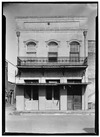 |
8019 | 112 N. Vale St.
32°45′24″N 94°20′44″W / 32.75667°N 94.34556°W |
Jefferson | 1966 | |
| Capt. Wm. Perry House |
 |
8047 | 510 N. Walnut St.
32°45′38″N 94°20′49″W / 32.76056°N 94.34694°W |
Jefferson | 1966 | |
| Carlson, Mary, Home |
.jpg) |
15468 | 501 E. Walker St.
32°45′34″N 94°21′0″W / 32.75944°N 94.35000°W |
Jefferson | 1966 | |
| Christ Episcopal Church |
.jpg) |
8022 | 703 S. Main St.
32°45′20″N 94°21′2″W / 32.75556°N 94.35056°W |
Jefferson | 1964 | |
| Claiborne House |
18545 | 312 S. Alley St.
32°45′31″N 94°21′4″W / 32.75861°N 94.35111°W |
Jefferson | 2016 | ||
| Dan N. Alley Home |
 |
8021 | 501 E. Walker St.
32°45′34″N 94°21′0″W / 32.75944°N 94.35000°W |
Jefferson | 1966 | |
| Deware, J. M., Residence |
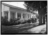 |
14492 | 202 E. Dixon St.
32°45′37″N 94°21′13″W / 32.76028°N 94.35361°W |
Jefferson | 1966 | |
| Doyle Bower House | 8017 | 1105 S. Line St.
32°45′10″N 94°20′57″W / 32.75278°N 94.34917°W |
Jefferson | 1966 | ||
| Early Jefferson Lodge Building |
.jpg) |
8057 | 61 W. Dallas St.
32°45′18″N 94°20′43″W / 32.75500°N 94.34528°W |
Jefferson | 1990 | |
| Early Jefferson Masonic Lodge Building |
.jpg) |
14819 | 61 W. Dallas St.
32°45′18″N 94°20′43″W / 32.75500°N 94.34528°W |
Jefferson | 1990 | |
| Excelsior House |
 |
8031 | 211 W. Austin St.
32°45′21″N 94°20′44″W / 32.75583°N 94.34556°W |
Jefferson | 1962 | |
| Falling Leaves, 1855 |
8032 | 304 E. Jefferson St.
32°45′22″N 94°21′9″W / 32.75611°N 94.35250°W |
Jefferson | 1965 | ||
| First Methodist Church |
.jpg) |
8039 | 305 W. Henderson St.
32°45′25″N 94°20′54″W / 32.75694°N 94.34833°W |
Jefferson | 1965 | |
| Freeman Plantation |
 |
8041 | 0.8 mi. W on SH 49
32°45′48″N 94°22′12″W / 32.76333°N 94.37000°W |
Jefferson | 1980 | 1 mi. west of Jefferson on SH 49 (watch for sign) |
| Freeman Plantation |
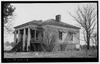 |
8042 | 0.8 mi. W on SH 49
32°45′48″N 94°22′12″W / 32.76333°N 94.37000°W |
Jefferson | 1965 | SH 49, 1 mi. west of Jefferson |
| "Gay 90's House" | 8015 | 1009 S. Line St.
32°45′9″N 94°20′57″W / 32.75250°N 94.34917°W |
Jefferson | 1966 | ||
| George T. Todd House | .jpg) |
8096 | 505 N. Polk St.
32°45′36″N 94°20′52″W / 32.76000°N 94.34778°W |
Jefferson | 1974 | |
| Godfrey-Singleton House |
18163 | 405 Delta St.
32°45′27″N 94°21′4″W / 32.75750°N 94.35111°W |
Jefferson | 2015 | ||
| Guarding Oak |
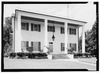 |
8045 | 301 S. Friou St.
32°45′33″N 94°21′11″W / 32.75917°N 94.35306°W |
Jefferson | 1964 | |
| Haggard, George E., Bldg. (RE 80) |
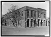 |
15238 | 123 W. Austin St.
32°45′23″N 94°20′43″W / 32.75639°N 94.34528°W |
Jefferson | 1966 | |
| Haggard, George E., Funeral Home |
 |
14604 | 123 W. Austin St.
32°45′23″N 94°20′43″W / 32.75639°N 94.34528°W |
Jefferson | 1966 | |
| Historic Houston Street Victorian Cottage | 8050 | 312 Houston St.
32°45′5″N 94°20′54″W / 32.75139°N 94.34833°W |
Jefferson | 1970 | ||
| Home of Capt. Charles G. Graham |
8044 | 409 Delta St.
32°45′28″N 94°21′2″W / 32.75778°N 94.35056°W |
Jefferson | 1986 | ||
| Houston Street College | 15137 | Jefferson | 1970 | |||
| Hudgins-Blake House | 8051 | 1111 S. Line St.
32°45′5″N 94°20′57″W / 32.75139°N 94.34917°W |
Jefferson | 1973 | ||
| Immaculate Conception Church |
.jpg) |
8052 | 201 N. Vale St.
32°45′25″N 94°20′47″W / 32.75694°N 94.34639°W |
Jefferson | 1964 | |
| J. H. Rowell Home |
8084 | 301 S. Alley St.
32°45′33″N 94°21′6″W / 32.75917°N 94.35167°W |
Jefferson | 1966 | ||
| Jay Gould Railroad Car |
.jpg) |
8043 | 208 W. Austin St.
32°45′21″N 94°20′43″W / 32.75583°N 94.34528°W |
Jefferson | 1964 | |
| Jefferson Ordnance Magazine |
.jpg) |
16909 | 0.3 mi. NE of SH 134 crossing of Big Cypress Bayou
32°45′29″N 94°20′18″W / 32.75806°N 94.33833°W |
Jefferson | 2011 | North-northeast of Highway 59 and Big Cypress Bayou |
| Jefferson Playhouse |
 |
8058 | 209 W. Henderson St.
32°45′25″N 94°20′51″W / 32.75694°N 94.34750°W |
Jefferson | 1965 | |
| Jefferson Public Library |
.jpg) |
8059 | 303 W. Lafayette St.
32°45′23″N 94°20′50″W / 32.75639°N 94.34722°W |
Jefferson | 1966 | |
| Knightwood |
8064 | 201 E. Walker St.
32°45′35″N 94°21′13″W / 32.75972°N 94.35361°W |
Jefferson | 1965 | ||
| Manse, The |
 |
15534 | 401 Delta St.
32°45′27″N 94°21′3″W / 32.75750°N 94.35083°W |
Jefferson | 1966 | |
| Marion County Courthouse |
.jpg) |
14394 | 102 W. Austin St.
32°45′23″N 94°20′40″W / 32.75639°N 94.34444°W |
Jefferson | 2002 | |
| McCasland, Joe, Home |
14851 | 403 E. Walker St.
32°45′35″N 94°21′4″W / 32.75972°N 94.35111°W |
Jefferson | 1966 | ||
| Methodist Church |
.jpg) |
15382 | 305 W. Henderson St.
32°45′25″N 94°20′54″W / 32.75694°N 94.34833°W |
Jefferson | 1965 | |
| Moseley, J.B., Home | 15495 | 412 N. Soda St.
32°45′40″N 94°20′44″W / 32.76111°N 94.34556°W |
Jefferson | 1966 | ||
| Murphy Building |
.jpg) |
8074 | 114 W. Austin St.
32°45′22″N 94°20′41″W / 32.75611°N 94.34472°W |
Jefferson | 1983 | |
| Old Apothecary Shop | 8010 | 312 E. Broadway St.
32°45′40″N 94°21′6″W / 32.76111°N 94.35167°W |
Jefferson | 1965 | ||
| Old Federal Building |
8033 | 107 N. Vale St.
32°45′23″N 94°20′44″W / 32.75639°N 94.34556°W |
Jefferson | 1965 | ||
| Old Federal Court and Post Office Building |
 |
8034 | 223 W. Austin St.
32°45′20″N 94°20′45″W / 32.75556°N 94.34583°W |
Jefferson | 1966 | |
| Old Home of Geo. Keese | 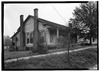 |
8062 | 112 S. Friou St.
32°45′38″N 94°21′9″W / 32.76056°N 94.35250°W |
Jefferson | 1966 | |
| Old Livery Stable |
8066 | 201 W. Austin St.
32°45′22″N 94°20′43″W / 32.75611°N 94.34528°W |
Jefferson | 1968 | ||
| Old Rosebud Saloon |
8082 | 205 N. Vale St.
32°45′22″N 94°20′44″W / 32.75611°N 94.34556°W |
Jefferson | 1965 | ||
| Perry Woods Home |
.jpg) |
8104 | 502 E. Walker St.
32°45′33″N 94°21′0″W / 32.75917°N 94.35000°W |
Jefferson | 1965 | |
| Plantation House |
8087 | 211 N. Market St.
32°45′24″N 94°20′52″W / 32.75667°N 94.34778°W |
Jefferson | 1966 | ||
| Planters Bank |
.jpg) |
8078 | 224 E. Walnut St.
32°45′26″N 94°20′42″W / 32.75722°N 94.34500°W |
Jefferson | 1965 | |
| Presbyterian Church |
.jpg) |
8080 | 501 E. Jefferson St.
32°45′24″N 94°20′59″W / 32.75667°N 94.34972°W |
Jefferson | 1966 | |
| Preston Home | 8073 | 412 N. Soda St.
32°45′40″N 94°20′44″W / 32.76111°N 94.34556°W |
Jefferson | 1966 | ||
| R. B. Walker House | .jpg) |
8102 | 524 N. Polk St.
32°45′38″N 94°20′52″W / 32.76056°N 94.34778°W |
Jefferson | 1990 | |
| Red River Warehouse | 8081 | Lake St. near Walnut | Jefferson | 1965 | ||
| Rogers Home |
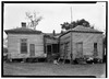 |
8068 | 401 Delta St.
32°45′27″N 94°21′3″W / 32.75750°N 94.35083°W |
Jefferson | 1966 | |
| Rogers Home |
8071 | 403 E. Walker St.
32°45′35″N 94°21′4″W / 32.75972°N 94.35111°W |
Jefferson | 1966 | ||
| Rowell Family Home |
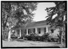 |
8028 | 202 E. Dixon St.
32°45′37″N 94°21′13″W / 32.76028°N 94.35361°W |
Jefferson | 1966 | |
| Rowell Home |
8083 | 307 N. Vale St.
32°45′29″N 94°20′51″W / 32.75806°N 94.34750°W |
Jefferson | 1966 | ||
| S. D. Rainey Home |
8092 | 109 W. Henderson St.
32°45′29″N 94°20′49″W / 32.75806°N 94.34694°W |
Jefferson | 1966 | ||
| Sagamore |
8085 | 201 E. Dixon St.
32°45′38″N 94°21′13″W / 32.76056°N 94.35361°W |
Jefferson | 1966 | ||
| Schluter Home |
.jpg) |
8086 | 602 Taylor St.
32°45′18″N 94°20′57″W / 32.75500°N 94.34917°W |
Jefferson | 1965 | |
| Sedberry, Mrs. Ruth, Home |
.jpg) |
14947 | 211 N. Market St.
32°45′24″N 94°20′51″W / 32.75667°N 94.34750°W |
Jefferson | 1966 | |
| Singleton Family Home |
 |
8088 | 401 N. Soda St.
32°45′37″N 94°21′21″W / 32.76028°N 94.35583°W |
Jefferson | 1966 | |
| St. Louis Commission Company Warehouse | 8089 | Jefferson | 1962 | |||
| Stilley-Young House |
.jpg) |
13675 | 405 Moseley St.
32°45′22″N 94°21′5″W / 32.75611°N 94.35139°W |
Jefferson | 2006 | 405 Moseley St |
| T. J. Taylor, Jr. Home | 8091 | 209 E. Broadway St.
32°45′42″N 94°21′11″W / 32.76167°N 94.35306°W |
Jefferson | 1964 | ||
| Terry, R.S., Home |
14632 | 109 W. Henderson St.
32°45′29″N 94°20′49″W / 32.75806°N 94.34694°W |
Jefferson | 1966 | ||
| The Figures House |
8035 | 407 E. Jefferson St.
32°45′24″N 94°21′3″W / 32.75667°N 94.35083°W |
Jefferson | 1973 | ||
| The Homestead |
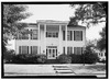 |
8048 | 410 Delta St.
32°45′26″N 94°21′2″W / 32.75722°N 94.35056°W |
Jefferson | 1965 | |
| The House of the Seasons |
.jpg) |
8049 | 409 S. Alley St.
32°45′27″N 94°21′6″W / 32.75750°N 94.35167°W |
Jefferson | 1962 | |
| "The Magnolias" |
.jpg) |
8067 | 209 E. Broadway St.
32°45′42″N 94°21′10″W / 32.76167°N 94.35278°W |
Jefferson | 1965 | |
| The Marsh Place |
 |
8070 | 202 S. Friou St.
32°45′37″N 94°21′9″W / 32.76028°N 94.35250°W |
Jefferson | 1972 | |
| The Thurman Place |
 |
8094 | 207 S. Alley St.
32°45′36″N 94°21′7″W / 32.76000°N 94.35194°W |
Jefferson | 1972 | |
| Todd-Terhune Residence |
8097 | 310 E. Jefferson St.
32°45′22″N 94°21′6″W / 32.75611°N 94.35167°W |
Jefferson | 1978 | ||
| Union Missionary Baptist Church | 17064 | 520 Houston St.
32°45′0″N 94°20′48″W / 32.75000°N 94.34667°W |
Jefferson | 2011 | 520 Houston Street, Jefferson | |
| W. S. Terry Home | 8093 | 404 N. Walnut St.
32°45′36″N 94°20′45″W / 32.76000°N 94.34583°W |
Jefferson | 1966 | ||
| William Clark Residence |
8023 | 201 W. Henderson St.
32°45′28″N 94°20′49″W / 32.75778°N 94.34694°W |
Jefferson | 1981 |
Martin County
| Registered Texas Historic Landmark | Image | Marker number | Physical address | Nearest city | Year designated | Description |
|---|---|---|---|---|---|---|
| Carmelite Monastery |
12545 | 400 E. Carpenter St.
32°8′2″N 101°47′21″W / 32.13389°N 101.78917°W |
Stanton | 2000 | ||
| Connell House | 12046 | 410 N. Convent St.
32°8′0″N 101°47′20″W / 32.13333°N 101.78889°W |
Stanton | 1997 | ||
| J. E. Millhollon Ranch House | 2674 | I-20 Bus. 0.5 mi. E of town
32°8′11″N 101°46′25″W / 32.13639°N 101.77361°W |
Stanton | 1974 | From Stanton, take US 80 about .5 mile East. | |
| Kelly Home | 15107 | Stanton | 1962 | |||
| Old Martin County Jail | 3762 | 300 N. St. Joseph St.
32°7′53″N 101°47′29″W / 32.13139°N 101.79139°W |
Stanton | 1982 | 300 St. Joseph St., Stanton | |
| Sister of Mercy Convent/Carmelite Monastery |
4715 | 400 E. Carpenter St.
32°8′2″N 101°47′21″W / 32.13389°N 101.78917°W |
Stanton | 2000 | 301 E. Carpenter St. Stanton |
See also
| Anderson-Callahan • Cameron-Duval • Eastland-Gray • Grayson-Hudspeth • Hunt-Martin • Mason-Rusk • Sabine-Travis • Trinity-Zavala |
