
Nagua facts for kids
Quick facts for kids
Nagua
|
|
|---|---|
|
Municipality
|
|

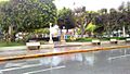
A street in Nagua
|
|
| Country | |
| Province | María Trinidad Sánchez |
| Municipal Districts | 3 |
| Municipality since | 1938 |
| Area | |
| • Total | 47.6 km2 (18.4 sq mi) |
| • Urban | 12.77 km2 (4.93 sq mi) |
| Elevation | 3 m (10 ft) |
| Population
(2014)
|
|
| • Total | 40,611 |
| • Density | 853.2/km2 (2,209.7/sq mi) |
| • Urban | 38,540 |
| Time zone | UTC-4 (AST) |
| • Summer (DST) | UTC-4 (AST) |
| Distance | 70 km (43 mi) to San Francisco de Macorís 180 km (110 mi) to Santo Domingo |
Nagua is a Dominican city and the head municipality of the María Trinidad Sánchez province, on the northeast (Atlantic) coast of the country. It was a town of fishermen that became a city in the second half of the 20th century. The city of Nagua is almost at sea level.
Contents
Population
The municipality had, in 2014, a total population of 40,611: 20,055 men and 20,556 women. The urban population was 94.9% of the total population.
History
Nagua was a small town close to the place where the river Nagua gets into the sea and that is the reason of its old name: Boca de Nagua (in English, "Nagua's Mouth"); it was part of the old municipality of Matanzas, Duarte province.
It was created a municipality in 1938 with the name Villa Julia Molina (Julia Molina was the mother of the dictator Rafael Trujillo). On 4 August 1946 there was a tsunami that destroyed the city of Matanzas and Villa Julia Molina became the main city of the region.
In 1945 the municipality became part of the Samaná province. With the creation of the new province of "Julia Molina" (now María Trinidad Sánchez), Villa Julia Molina became the head municipality of the province. The name of the city was changed to Nagua in 1961, after Trujillo's death.
Geography
The municipality of Nagua has a total area of 47.6 km2 (18.4 sq mi). It has three municipal districts (a municipal district is a subdivision of a municipality). These are San José de Matanzas, Las Gordas and Arroyo al Medio.
Nagua is at 180 km (112 mi) to the northwest of Santo Domingo and at 70 km (43 mi) to the north of San Francisco de Macorís. The altitude of the city of Nagua is 3 m (10 ft) above sea level.
The municipality has the Atlantic Ocean to the east, the Samaná province to the southeast, the municipality of El Factor to the south, the Duarte province to the west and the municipalities of Cabrera and Río San Juan to the north.
The Cordillera Septentrional (in English, "Northern mountain range") runs along the western half of the municipality. Even if the mountains are not too high, most people live along the coast.
In the southwestern part of the municipality, on the border with the Samaná province, there is a region with swamps.
Rivers in Nagua are short; one of them is the river Nagua. The city and the region is named after this small river.
Climate
Nagua has a tropical wet climate (Köppen-Geiger classification: Af) with no dry or cold season as it is constantly moist (rainfalls during the whole year).
The average amount of rainfall for the year in the city is 1,926.3 mm (75.8 in). The month with the most precipitation on average is November with 253.6 mm (10.0 in) of rainfall, followed by May with 230.3 mm (9.1 in).
The driest season is winter. The month with the least rainfall on average is February with an average of 97.2 mm (3.8 in) followed by March, 99.2 mm (3.9 in).
Nagua is in a warm region; the average temperature for the year is 25.7 °C (78 °F). The warmest month, on average, is September with an average temperature of 26.95 °C (80.5 °F). The coolest month on average is January, with an average temperature of 24.3 °C (75.74 °F).
| Climate data for Nagua (1961–1990) | |||||||||||||
|---|---|---|---|---|---|---|---|---|---|---|---|---|---|
| Month | Jan | Feb | Mar | Apr | May | Jun | Jul | Aug | Sep | Oct | Nov | Dec | Year |
| Average high °C (°F) | 28.5 (83.3) |
28.9 (84.0) |
29.5 (85.1) |
29.9 (85.8) |
30.2 (86.4) |
30.8 (87.4) |
30.8 (87.4) |
31.0 (87.8) |
31.3 (88.3) |
30.8 (87.4) |
29.8 (85.6) |
28.8 (83.8) |
30.0 (86.0) |
| Daily mean °C (°F) | 24.3 (75.7) |
24.6 (76.3) |
25.1 (77.2) |
25.5 (77.9) |
25.9 (78.6) |
26.5 (79.7) |
26.5 (79.7) |
26.8 (80.2) |
27.0 (80.6) |
26.6 (79.9) |
25.8 (78.4) |
24.7 (76.5) |
25.8 (78.4) |
| Average low °C (°F) | 20.1 (68.2) |
20.2 (68.4) |
20.6 (69.1) |
21.0 (69.8) |
21.5 (70.7) |
22.2 (72.0) |
22.2 (72.0) |
22.5 (72.5) |
22.6 (72.7) |
22.3 (72.1) |
21.7 (71.1) |
20.5 (68.9) |
21.5 (70.6) |
| Average rainfall mm (inches) | 137.9 (5.43) |
97.2 (3.83) |
99.2 (3.91) |
146.0 (5.75) |
230.3 (9.07) |
111.7 (4.40) |
118.0 (4.65) |
155.3 (6.11) |
146.1 (5.75) |
216.1 (8.51) |
253.6 (9.98) |
214.9 (8.46) |
1,926.3 (75.85) |
| Source 1: NOAA | |||||||||||||
| Source 2: Climatemps.com | |||||||||||||
Administrative division
The municipality of Nagua has three municipal districts:
| Code | Municipal district | Population (2010) |
|---|---|---|
| 140102 | San José de Matanzas | 10,586 |
| 140103 | Las Gordas | 15,359 |
| 140104 | Arroyo al Medio | 10,437 |
Economy
Farming, cattle raising (mainly for milk), and fishing are very important around the city. Some important products are rice, coconut, and cacao.
| Provincial capitals of the Dominican Republic | |
|---|---|
| Azua • Baní • Barahona • Bonao • Comendador • Cotuí • Dajabón • El Seibo • Hato Mayor • Higüey • Jimaní • La Romana • La Vega • Mao • Moca • Monte Cristi • Monte Plata • Nagua • Neiba • Pedernales • Puerto Plata • Sabaneta • Salcedo • Samaná • San Cristóbal • San Francisco de Macorís • San José de Ocoa • San Juan de la Maguana • San Pedro de Macorís • Santiago de los Caballeros • Santo Domingo • Santo Domingo Este | |
Images for kids
-
Nagua city streets.

See also
 In Spanish: Nagua para niños
