
Mao facts for kids
Quick facts for kids
Mao
|
||
|---|---|---|
|
Municipality
|
||
| Santa Cruz de Mao | ||

Street in Mao
|
||
|
||
| Nickname(s):
City of Beautiful Sunsets
|
||
| Country | ||
| Province | Valverde | |
| Founded | 1875 | |
| Municipality since | 1882 | |
| Municipal Districts | Ámina, Jaibón (Pueblo Nuevo), Guatapanal | |
| Area | ||
| • Total | 116.3 km2 (44.9 sq mi) | |
| • Urban | 11.51 km2 (4.44 sq mi) | |
| Elevation | 78 m (256 ft) | |
| Population
(2010)
|
||
| • Total | 51,647 | |
| • Density | 444.08/km2 (1,150.2/sq mi) | |
| • Urban | 49,714 | |
| Demonym(s) | Maeño (female, maeña) | |
| Time zone | UTC-4 (AST) | |
| • Summer (DST) | UTC-4 (AST) | |
| Distance | 60 km (37 mi) to Santiago 210 km (130 mi) to Santo Domingo |
|

The Dominican city of Santa Cruz de Mao, or simply Mao. It is the head municipality of the Valverde province, on the northwest of the country. It is the largest city of the Dominican northwest and the centre of the region.
Contents
Name
Its name is a Taíno word. It comes from the Mao River, near the city. Its nickname is Ciudad de los Bellos Atardeceres ("City of the Beautiful Sunsets") because there are not many mountains to the west of the city. Instead, it is common to see a "red" sky during sunsets. It is a very dry region and there are much dust in the air which gives the red color to the sky.
Population
There were a total of 51,647 people living in the area in in 2014. Out of this, 25,663 are men while there were 25,984 women. The urban population was 9.5% of the total population.
History
For most of its history, the region was called "El Despoblado". It means a region without any population. Since it is a very dry region, agriculture was not possible.
When the governor of the Spanish colony gave the order in 1606 that everybody living on the northern coast had to move inland, some people came to live around the present Mao. They had cows that were raised in hatos; "hato", which means a large farm for raising cattle (a ranch). So "hato" is the name of many places around Mao: Hatico, Hato del Yaque, Hato Nuevo, Hato Viejo, Hato del Medio.
The town of Mao was built close to where the Mao river flows into the Yaque del Norte river. The first Catholic church was build in 1869.
Mao was made a Puesto Cantonal (an old category similar to the present Municipal District under a military government). In 1882, Mao was elevated to the category of municipality and in 1904 its official name was changed to "Valverde" after José Desiderio Valverde, past President of the Dominican Republic. Because the name Mao was known by everybody and Valverde was a new name, people called the city as "Valverde (Mao)", and it is still common to say so.
When the province was created in 1959, Mao was made its head municipality and provincial capital.
Geography
Mao has a total area of 116.3 km2 (45 sq mi). It is about 14.1% of the total area of the province of Valverde. The city has an elevation of 78 m (256 ft), and at 210 km (130 mi) to the northwest of Santo Domingo.
The municipality of Mao has the Santiago Rodríguez province to the west, the Santiago province to the south and east, the municipality of Laguna Salada to the northwest and the municipality of Esperanza to the northeast.
Climate
Mao has a tropical wet and dry/savanna climate (Köppen-Geiger classification: Aw) with a noticeable dry season in winter.
The average amount of rainfall for the year in the city is 699.6 mm (27.5 in). The month with the most precipitation on average is May with 119.1 mm (4.7 in) of rainfall, followed by October with 81.9 mm (3.2 in).
The driest season is winter. The month with the least rainfall on average is January with an average of 21.6 mm (0.9 in) and the second is July with 27.3 mm (1.1 in).
Mao is in a hot region. The average temperature for the year is 27 °C (80.6 °F).
| Climate data for San José de Ocoa (1961–1990) | |||||||||||||
|---|---|---|---|---|---|---|---|---|---|---|---|---|---|
| Month | Jan | Feb | Mar | Apr | May | Jun | Jul | Aug | Sep | Oct | Nov | Dec | Year |
| Average high °C (°F) | 30.2 (86.4) |
30.9 (87.6) |
32.1 (89.8) |
33.0 (91.4) |
33.7 (92.7) |
34.7 (94.5) |
35.1 (95.2) |
35.5 (95.9) |
35.2 (95.4) |
34.1 (93.4) |
31.7 (89.1) |
30.1 (86.2) |
33.0 (91.5) |
| Average low °C (°F) | 18.7 (65.7) |
19.1 (66.4) |
19.9 (67.8) |
20.9 (69.6) |
21.9 (71.4) |
22.7 (72.9) |
23.1 (73.6) |
23.0 (73.4) |
22.5 (72.5) |
21.9 (71.4) |
20.7 (69.3) |
19.2 (66.6) |
21.1 (70.1) |
| Average rainfall mm (inches) | 21.6 (0.85) |
34.4 (1.35) |
38.5 (1.52) |
71.4 (2.81) |
119.1 (4.69) |
72.0 (2.83) |
27.3 (1.07) |
42.9 (1.69) |
75.3 (2.96) |
81.9 (3.22) |
74.9 (2.95) |
40.3 (1.59) |
699.6 (27.53) |
| Source: NOAA | |||||||||||||
| Weather chart for Mao | |||||||||||||||||||||||||||||||||||||||||||||||
|---|---|---|---|---|---|---|---|---|---|---|---|---|---|---|---|---|---|---|---|---|---|---|---|---|---|---|---|---|---|---|---|---|---|---|---|---|---|---|---|---|---|---|---|---|---|---|---|
| J | F | M | A | M | J | J | A | S | O | N | D | ||||||||||||||||||||||||||||||||||||
|
22
30
19
|
34
31
19
|
39
32
20
|
71
33
21
|
119
34
22
|
72
35
23
|
27
35
23
|
43
36
23
|
75
35
23
|
82
34
22
|
75
32
21
|
40
30
19
|
||||||||||||||||||||||||||||||||||||
| temperatures in °C precipitation totals in mm |
|||||||||||||||||||||||||||||||||||||||||||||||
|
Imperial conversion
|
|||||||||||||||||||||||||||||||||||||||||||||||
Administrative division
The municipality of Mao has three municipal districts:
| Code | Municipal district | Population (2010) |
|---|---|---|
| 270102 | Ámina | 8,270 |
| 270103 | Jaibón (Pueblo Nuevo) | 8,309 |
| 270104 | Guatapanal | 8,637 |
Economy
The main economic activity of the province is agriculture; the main products in the municipality are rice, bananas and plantain.
| Provincial capitals of the Dominican Republic | |
|---|---|
| Azua • Baní • Barahona • Bonao • Comendador • Cotuí • Dajabón • El Seibo • Hato Mayor • Higüey • Jimaní • La Romana • La Vega • Mao • Moca • Monte Cristi • Monte Plata • Nagua • Neiba • Pedernales • Puerto Plata • Sabaneta • Salcedo • Samaná • San Cristóbal • San Francisco de Macorís • San José de Ocoa • San Juan de la Maguana • San Pedro de Macorís • Santiago de los Caballeros • Santo Domingo • Santo Domingo Este | |
Images for kids
-
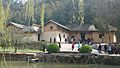
Mao Zedong's childhood home in Shaoshan, in 2010, by which time it had become a tourist destination
-
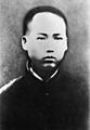
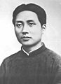
Mao in 1913
-
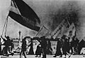
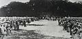
Students in Beijing rallying during the May Fourth Movement
-
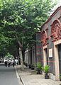
Location of the first Congress of the Chinese Communist Party in July 1921, in Xintiandi, former French Concession, Shanghai
-
Mao Zedong around the time of his work at Guangzhou's PMTI in 1925
-
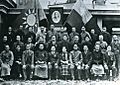
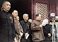
Third Plenum of the KMT Central Executive Committee in March 1927. Mao is third from the right in the second row.
-
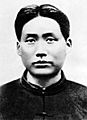
Mao in 1927
-
Chinese Communist revolutionaries in the 1920s
-
Mao in Yan'an
-
Military parade on the occasion of the founding of a Chinese Soviet Republic in 1931
-
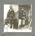
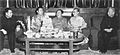
Zhang Guotao (left) and Mao Zedong in Yan'an, 1937
-
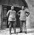
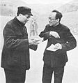
In an effort to defeat the Japanese, Mao (left) agreed to collaborate with Chiang (right).
-
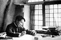
Mao in 1938, writing On Protracted War
-
Mao with Kang Sheng in Yan'an, 1945
-
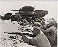
PLA troops, supported by captured M5 Stuart light tanks, attacking the Nationalist lines in 1948
-
Mao Zedong declares the founding of the modern People's Republic of China on October 1, 1949
-
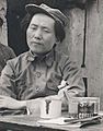
Mao with his fourth wife, Jiang Qing, called "Madame Mao", 1946
-
Mao at Joseph Stalin's 70th birthday celebration in Moscow, December 1949
-
Mao and Zhou Enlai meeting with Dalai Lama (right) and Panchen Lama (left) to celebrate Tibetan New Year, Beijing, 1955
-
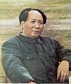
Photo of Mao Zedong sitting, published in "Quotations from Chairman Mao Tse-Tung", ca. 1955
-

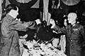
Mao with Nikita Khrushchev, Ho Chi Minh and Soong Ching-ling during a state dinner in Beijing, 1959
-
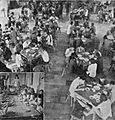
Early in the Great Leap Forward, commune members were encouraged to eat their fill in communal canteens, but many canteens shut down as they ran out of food and fuel.
-
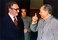
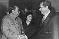
Mao with Henry Kissinger and Zhou Enlai, Beijing, 1972
-
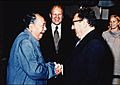
U.S. President Gerald Ford watches as Henry Kissinger shakes hands with Mao during their visit to China, December 2, 1975
-
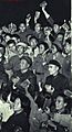
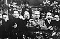
A public appearance of Chairman Mao and Lin Biao among Red Guards, in Beijing, during the Cultural Revolution (November 1966)
-
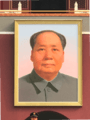
A large portrait of Mao at Tiananmen
-
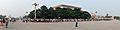
Mao Zedong Square at Saoshan
-
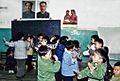
In 1978, the classroom of a kindergarten in Shanghai putting up portraits of then- Chairman Hua Guofeng and former Chairman Mao Zedong
-
Mao greets U.S. President Richard Nixon during his visit to China in 1972.
-
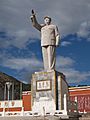
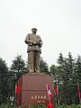
Statue of Mao in Lijiang
-
Visitors wait in line to enter the Mao Zedong Mausoleum.
-
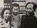
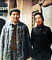
Mao with Jiang Qing and daughter Li Na in the 1940s
-

Mao Zedong with his nephew Mao Yuanxin, and daughters Li Min (second from left) and Li Na
-
Mao and Zhang Yufeng in 1964
-
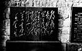
Mao's calligraphy: a bronze plaque of a poem by Li Bai. (Chinese: 白帝城毛澤東手書李白詩銅匾 )


.jpg)


See also
 In Spanish: Mao Zedong para niños
