
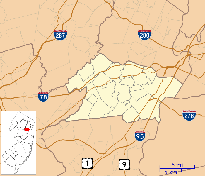
Image: Location map of Union County, New Jersey

Size of this PNG preview of this SVG file: 700 × 600 pixels. Other resolution: 280 × 240 pixels.
Original image (SVG file, nominally 896 × 768 pixels, file size: 390 KB)
Description: This is a map of Union County, New Jersey, USA which includes incorporated settlements, township borders, and major highways.
Title: Location map of Union County, New Jersey
Credit: My own work, using custom-written MapScript applications with United States Census Bureau data
Author: Omnedon
Usage Terms: Public domain
License: Public domain
Attribution Required?: No
Image usage
The following 39 pages link to this image:
- Baltusrol Golf Club
- Belcher–Ogden Mansion; Benjamin Price House; and Price–Brittan House Historic District
- Berkeley Heights, New Jersey
- Boxwood Hall
- Caldwell Parsonage
- Clark, New Jersey
- Connecticut Farms Presbyterian Church
- Crane-Phillips House
- Cranford, New Jersey
- Droescher's Mill
- Elizabeth Public Library
- Elizabeth station (Central Railroad of New Jersey)
- Fanwood, New Jersey
- Fanwood station
- Feltville Historic District
- First Presbyterian Church of Elizabeth
- Free Acres, New Jersey
- Garwood, New Jersey
- Grace Episcopal Church (Plainfield, New Jersey)
- Hillside, New Jersey
- Liberty Hall (New Jersey)
- Littel-Lord Farmstead
- Mid-Town Historic District (Elizabeth, New Jersey)
- Mountainside, New Jersey
- Murray Hill, New Jersey
- Netherwood station
- New Providence, New Jersey
- Reeves-Reed Arboretum
- Roselle, New Jersey
- Scotch Plains Baptist Church
- Springfield Township, Union County, New Jersey
- St. John's Parsonage
- Summit, New Jersey
- Summit Downtown Historic District
- Summit Playhouse
- Union County Performing Arts Center
- Union Township, Union County, New Jersey
- Vauxhall, New Jersey
- Winfield Township, New Jersey

All content from Kiddle encyclopedia articles (including the article images and facts) can be freely used under Attribution-ShareAlike license, unless stated otherwise.